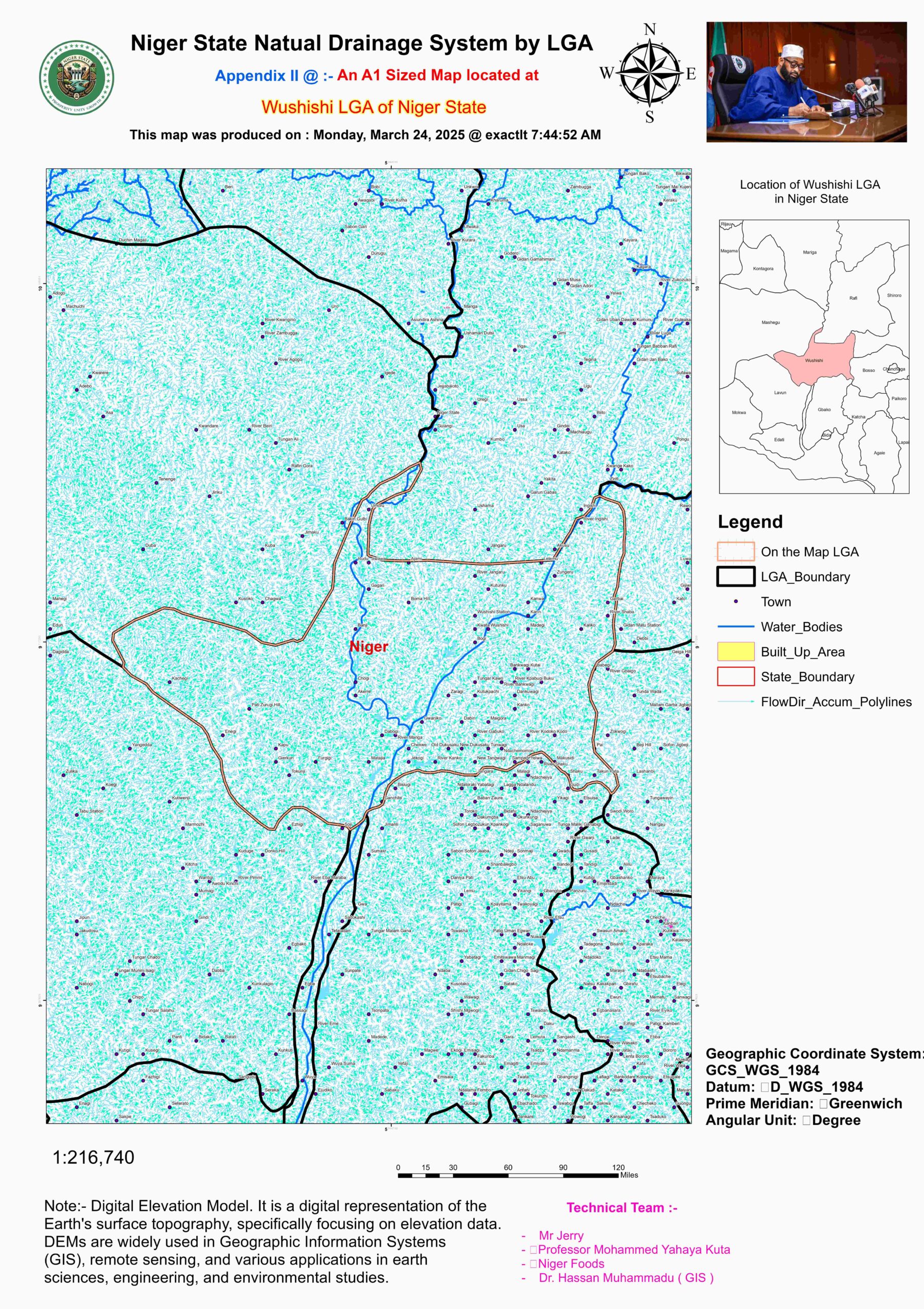
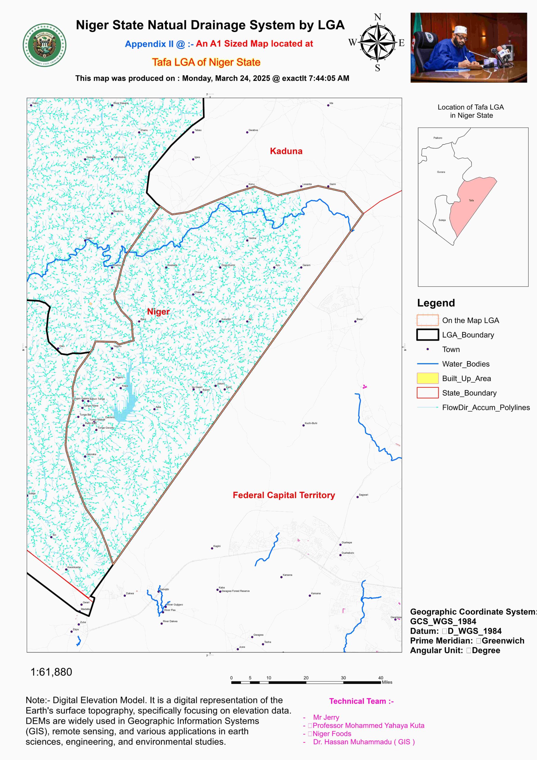
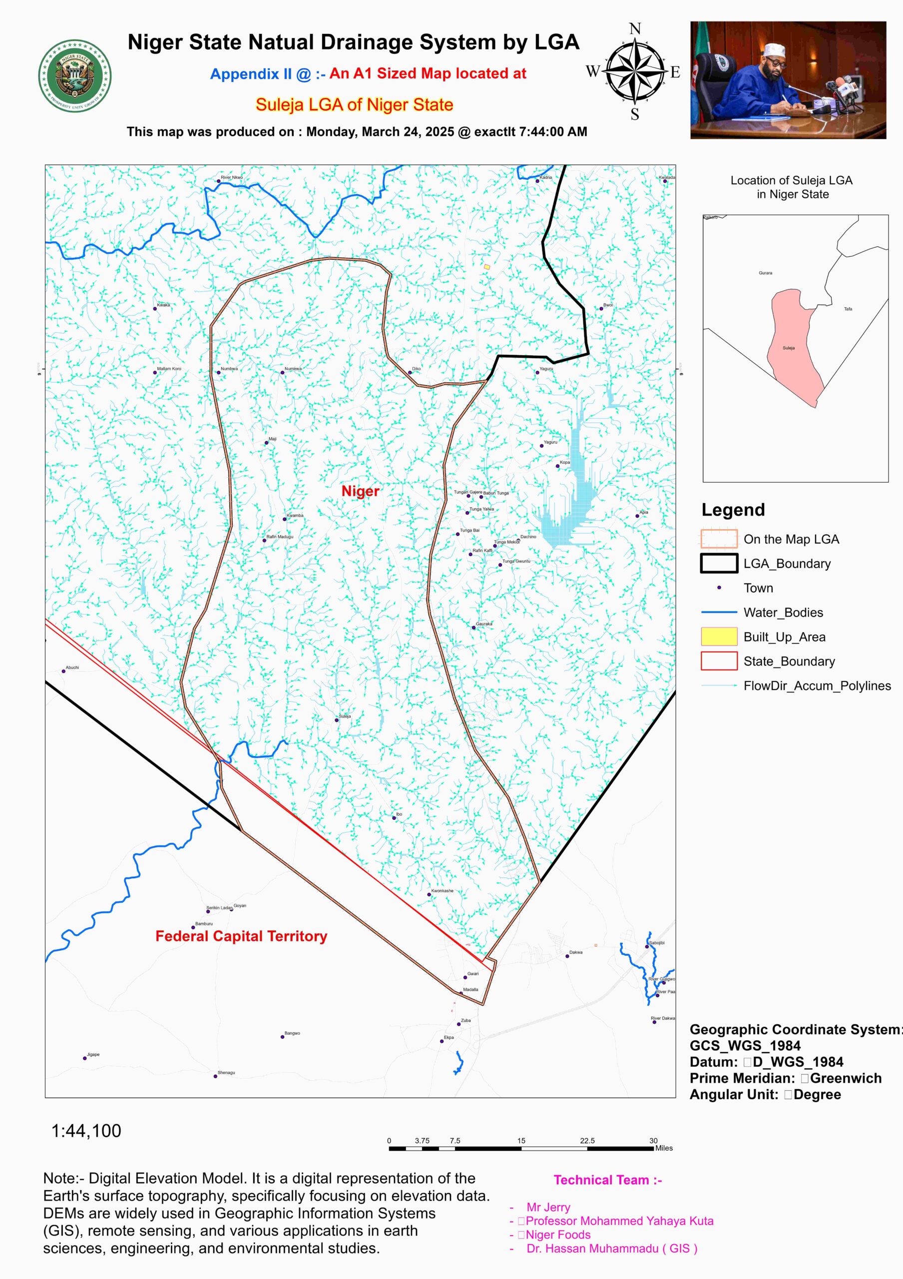
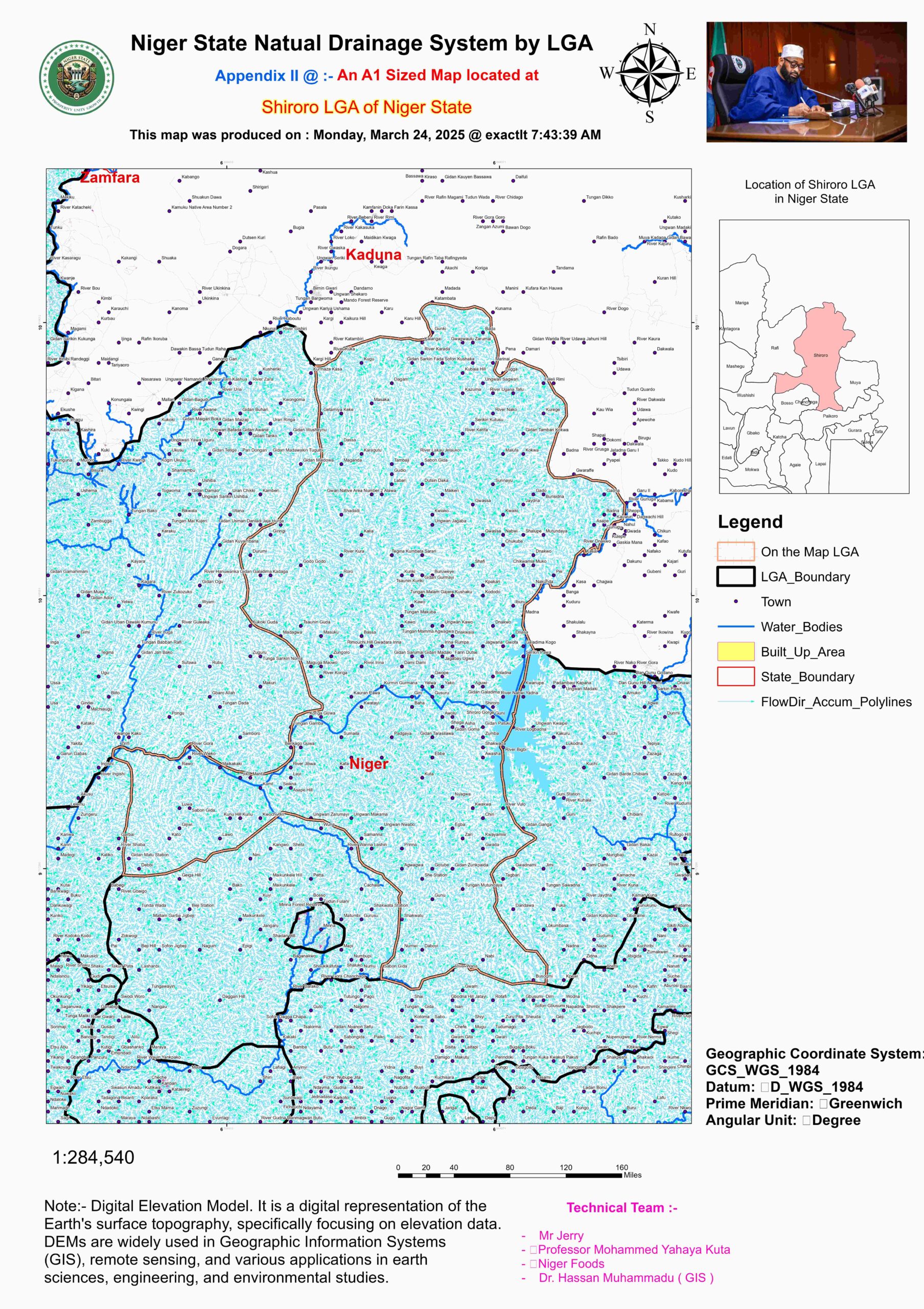
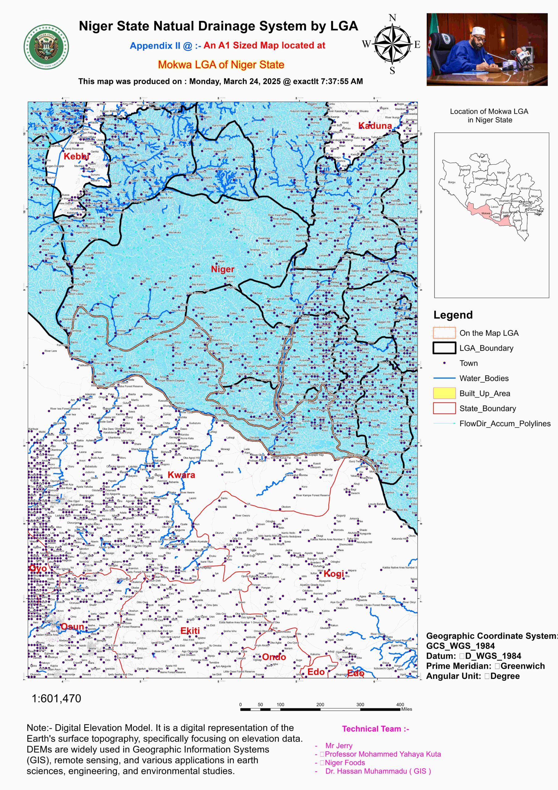
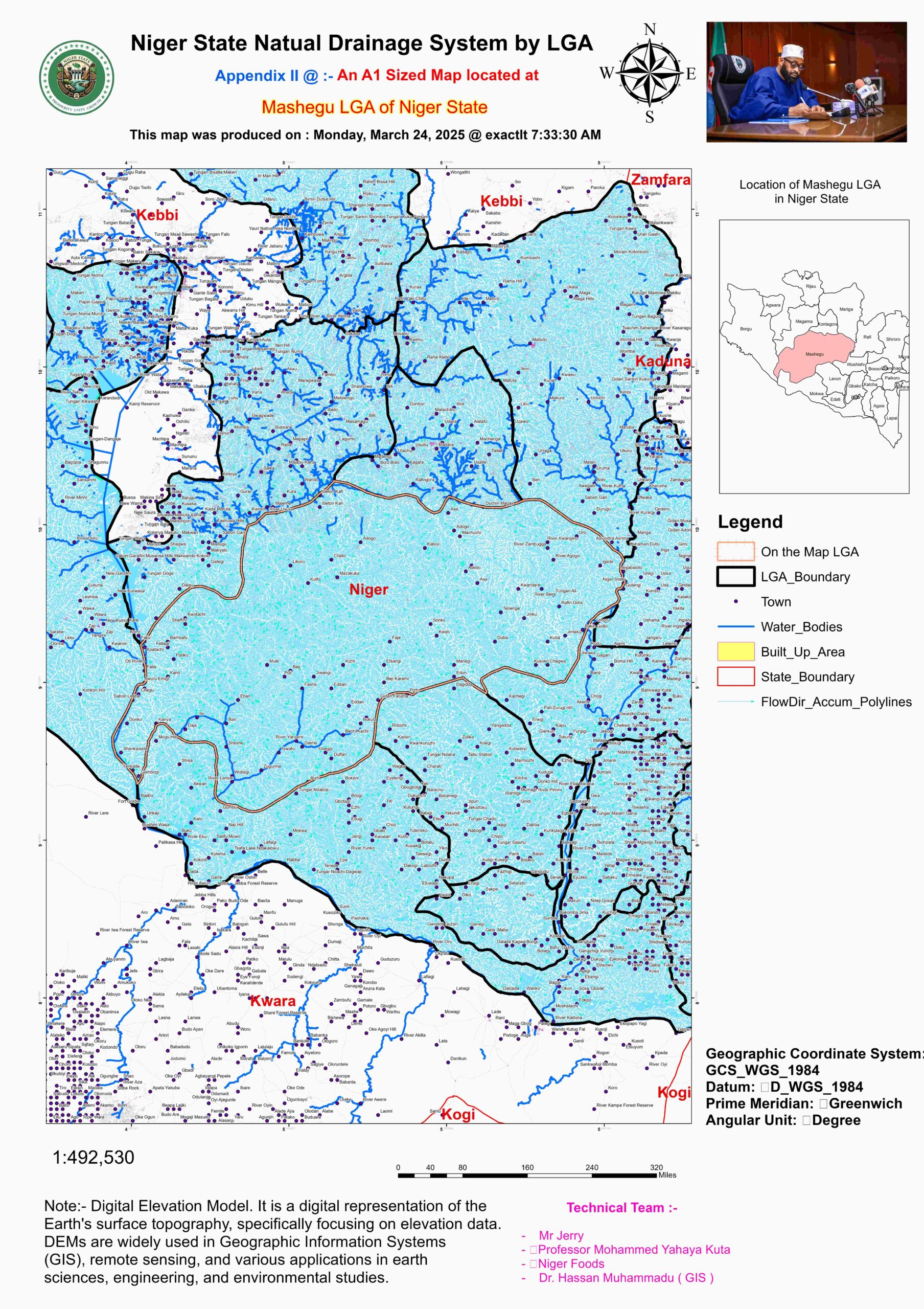
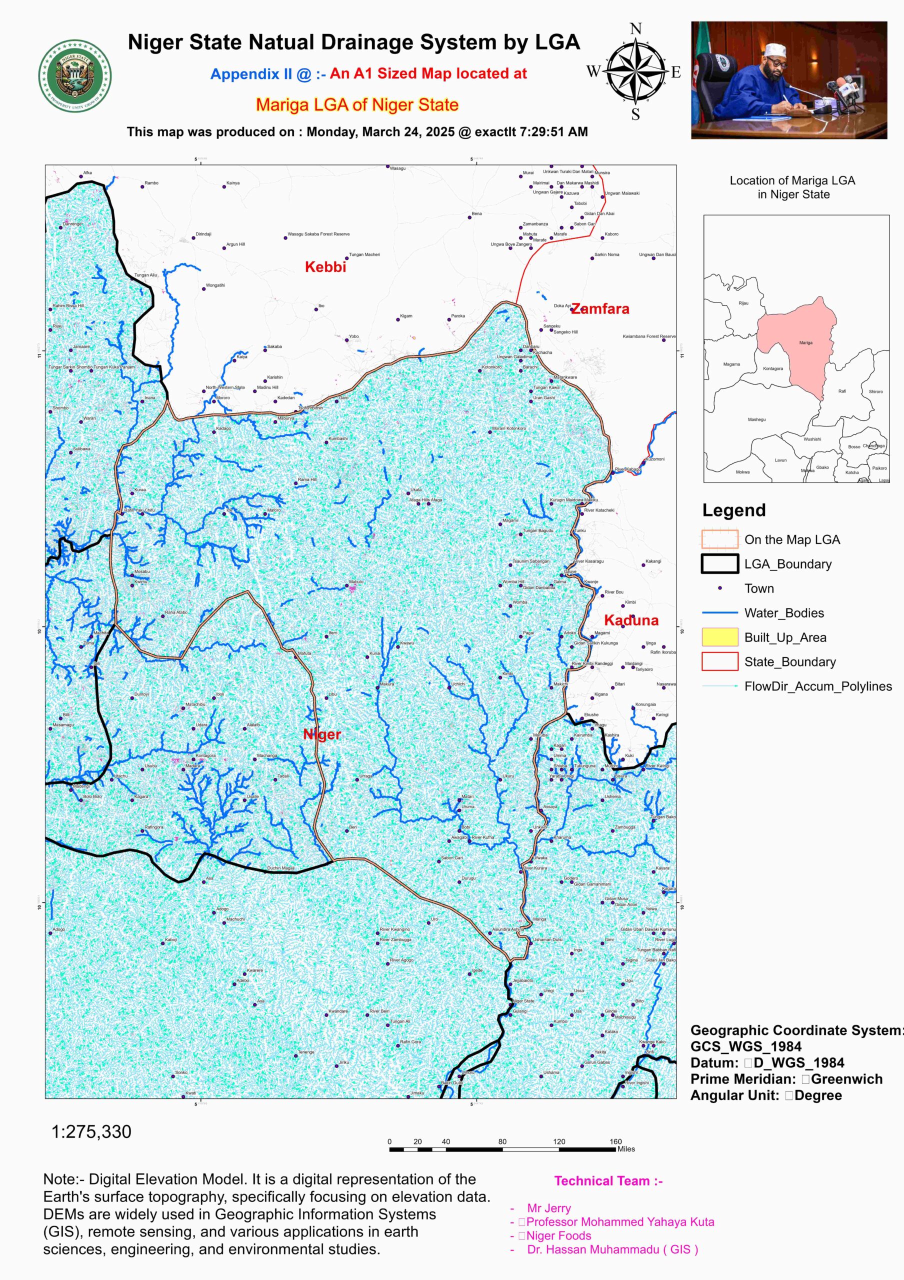
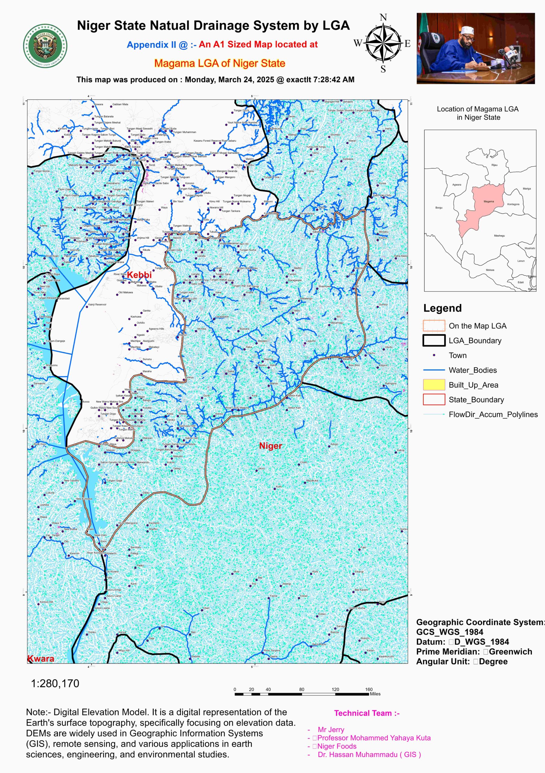
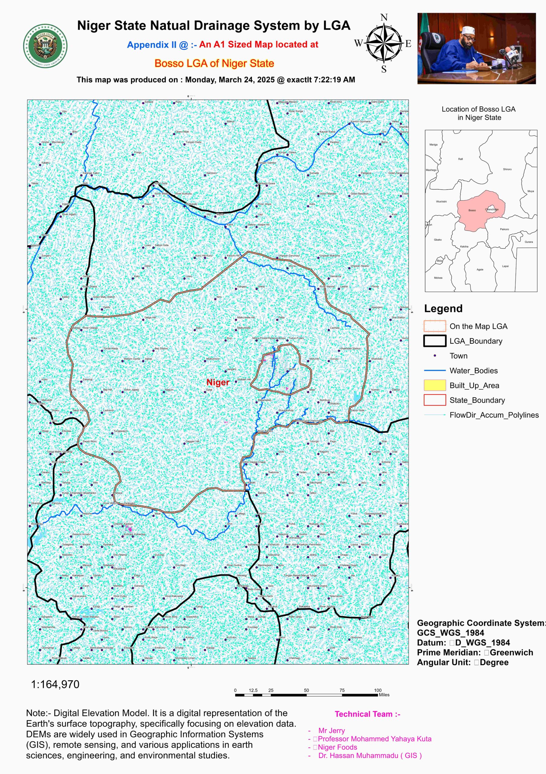
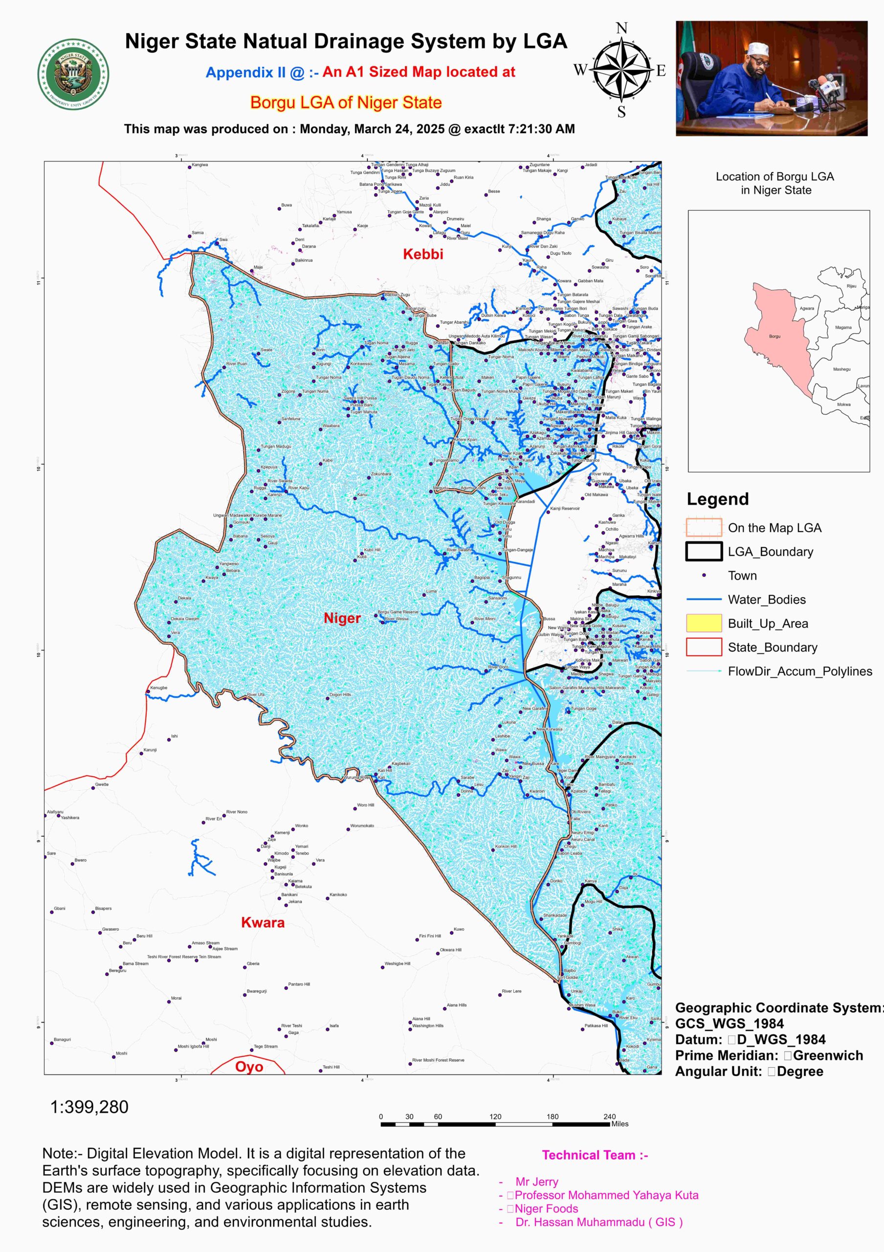
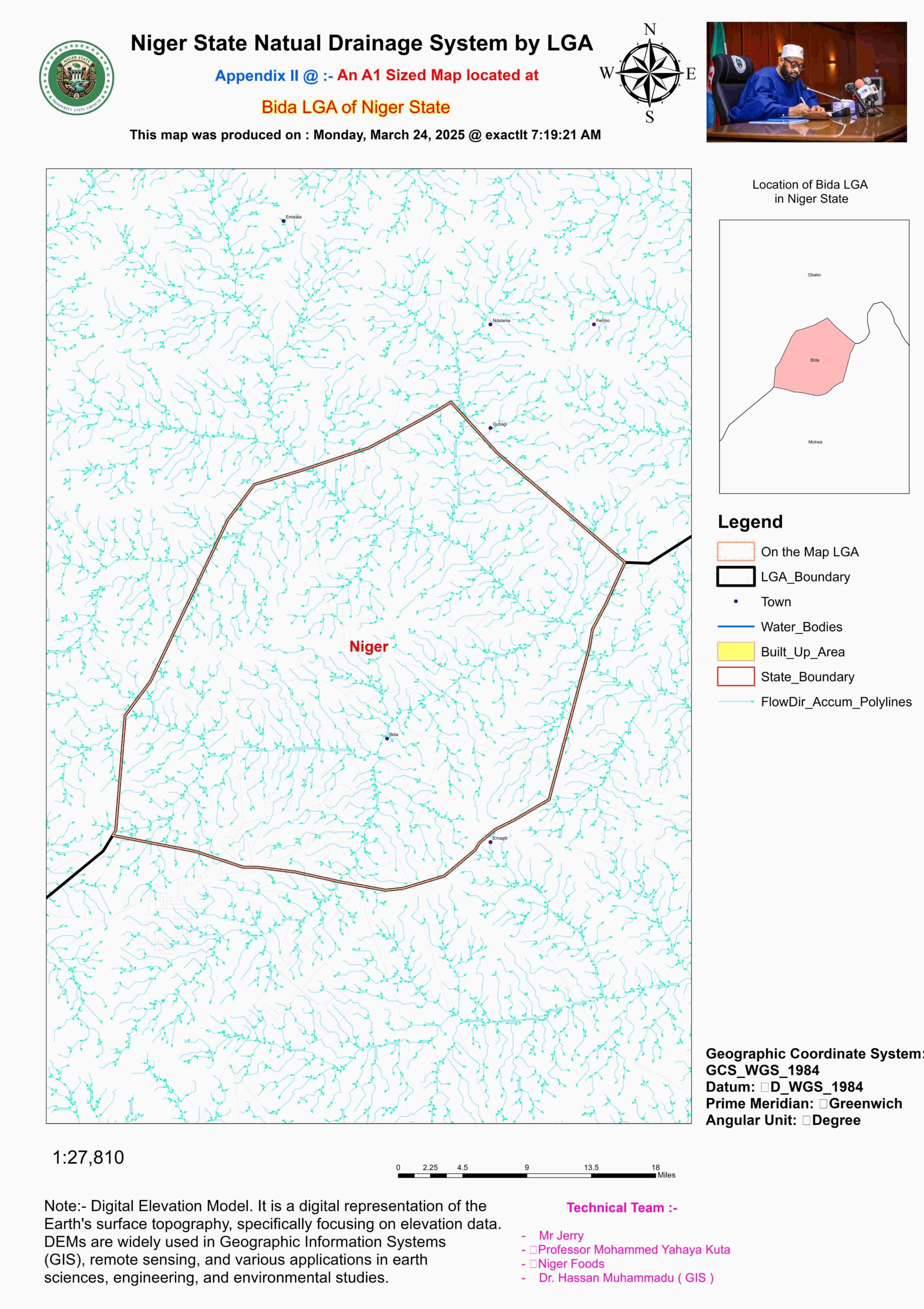
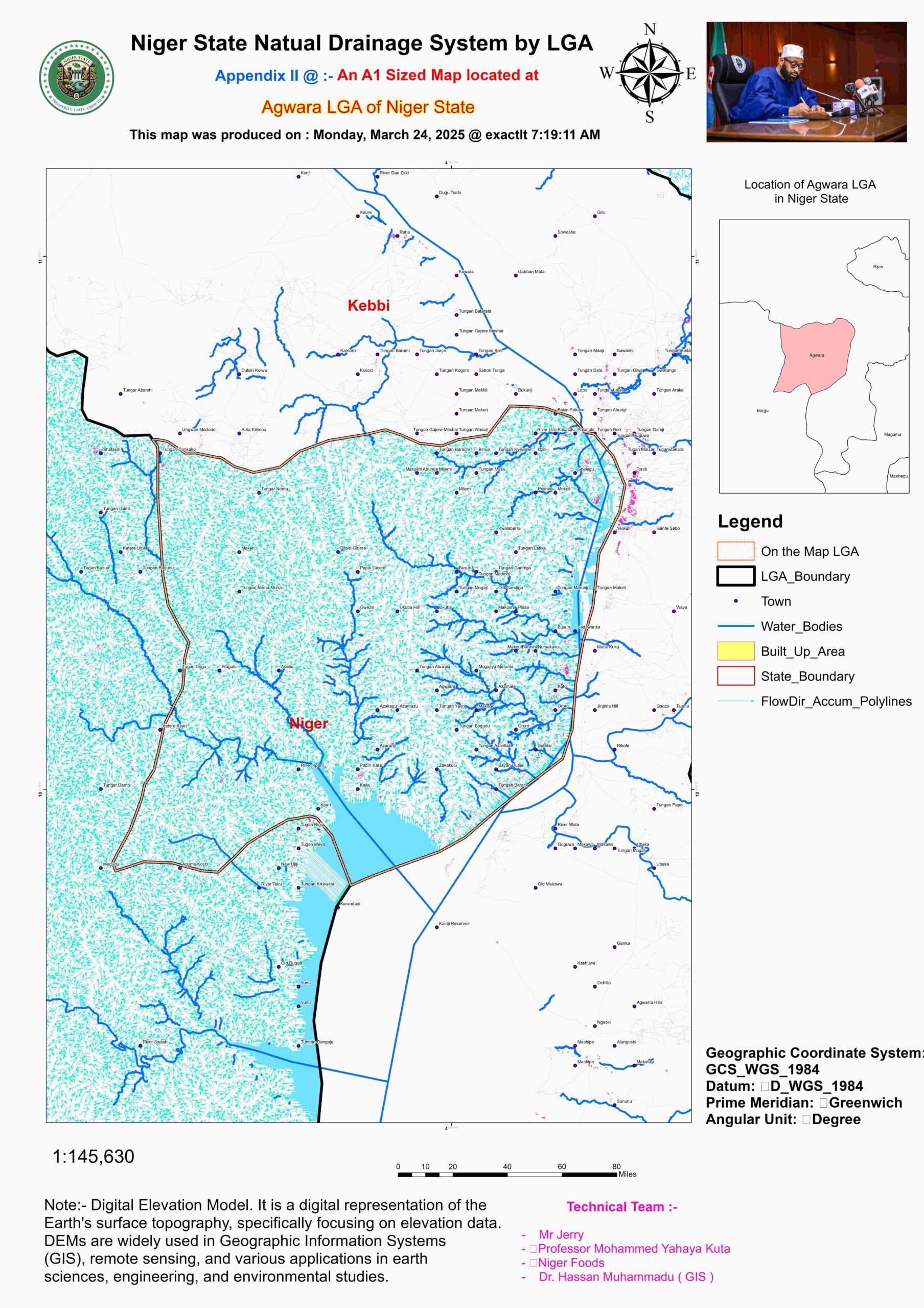
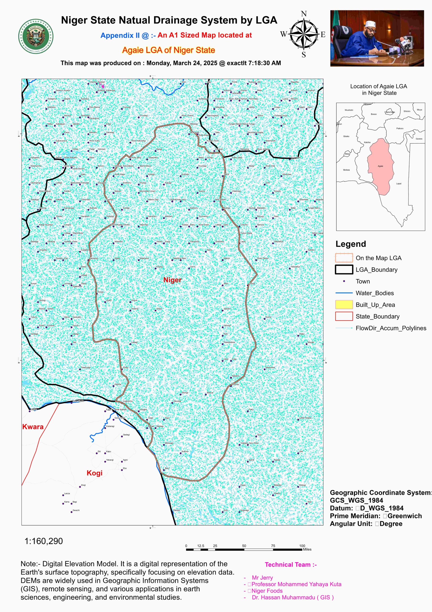
Water Flow Accumulation & Direction Maps
Niger State’s hydrological network is defined by an extensive river system that plays a crucial role in agriculture, water supply, energy production, and ecological sustainability. The state is home to several major rivers, with the Niger River serving as the primary drainage artery, shaping both the landscape and human settlements. Other significant rivers include the Kaduna River, which originates from the Jos Plateau and meanders through the state, providing a vital water source for irrigation and hydroelectric power. The Gurara River, another important tributary, feeds into the Lower Niger and supports key infrastructural projects like the Gurara Dam, which supplies water to Abuja and supports irrigation schemes. In the northwestern part of the state, the Sokoto River flows through Borgu, contributing to the broader Sokoto Basin hydrological system, while the Eko River in Kontagora serves as a local waterway supporting livestock farming and dry-season agriculture.
The flow direction of these rivers is largely governed by Niger State’s topography, with most water bodies moving in a southwest-to-northeast trajectory, ultimately draining into the Niger River Basin. However, local variations exist due to the state’s undulating plains and highland formations. For instance, the Shiroro Hills and other elevated areas cause deviations in river courses, influencing localized water retention and erosion patterns. This variation affects groundwater recharge rates, influencing both rural and urban water availability. Additionally, seasonal fluctuations in river flow are driven by rainfall patterns, with peak discharge occurring during the wet season (May–October) and significant reductions in flow during the dry months (November–April).
Beyond their natural significance, these rivers are central to Niger State’s economic activities. The Shiroro and Jebba dams, both located on the Niger River, are major sources of hydroelectric power, supplying energy to the national grid. The Kaduna and Gurara rivers also hold untapped hydropower potential, making them strategic for future investments in renewable energy. Agricultural irrigation schemes depend heavily on these water bodies, particularly in areas like Bida, Mokwa, and Wushishi, where rice and sugarcane farming are prominent. Additionally, the floodplains of the Niger and Kaduna rivers create fertile lands suitable for year-round farming, supporting crops such as maize, vegetables, and yams.
Water resource management in Niger State remains a pressing issue, with challenges ranging from seasonal flooding along the Niger River banks to increasing water demand from the growing population. Erosion and sedimentation threaten the long-term sustainability of river channels, particularly in areas with intensive land use. Climate change further complicates the hydrological balance, with erratic rainfall patterns leading to unpredictable river flow and water availability. Addressing these concerns requires an integrated water management approach, incorporating conservation strategies, efficient irrigation practices, and improved dam infrastructure to regulate seasonal variability.
As Niger State continues to expand its agricultural and energy sectors, the role of its river systems in economic development cannot be overstated. Strategic investments in hydropower, irrigation infrastructure, and flood control measures will be essential to harness the full potential of these waterways. Furthermore, protecting watersheds and promoting sustainable land use practices will help mitigate environmental degradation, ensuring that the state’s hydrological resources remain viable for future generations. With proper management, Niger State’s rivers can serve as a backbone for food security, energy stability, and economic growth in Nigeria.
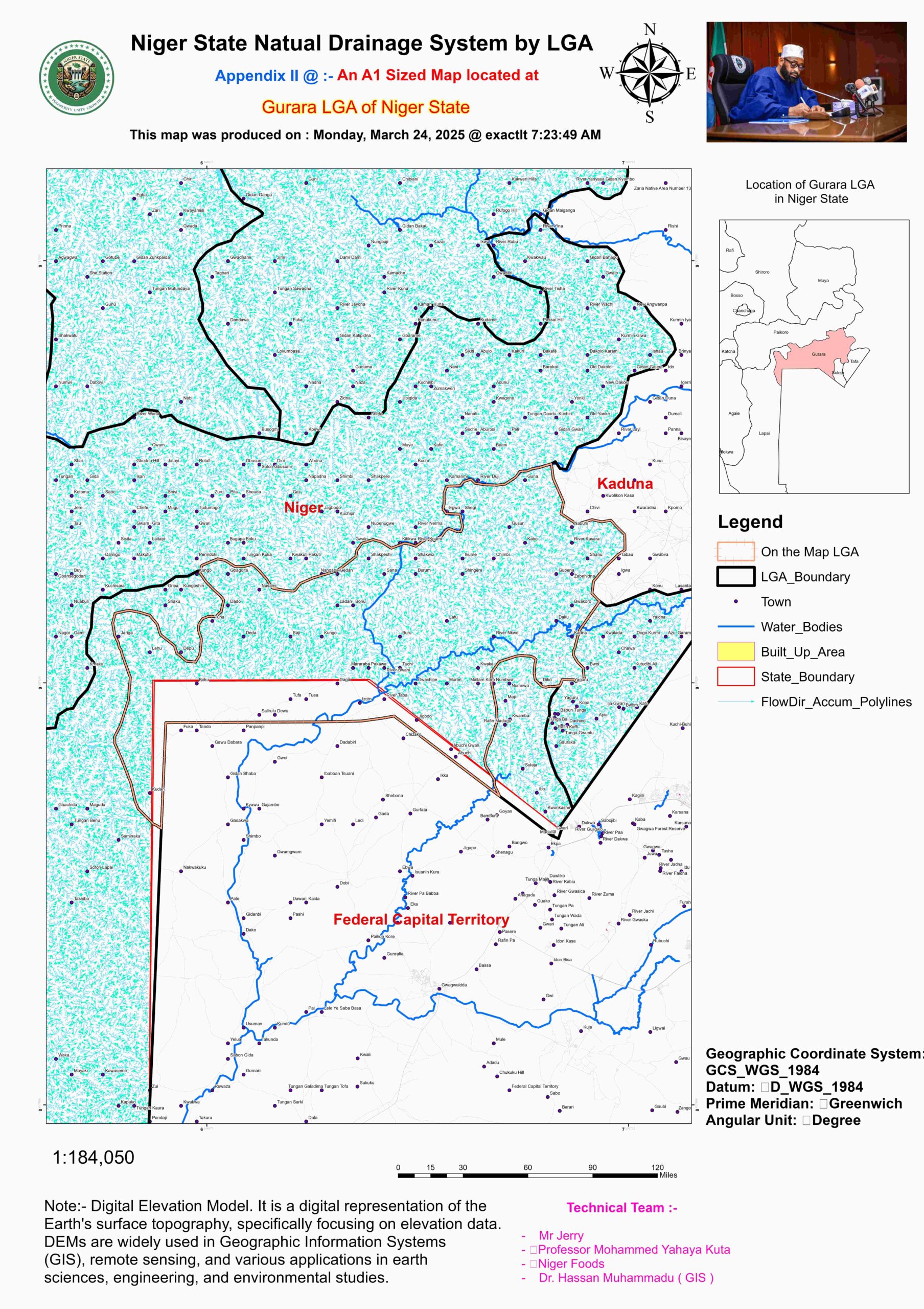
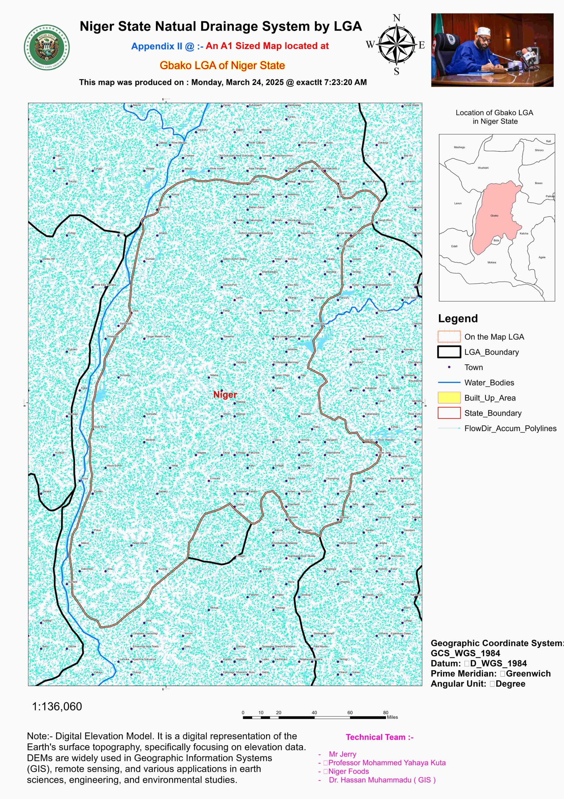
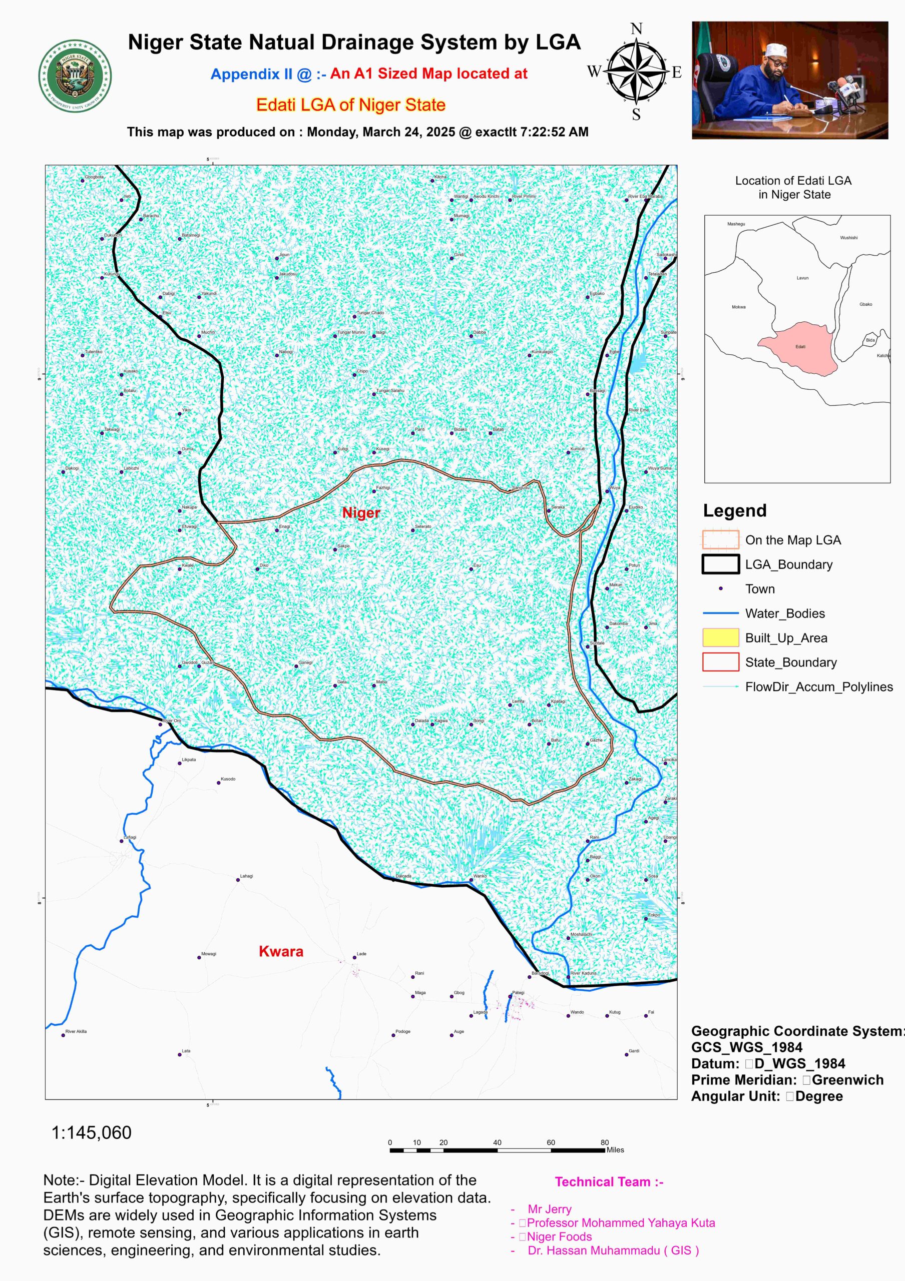
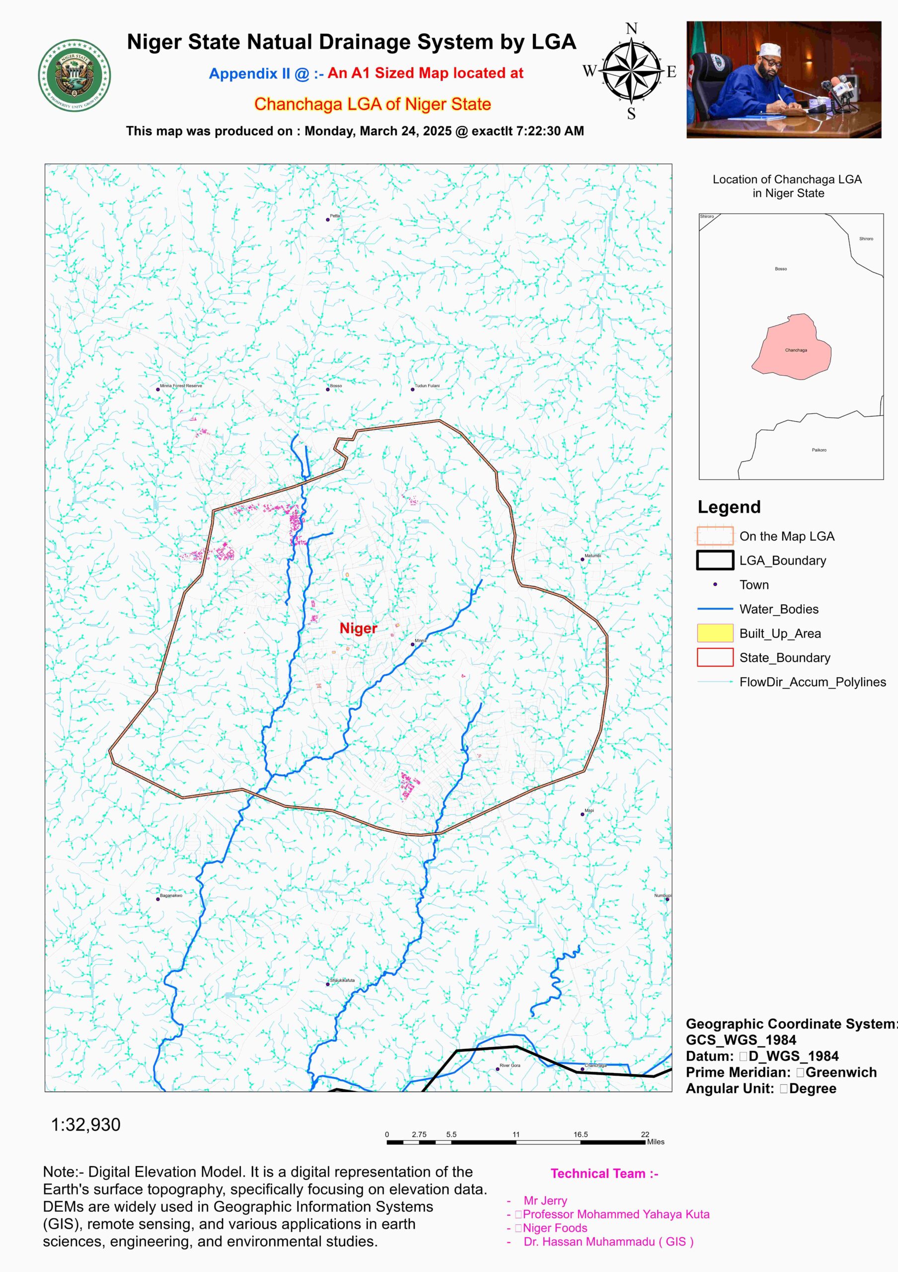
- Water Flow Accumulation & Direction by LGA
LGA | Major Rivers/Streams | Flow Accumulation | Flow Direction | Hydrological Notes |
Agaie | Niger River, Eku River | Moderate (floodplains) | SW → NE (to Niger River) | Seasonal flooding |
Agwara | Sokoto River, Oli River | High (converges at Sokoto) | NW → SE | Borgu wetlands |
Bida | Niger River, Gbako River | High (alluvial plains) | W → E (towards Niger) | Fertile floodplains |
Borgu | Sokoto River, Oli River | Very High (wetlands) | NW → SE (into Benin) | Kainji Lake influence |
Bosso | Tagwai Dam, Gurara tributaries | Moderate (hilly areas) | N → S (to Gurara River) | Urban runoff impact |
Chanchaga | Gurara River, Chanchaga River | Moderate (urban drainage) | NE → SW (to Niger River) | Minna city runoff |
Edati | Niger River, Etsu River | High (floodplain sedimentation) | W → E | Rice-growing areas |
Gbako | Gbako River, Eku tributaries | Moderate (rolling plains) | N → S (to Niger River) | Irrigation schemes |
Gurara | Gurara River, Ebo River | High (confluence zone) | NE → SW (to Niger) | Gurara Falls |
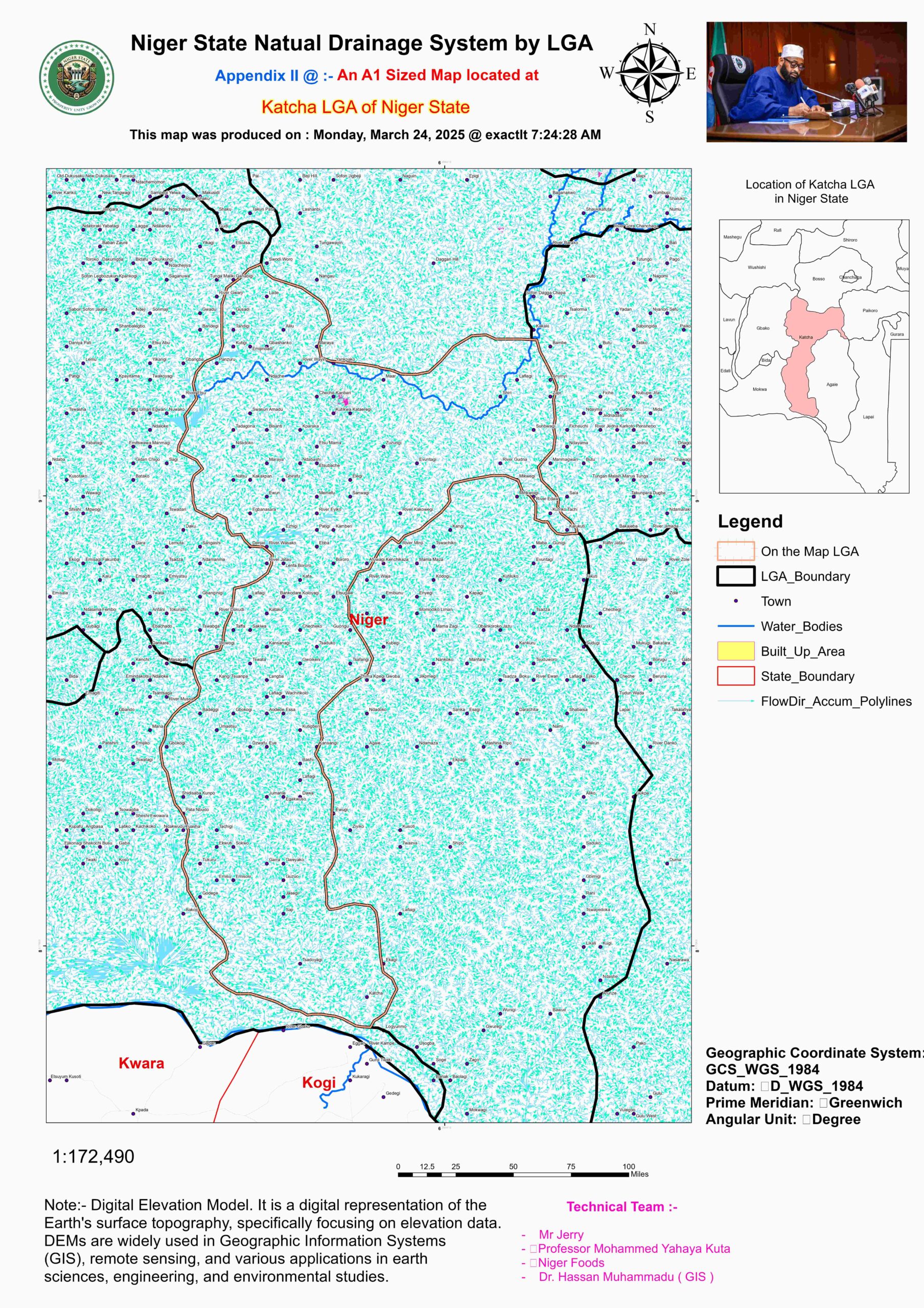
Katcha | Niger River, Doko River | Very High (flood basins) | W → E | Annual flooding |
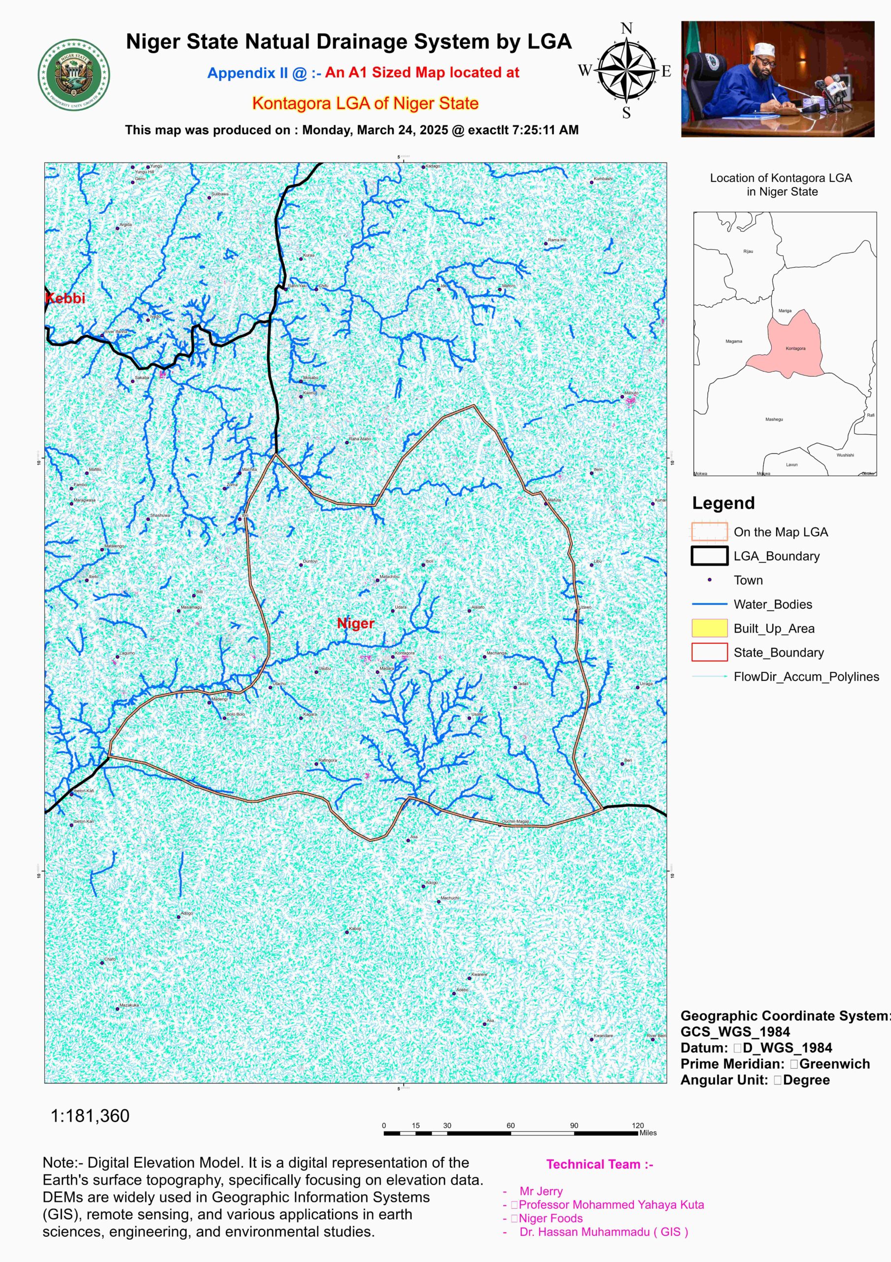
Kontagora | Eko River, Mariga River | Moderate (savanna drainage) | N → S (to Kaduna River) | Dry-season flow loss |
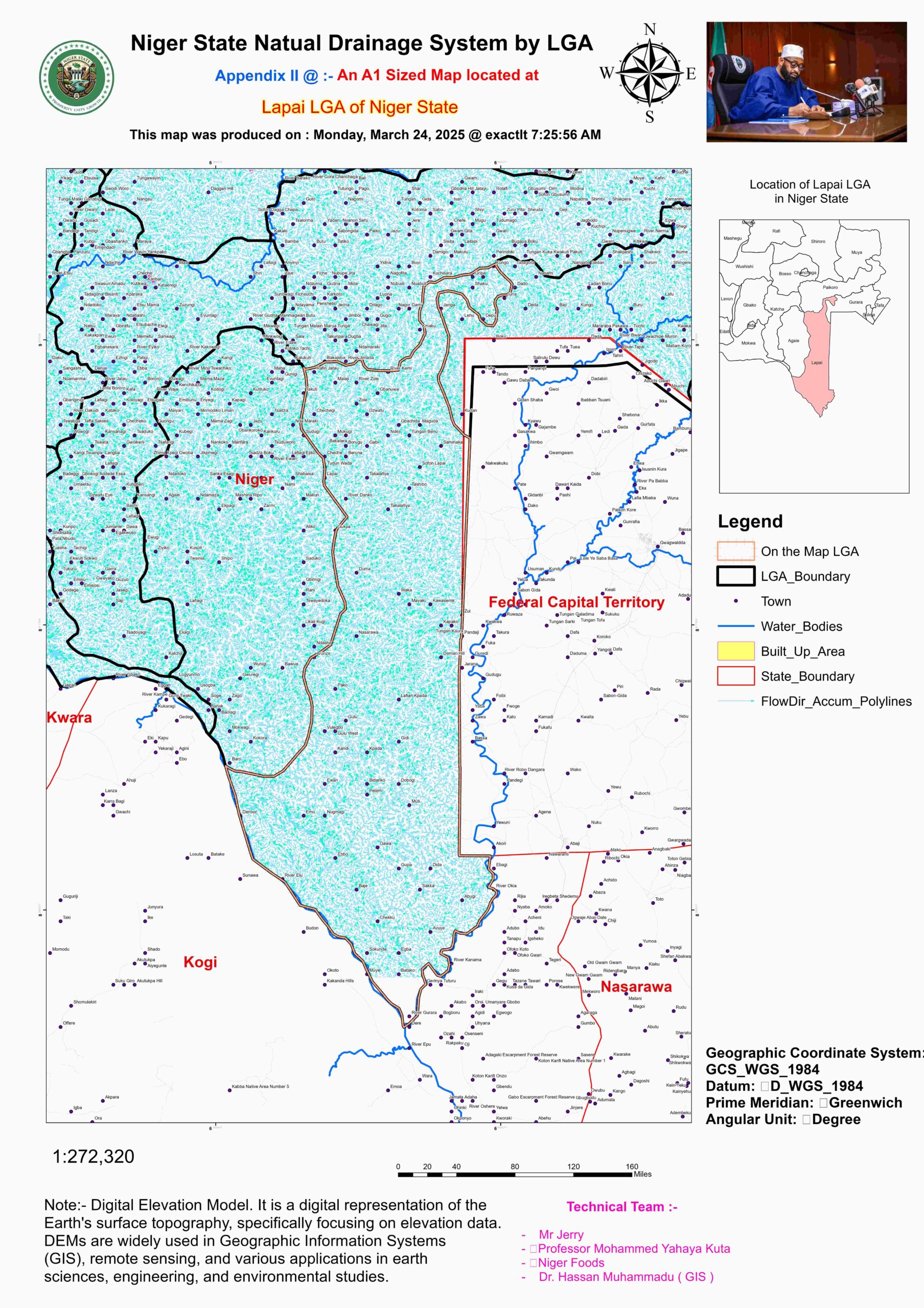
Lapai | Gurara River, Lapai River | Moderate (undulating terrain) | NE → SW | Small watersheds |
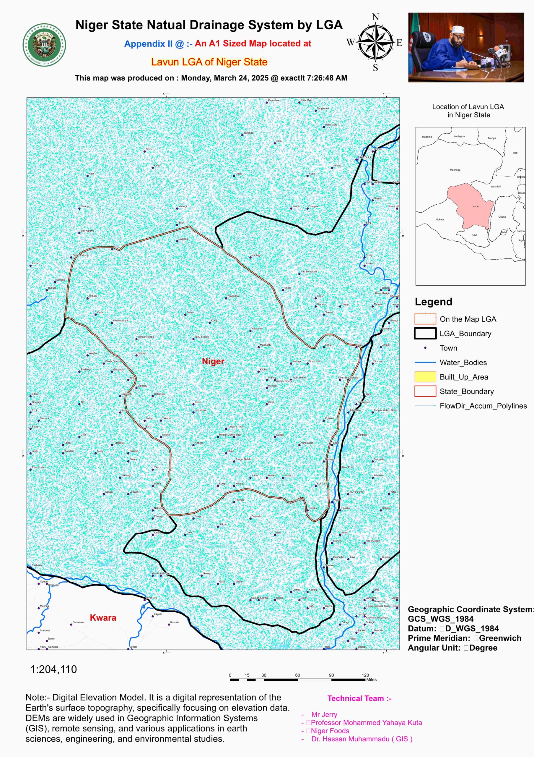
Lavun | Niger River, Edozhigi River | High (alluvial deposits) | NW → SE | Fishing communities |
Magama | Rima River (Sokoto basin) | Low (semi-arid drainage) | N → S (to Sokoto) | Sparse streams |
Mariga | Mariga River, Kontagora tributaries | Moderate (hilly) | NE → SW | Seasonal streams |
Mashegu | Oli River, Tunga River | Low (eroded channels) | N → S (to Sokoto) | Gully erosion |
Mokwa | Niger River, Jebba Lake | Very High (Jebba Dam basin) | W → E (dam-controlled) | Hydroelectric flow |
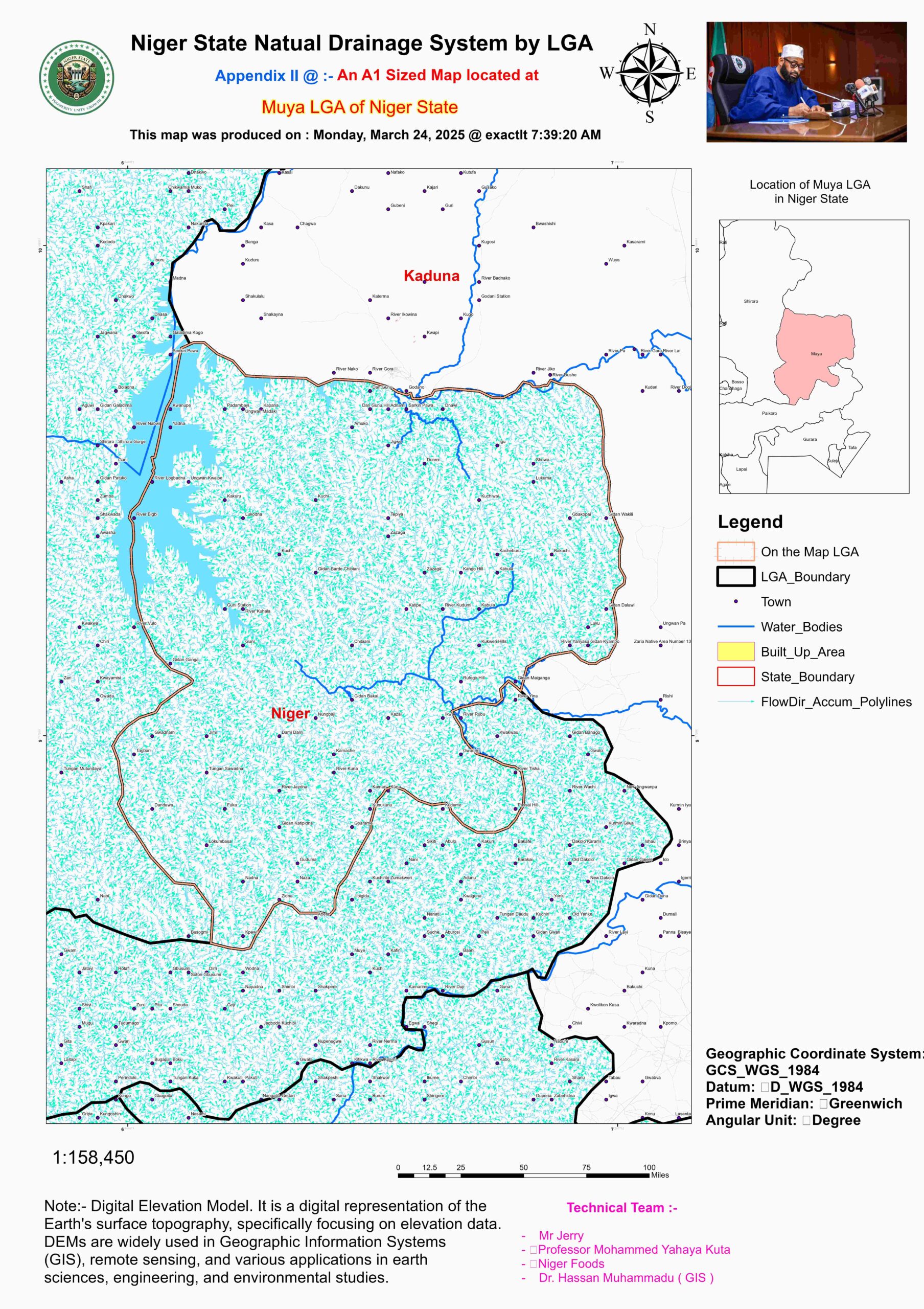
Muya | Kaduna River tributaries | Moderate (forested watershed) | E → W (to Kaduna) | Forest retention |
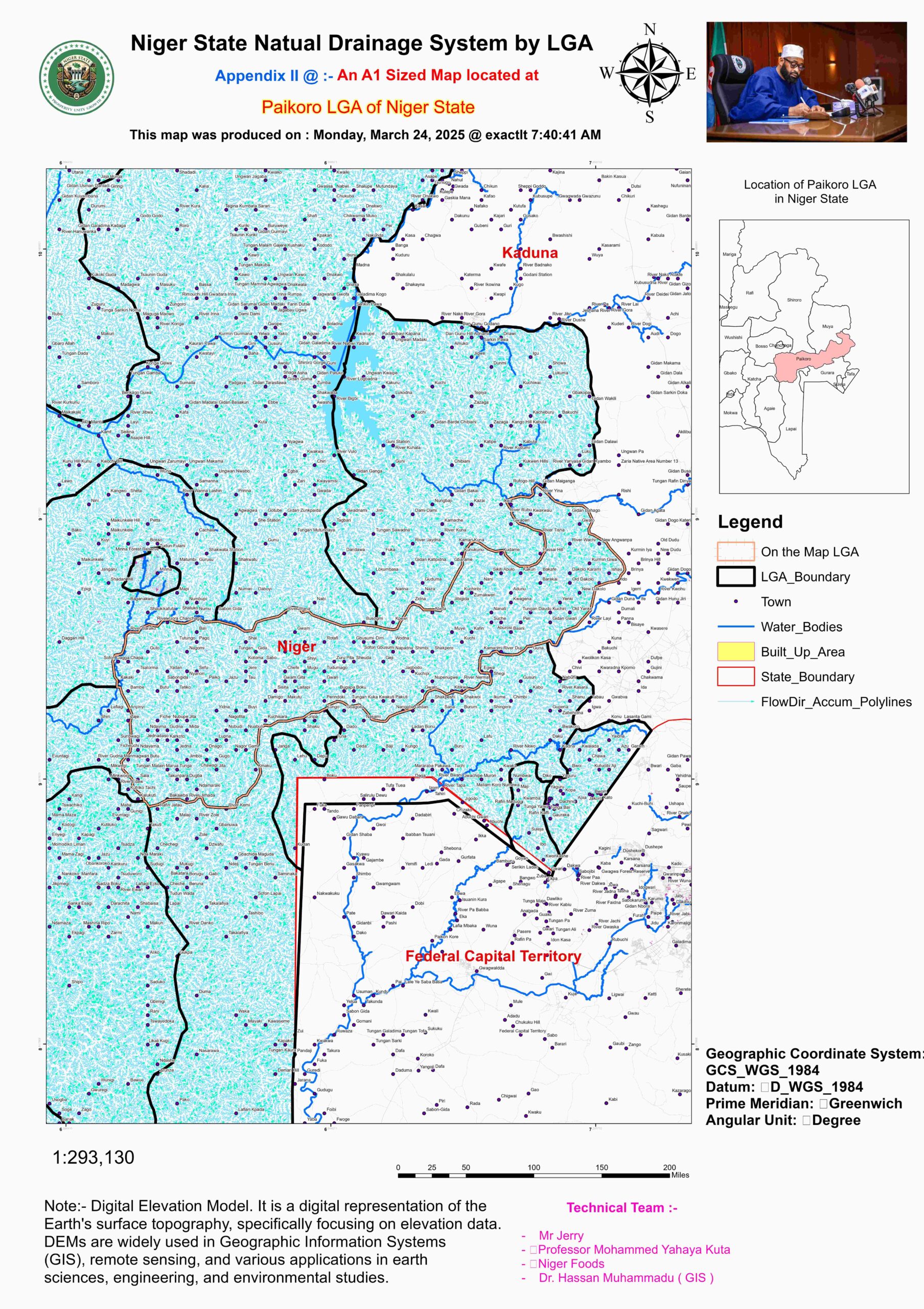
Paikoro | Gurara River, Paiko River | Moderate (rocky terrain) | N → S | Flash floods |
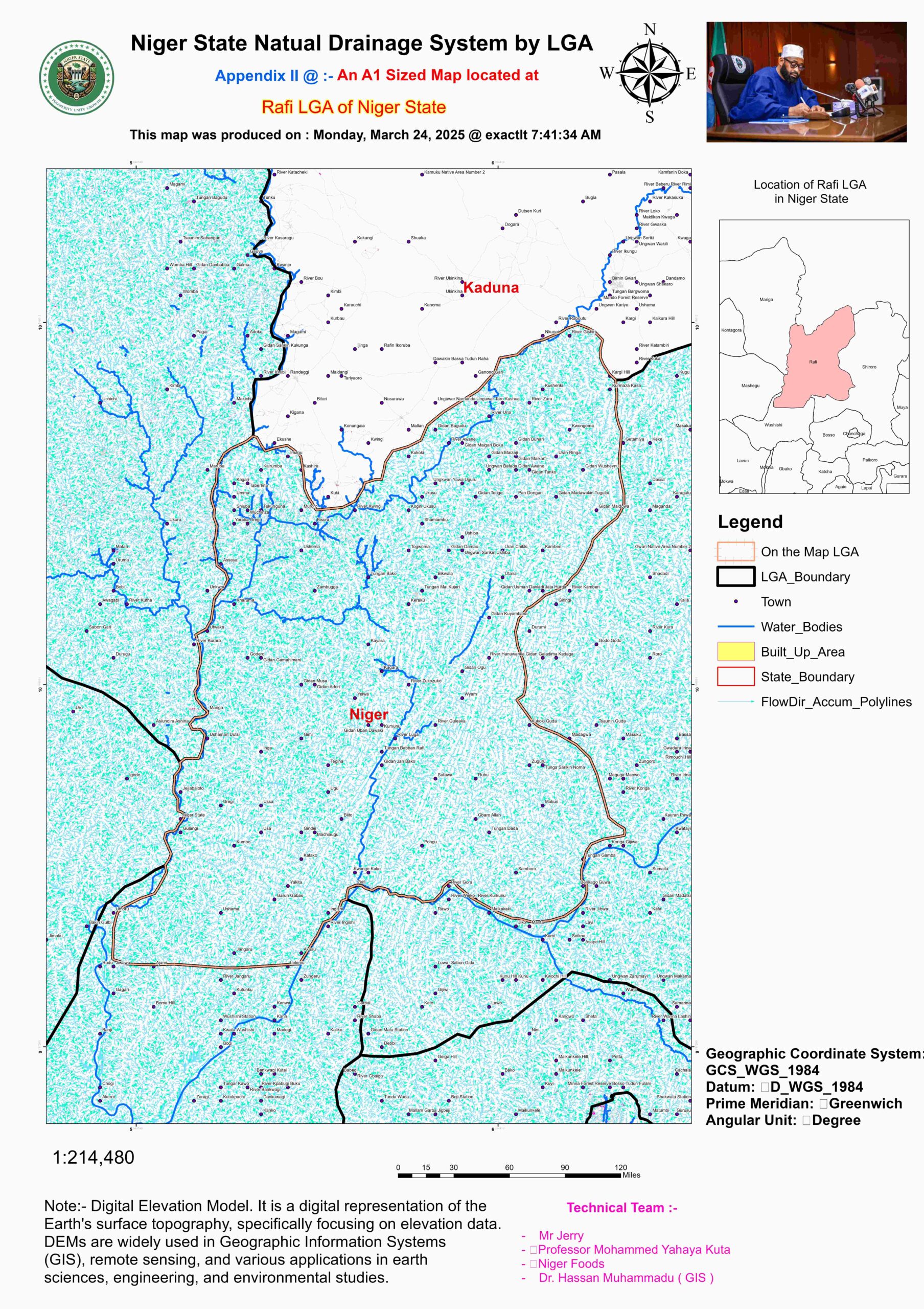
Rafi | Tegina River, Urmaruka River | Low (dryland drainage) | NE → SW (to Kaduna) | Erosion-prone |
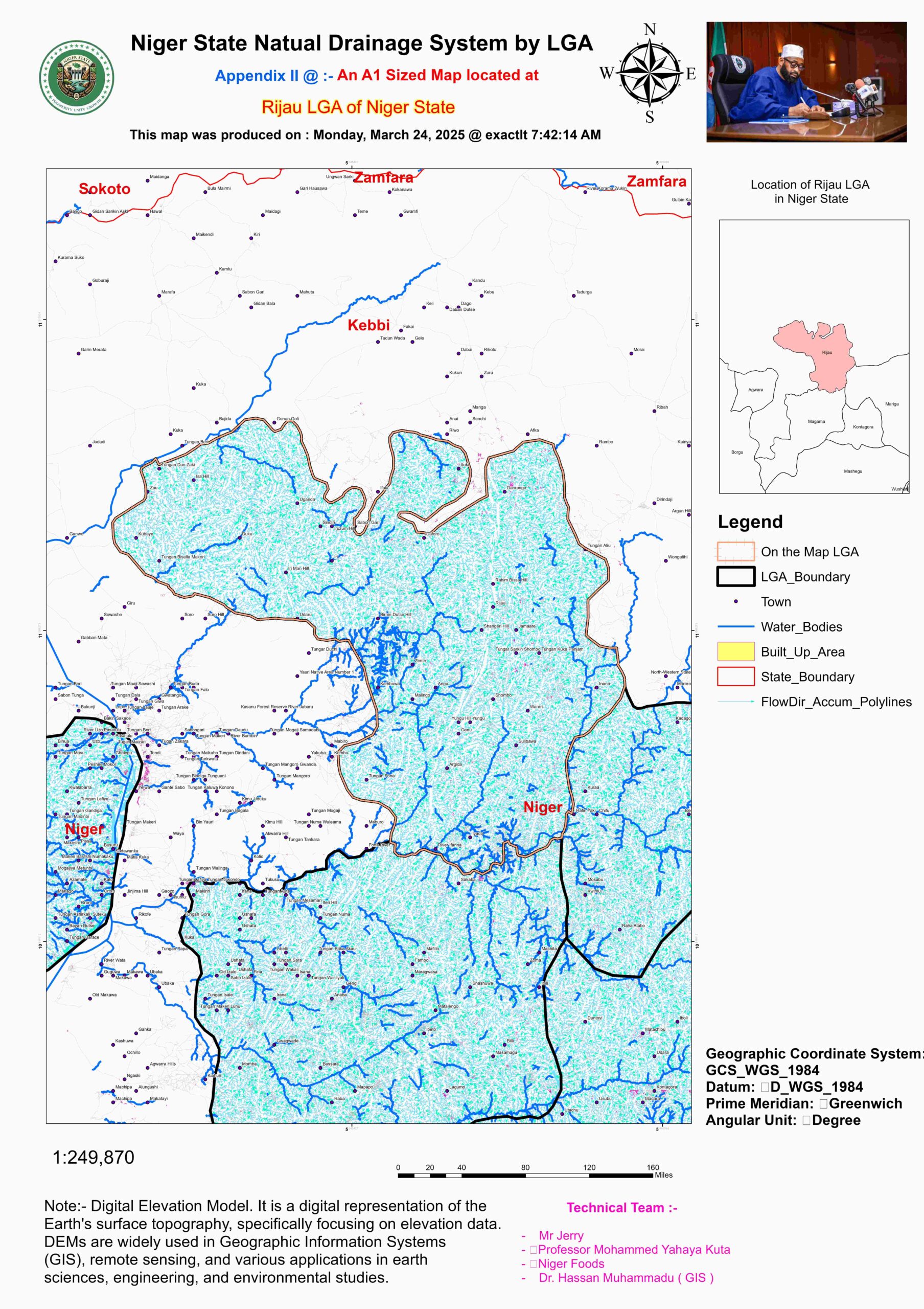
Rijau | Dongo River, Rijau River | Very Low (Sahelian zone) | N → S (intermittent) | Drought-sensitive |
Shiroro | Kaduna River, Shiroro Dam | Very High (reservoir inflow) | E → W (dam-controlled) | Hydroelectric hub |
Suleja | Gurara River, Iku River | Moderate (urban watershed) | NE → SW | Polluted runoff |
Tafa | Gurara tributaries | Low (rocky outcrops) | N → S | Small catchment |
Wushishi | Niger River, Maito River | High (floodplain agriculture) | NW → SE | Irrigation projects |
- Key Hydrological Observations in Niger State
Areas with the Highest Flow Accumulation
Certain regions in Niger State experience significantly high flow accumulation due to their proximity to major river basins and dam inflow systems. Borgu, located in the northwestern part of the state, falls within the Sokoto River Basin, contributing to its substantial water collection capacity. This area benefits from multiple tributaries feeding into the Sokoto River, making it a crucial watershed for both local water supply and ecological balance. Similarly, Shiroro, which hosts the Shiroro Hydroelectric Dam, experiences immense inflow from upstream sources, including tributaries of the Kaduna River. The dam itself regulates water levels, but during peak rainfall seasons, high accumulation is observed due to intensified runoff from the surrounding highlands and hills. Mokwa, situated along the Niger River, also records heavy flow accumulation, largely because of its direct connection to the largest river system in West Africa. This region serves as a key floodplain area, making it fertile for agriculture but also prone to seasonal flooding.
Areas with the Lowest Flow Accumulation
Conversely, certain parts of the state exhibit low flow accumulation, primarily due to their arid and semi-arid climatic conditions and relatively poor surface drainage. Rijau, situated in the Sahelian zone, experiences minimal surface water retention due to its sandy soils and sparse vegetation cover, which accelerate water infiltration and reduce runoff. The lack of substantial perennial rivers in this region further exacerbates its low hydrological potential. Similarly, Magama, an area characterized by an arid drainage system, struggles with limited water flow accumulation. Its predominantly flat topography, combined with high evaporation rates and limited rainfall, results in poor surface water retention. These regions often rely on groundwater extraction and seasonal rainwater harvesting for their water needs, making sustainable water management critical for their agricultural and domestic supply.
Dominant Flow Direction and Hydrological Trends
The overall flow direction in Niger State follows a predominant southwest-to-northeast trajectory, aligning with the natural course of the Niger River Basin. This hydrological trend is influenced by the state’s general topography, where water from higher elevations, such as the Jos Plateau and various highland areas, drains towards lower-lying floodplains and river channels. The Niger River, acting as the state’s main drainage artery, dictates the movement of most surface water, channeling it towards the northeastern regions before eventually merging with other river systems downstream. However, local variations exist, especially in areas with undulating terrains, such as the Shiroro hills, where micro-drainage patterns alter the typical flow direction.
The significance of these observations extends beyond just hydrology; they impact agricultural planning, flood risk assessment, water resource management, and infrastructure development. High flow accumulation areas, such as Shiroro and Mokwa, are ideal locations for irrigation schemes, hydroelectric power projects, and large-scale farming, while low-flow regions like Rijau and Magama require groundwater conservation strategies and drought-resistant agricultural techniques. Moving forward, investment in efficient water management systems, such as dam regulation, irrigation infrastructure, and climate adaptation strategies, will be essential for balancing water availability across different regions of Niger State.
- Data Sources & Methodology for Hydrological Analysis in Niger State
Understanding the hydrology of Niger State requires an accurate representation of flow direction and flow accumulation, which are key indicators of water movement and drainage patterns. These hydrological attributes were analyzed using advanced Geospatial Information Systems (GIS) techniques, leveraging high-resolution Digital Elevation Models (DEMs) and hydrographic datasets to model water flow across the state’s diverse topography.
4.1 Flow Direction Mapping
Flow direction represents the path that surface water follows based on terrain elevation. To determine the dominant flow pathways in Niger State, hydrological modeling was conducted using 30-meter resolution Shuttle Radar Topography Mission (SRTM) DEM data. The DEM, sourced from NASA’s Earth Observation Database and the USGS Earth Explorer, provides a digital representation of elevation changes across the landscape. By applying hydrological processing tools in QGIS, ArcGIS, and Whitebox GAT, water flow patterns were established, revealing the primary southwest-to-northeast drainage trend in alignment with the Niger River basin. In localized areas with significant elevation variation—such as the Shiroro Hills, Gurara Highlands, and Mokwa floodplains—additional adjustments were made to reflect micro-drainage influences.
4.2 Flow Accumulation Estimation
Flow accumulation represents the total upstream area that contributes water to a specific point in the landscape. Using Raster Analysis and Hydrology Processing tools in QGIS, the flow accumulation model was derived from the DEM by computing the contributing area for each pixel. This method allowed for the identification of high-accumulation zones (e.g., Shiroro, Mokwa, Borgu) where large volumes of surface runoff converge, as well as low-accumulation zones (e.g., Rijau, Magama) where minimal drainage occurs. These findings provide critical insights for flood risk assessments, irrigation potential mapping, and watershed management planning.
4.3 Validation & Cross-Referencing
To ensure the reliability of the hydrological analysis, the computed flow direction and accumulation maps were validated against field data and secondary hydrological reports. The Niger State Water Board’s hydrological surveys and dam monitoring records were used as reference datasets to cross-check the model outputs. Additionally, satellite-based precipitation and water flow data from NASA’s Global Precipitation Measurement (GPM) mission and CHIRPS (Climate Hazards Group InfraRed Precipitation with Stations) datasets were integrated to refine the accuracy of flow predictions.
For more details by LGA please see the Maps below:
