Soil Texture of Niger State PDF Maps
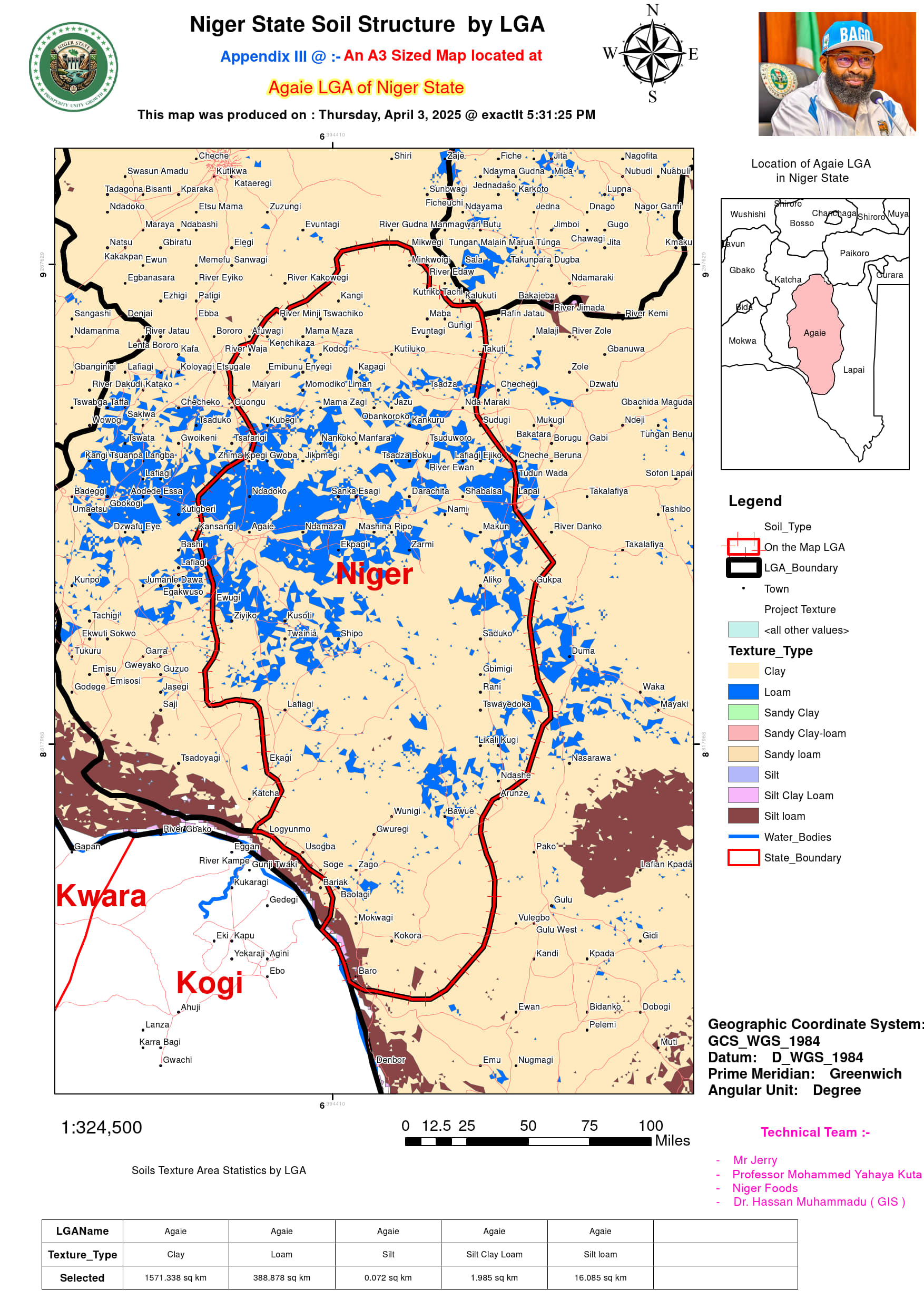
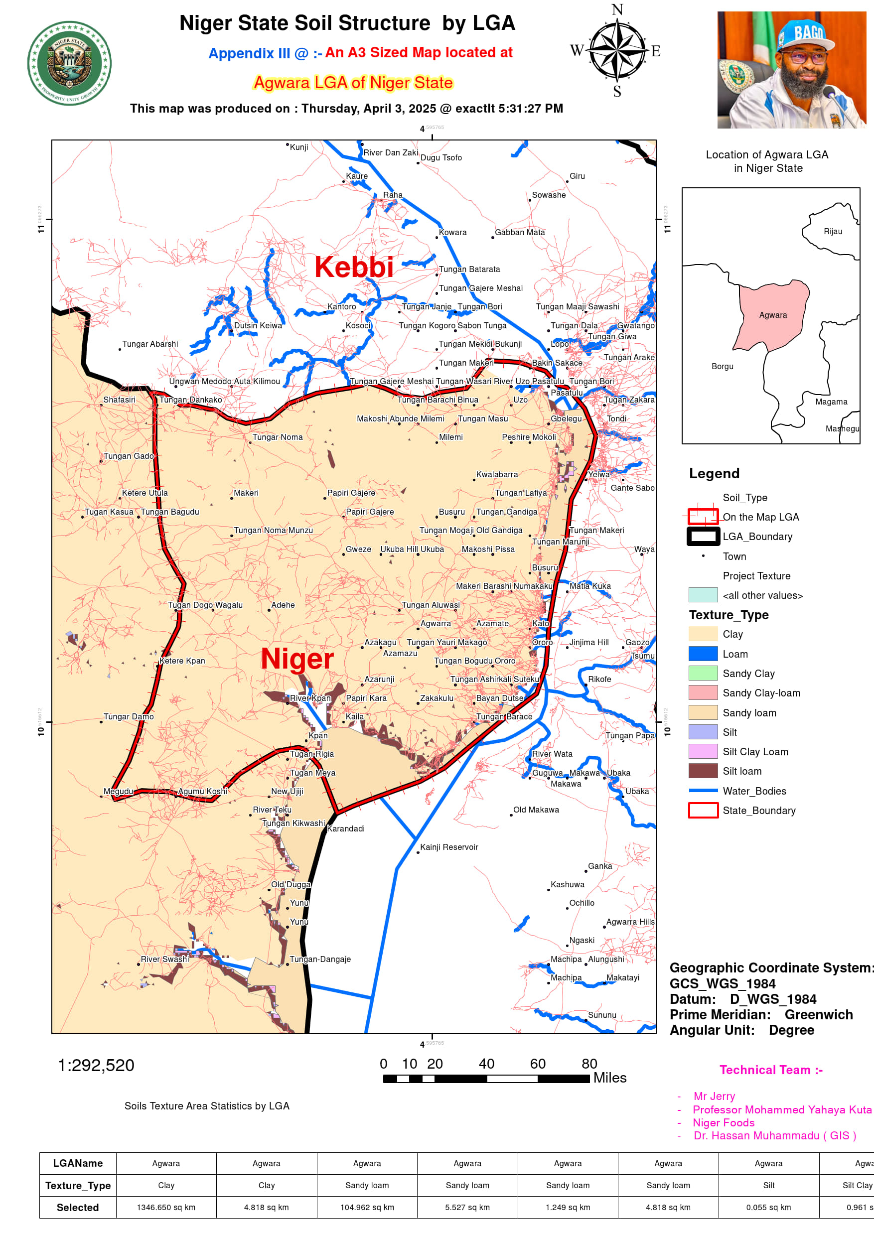
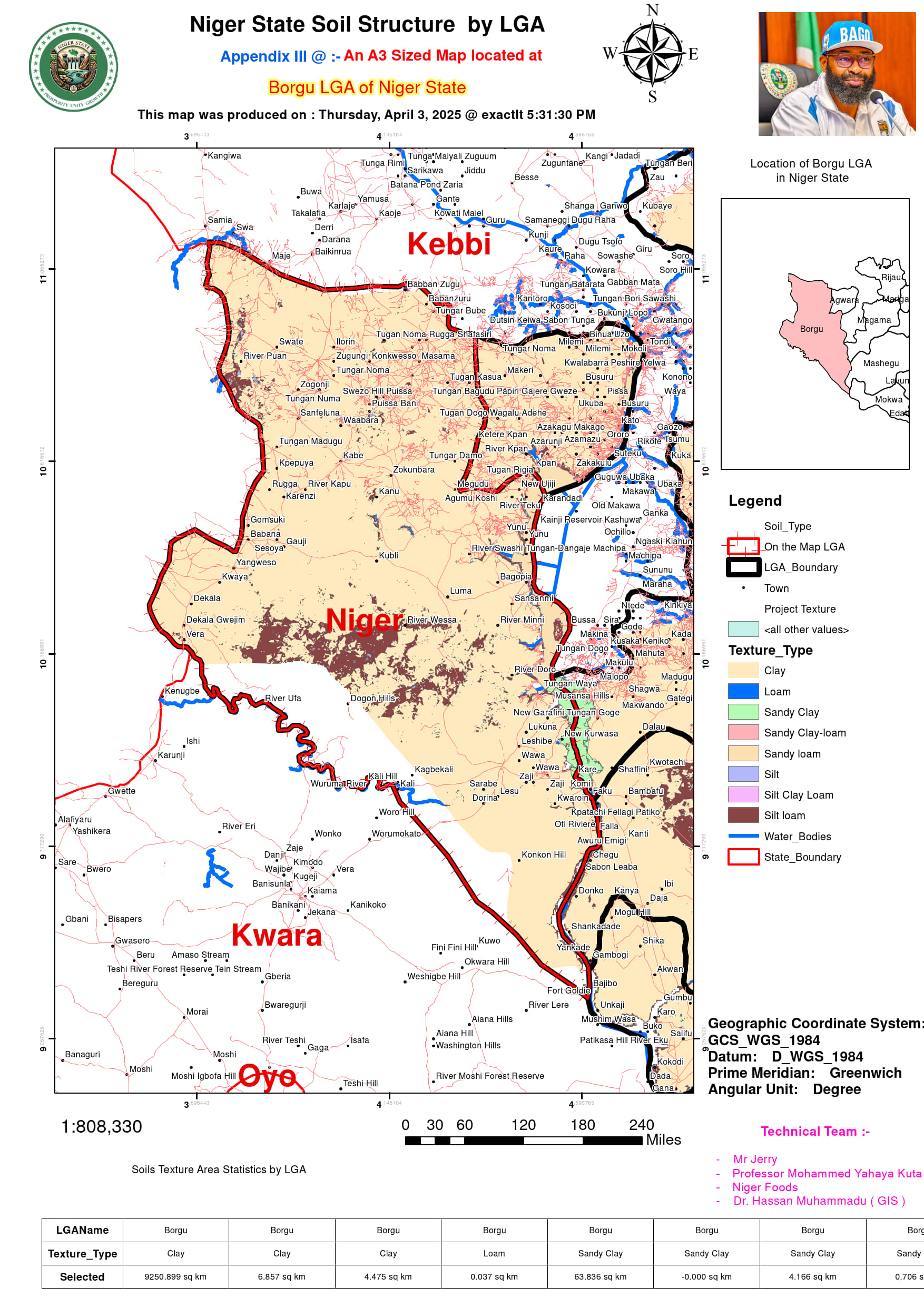
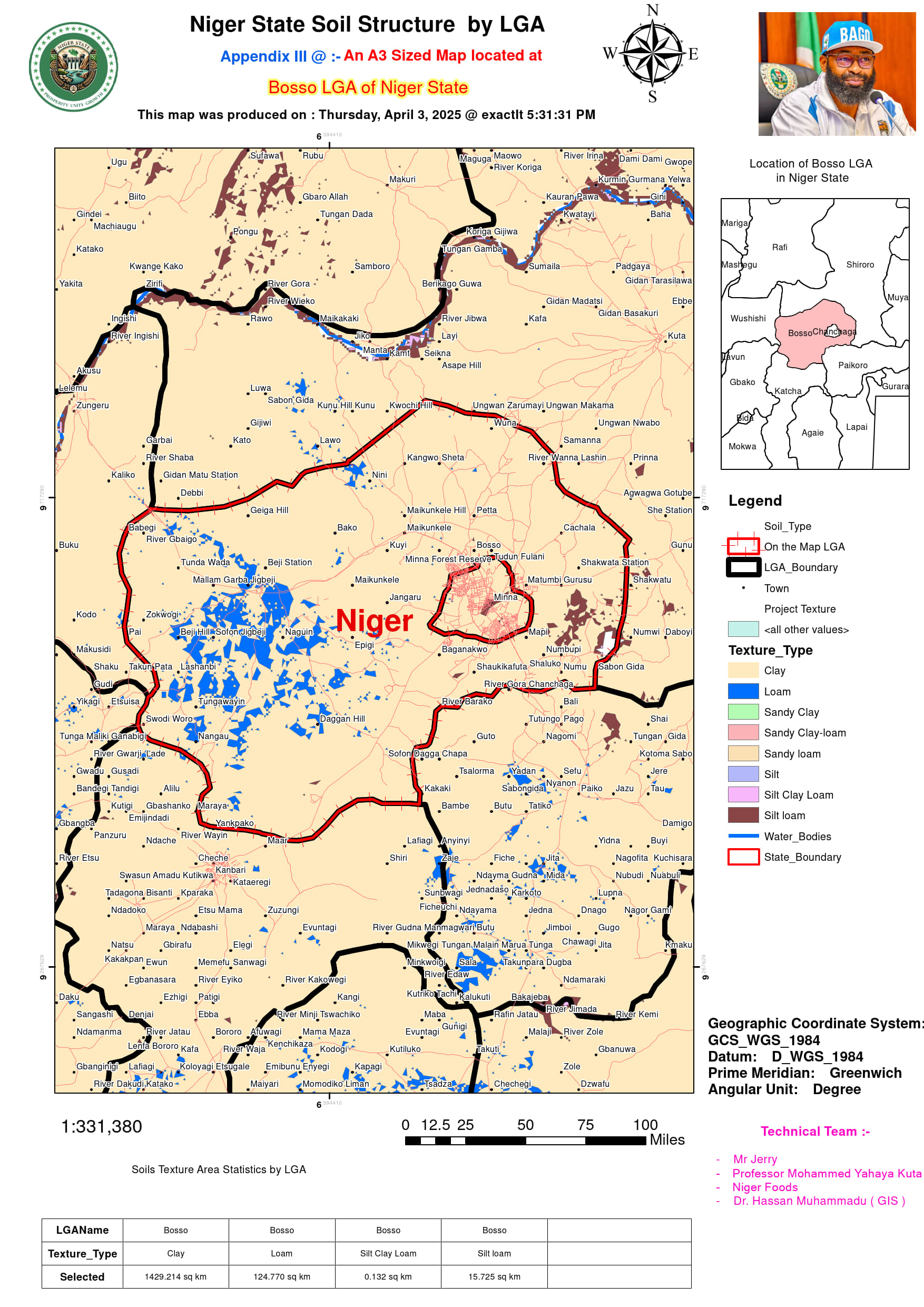
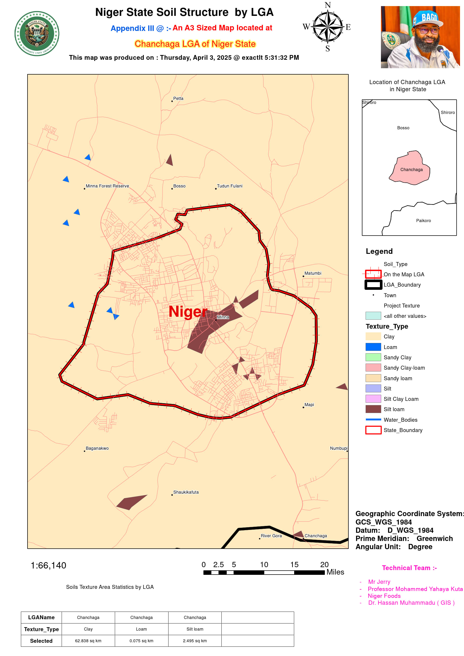
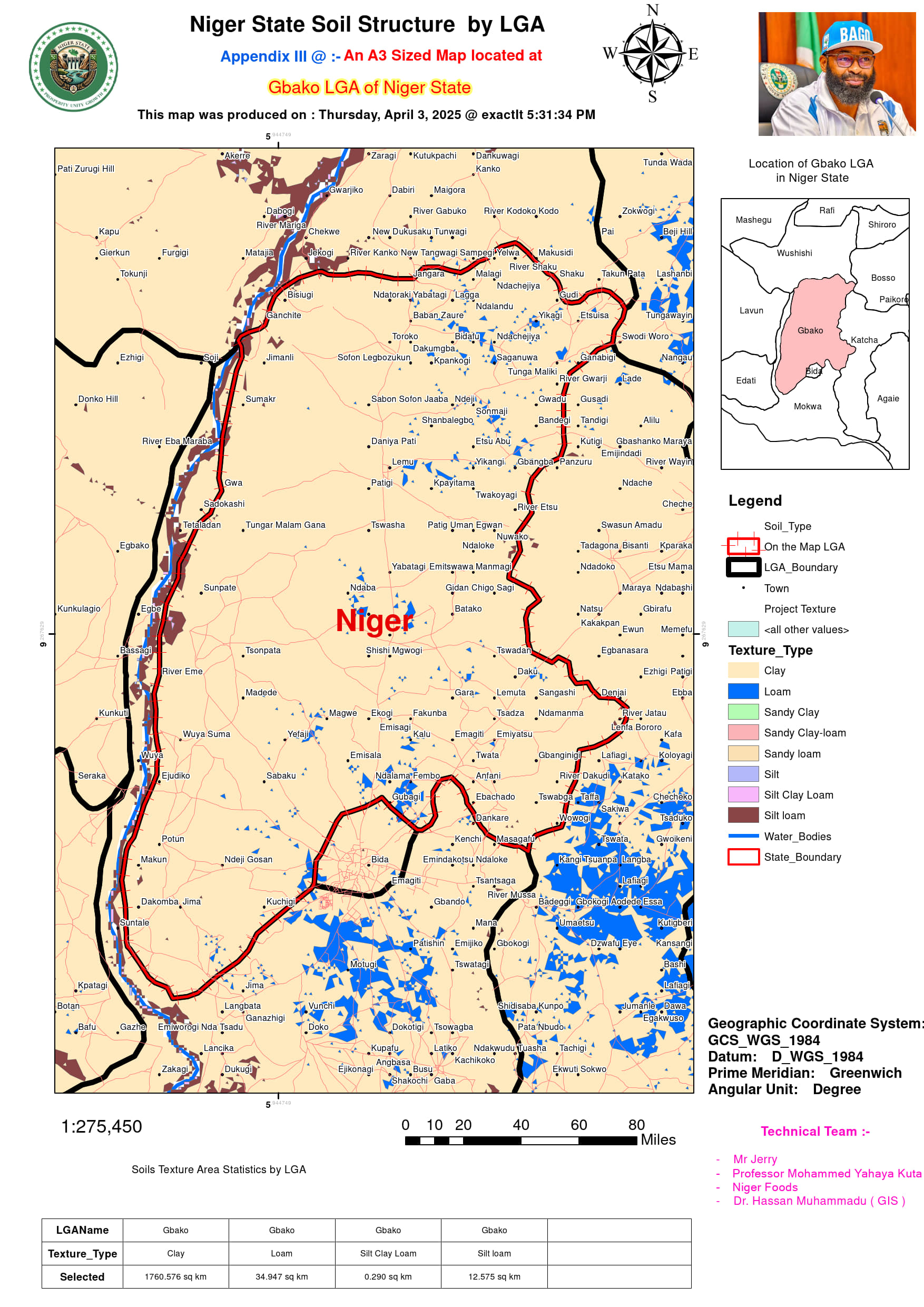
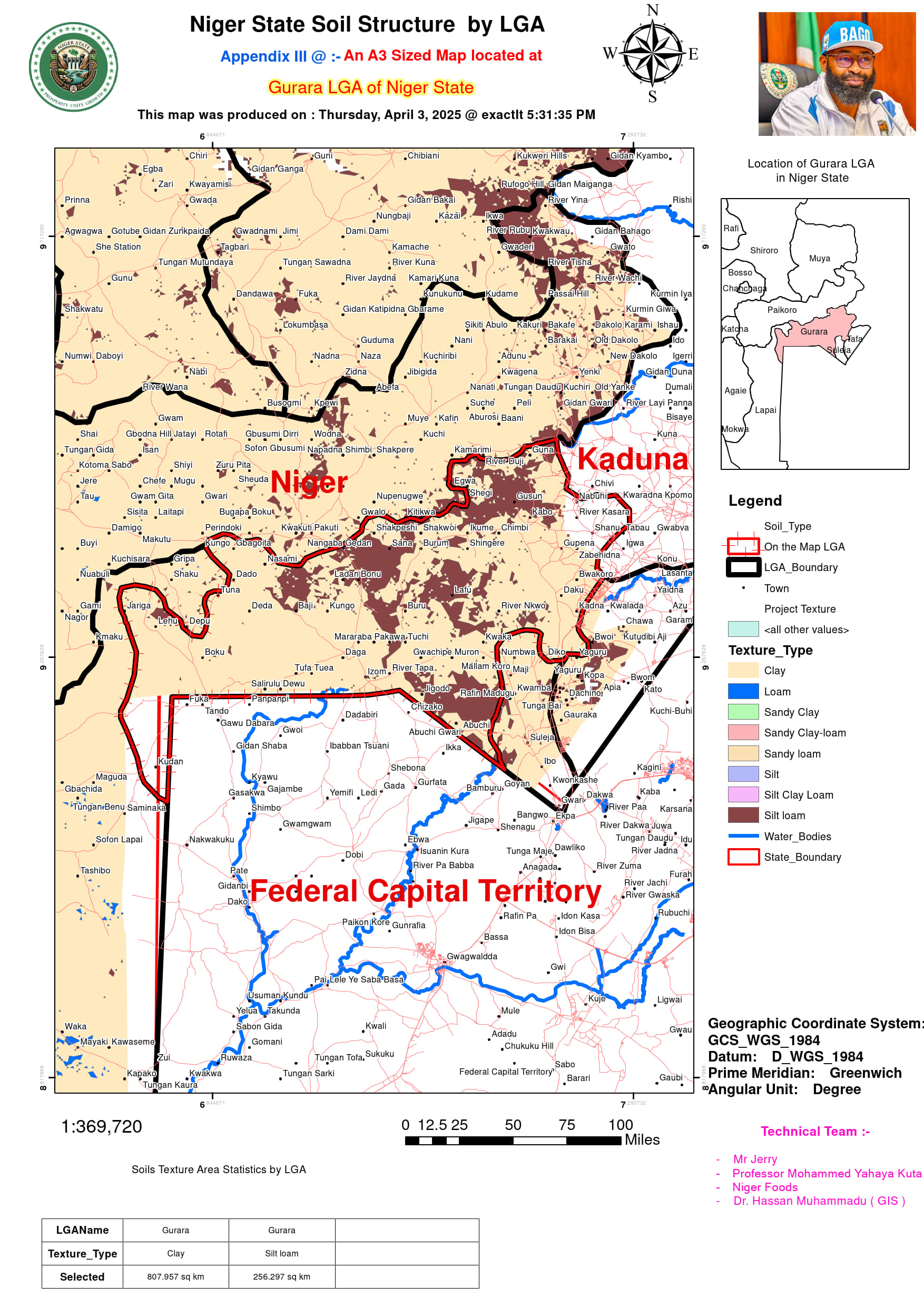
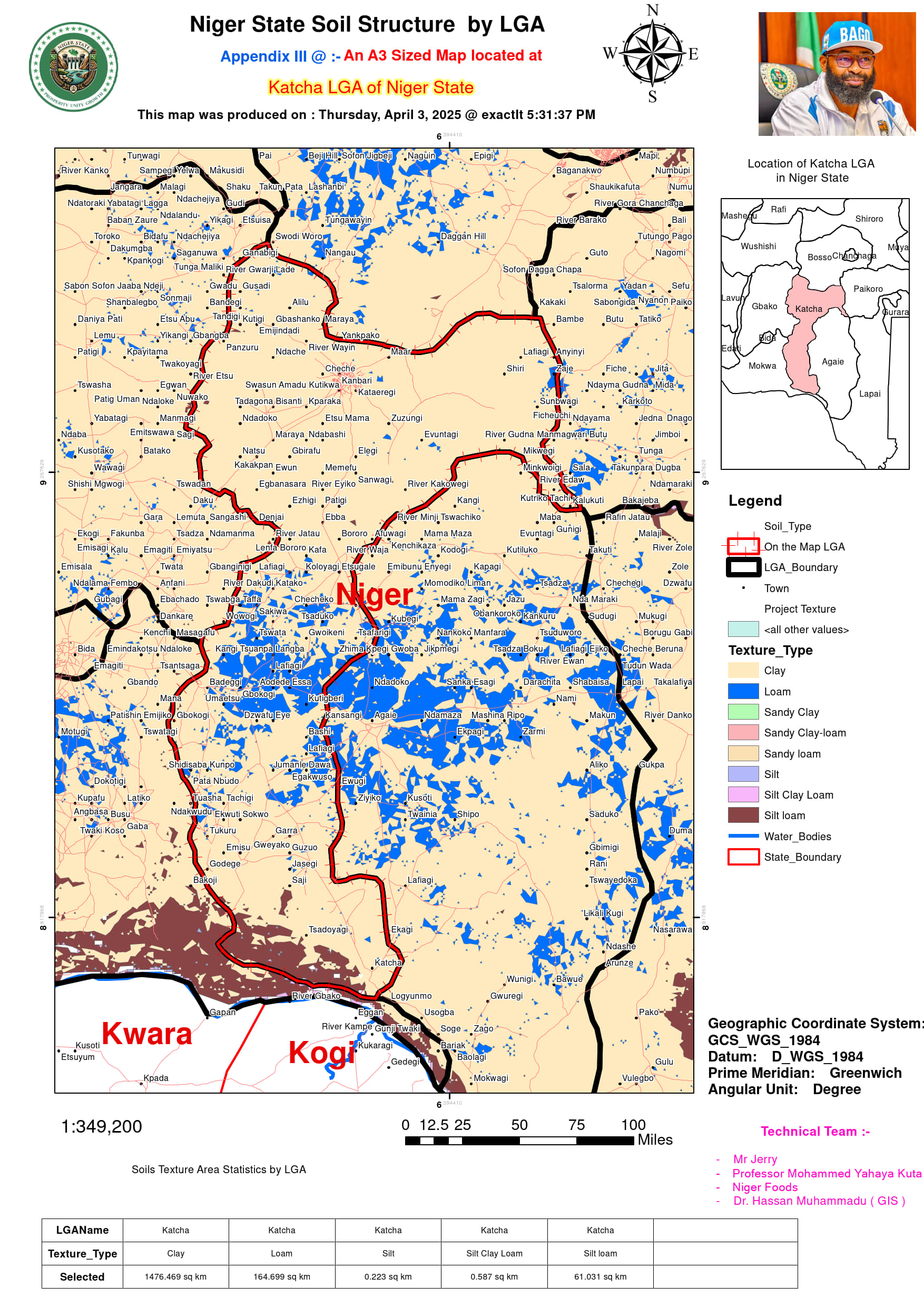
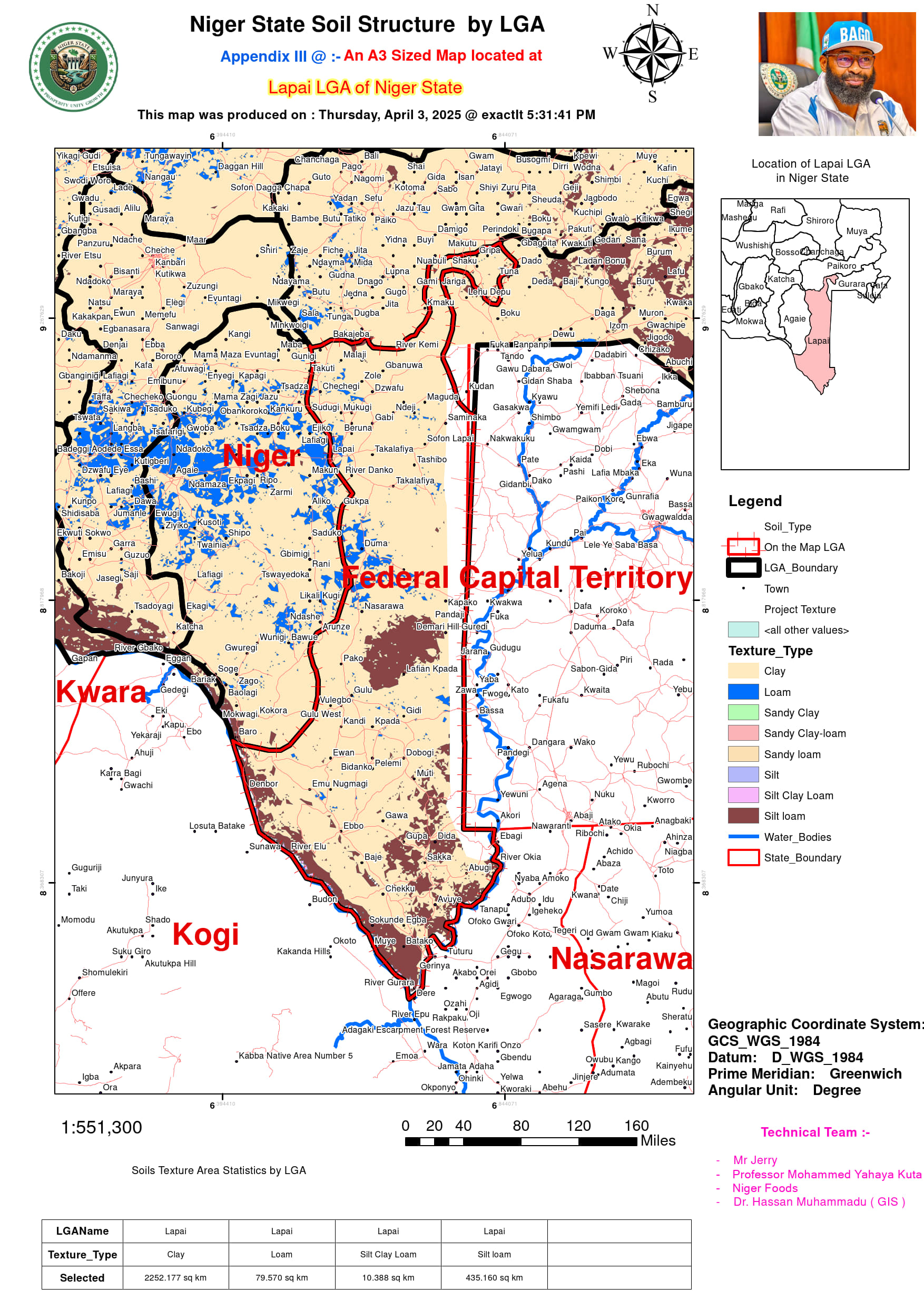
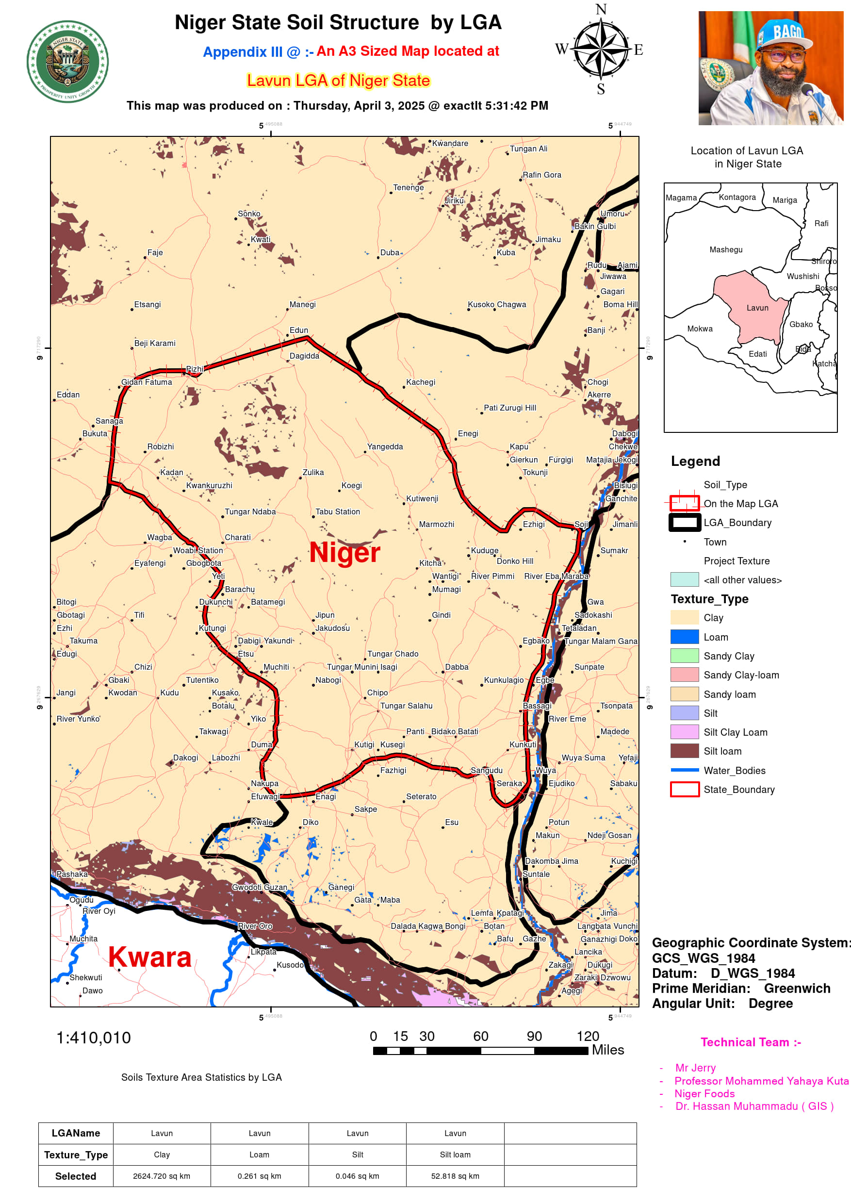
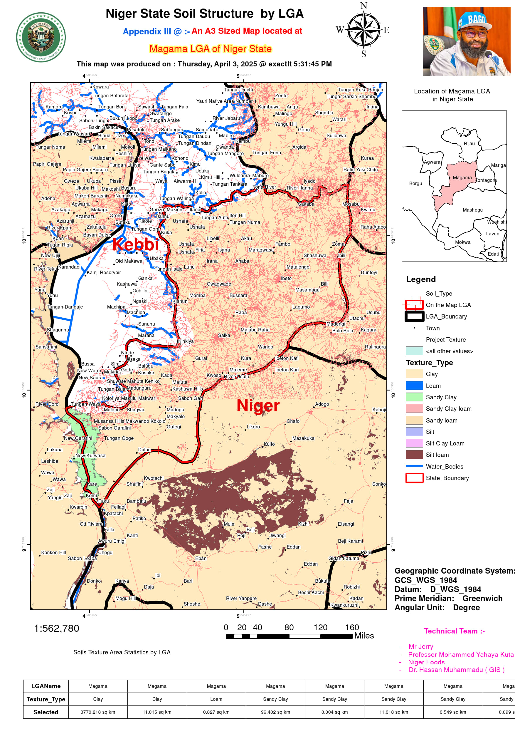
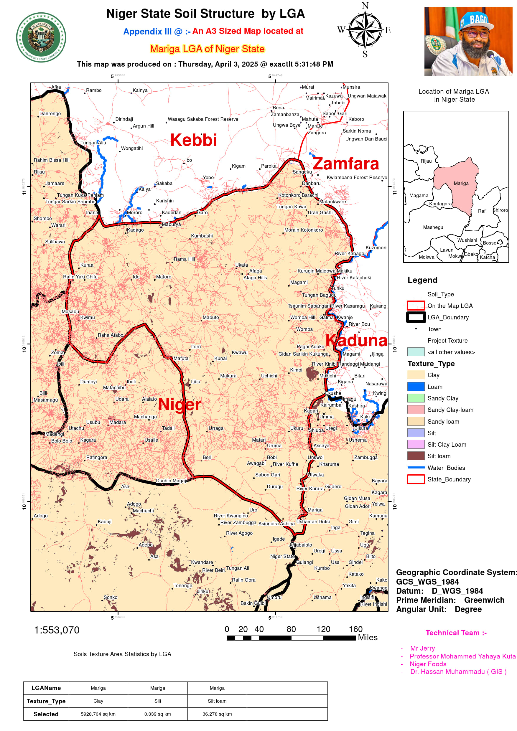
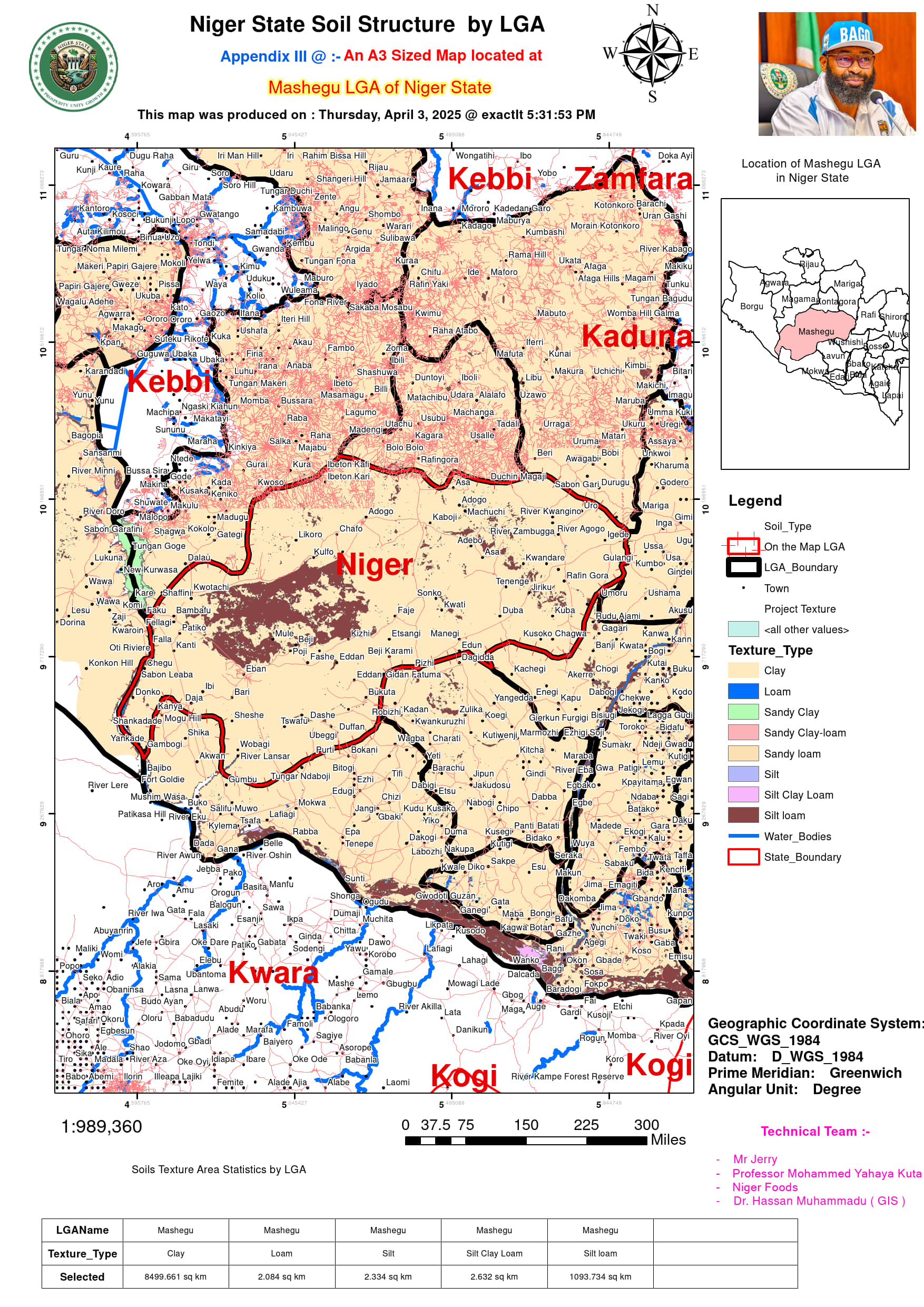
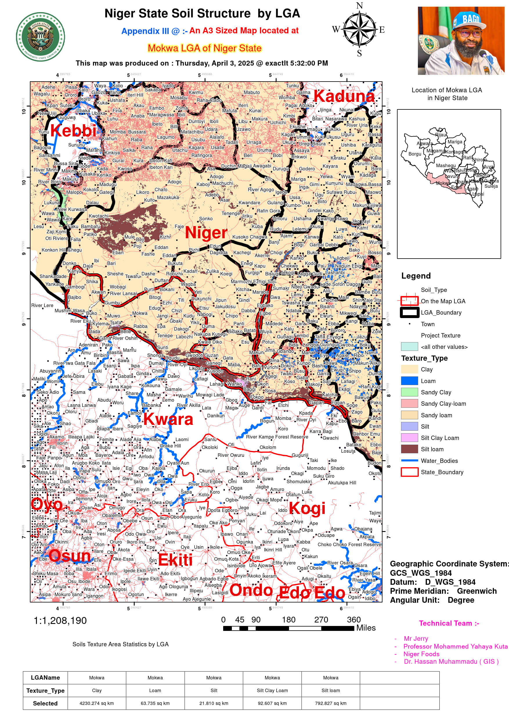
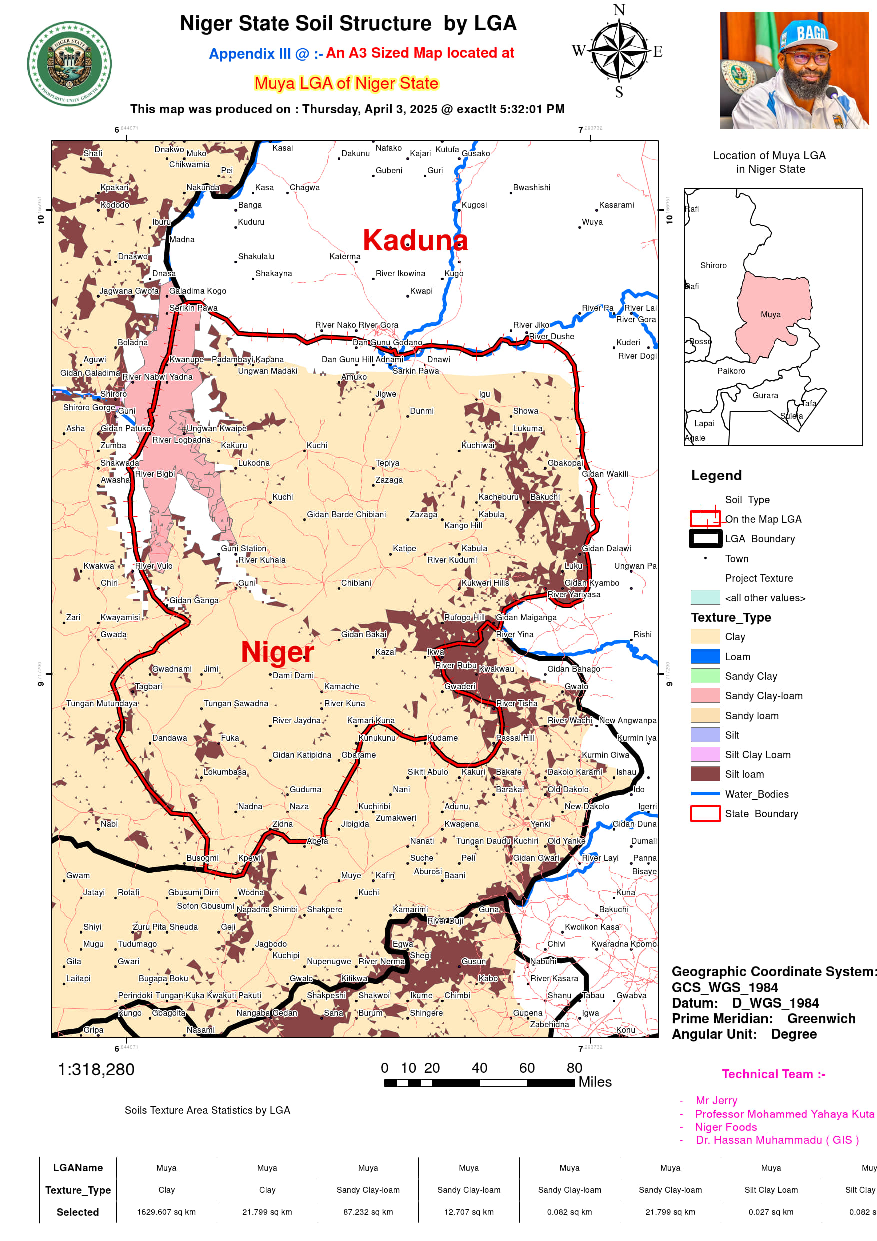
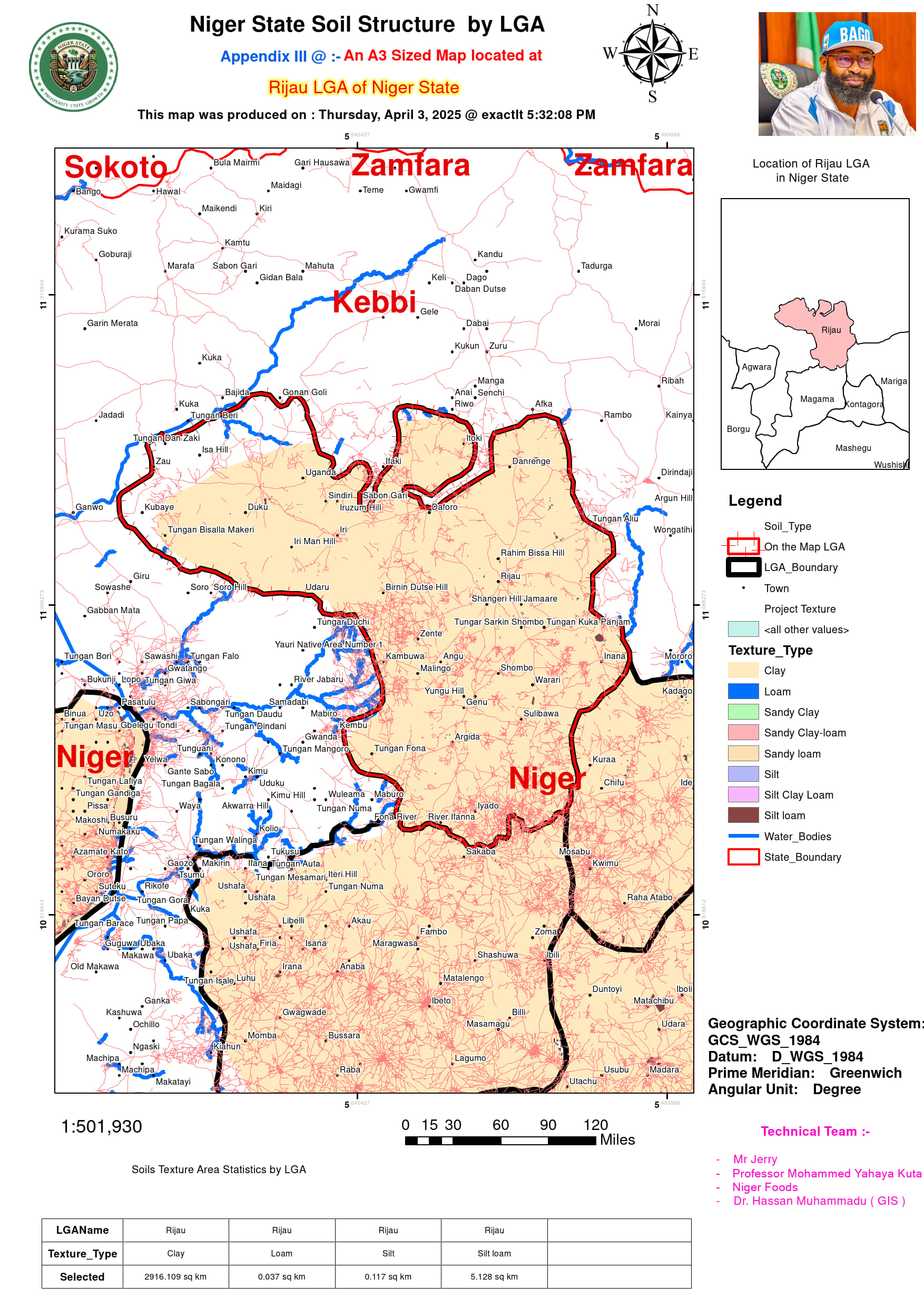
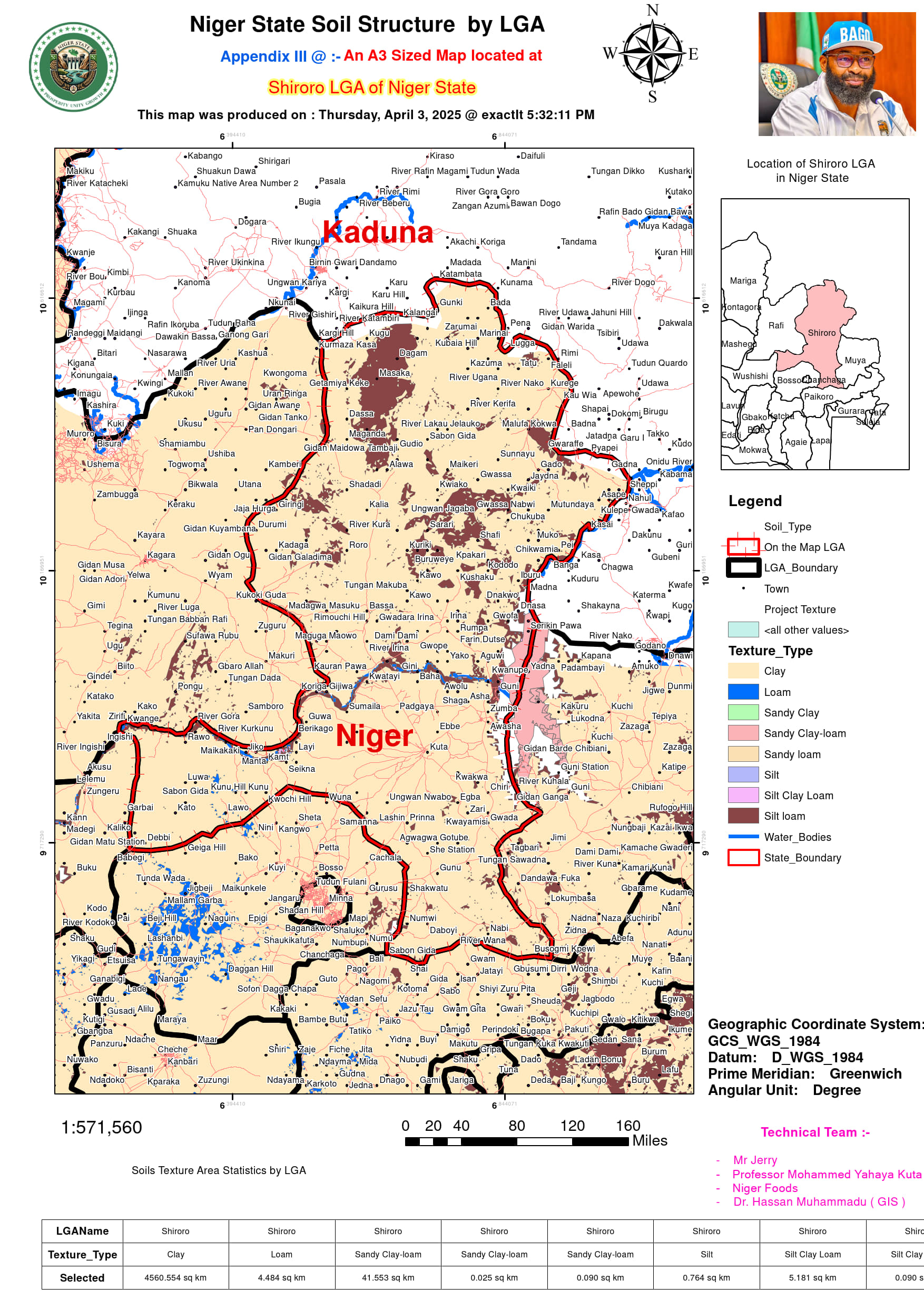
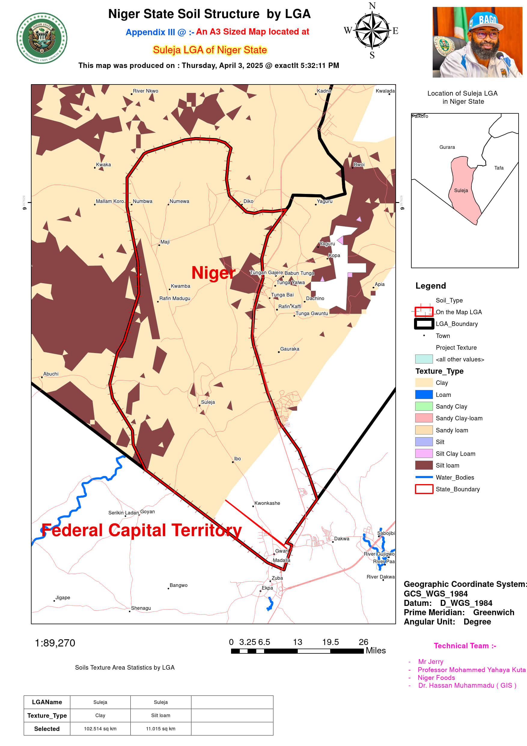
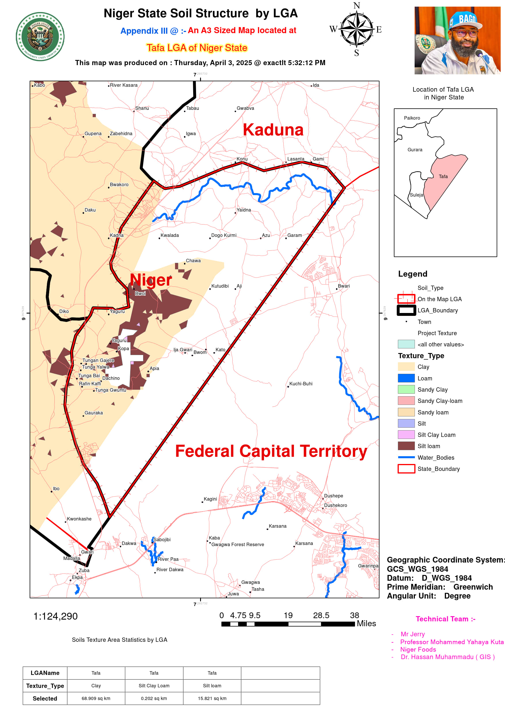
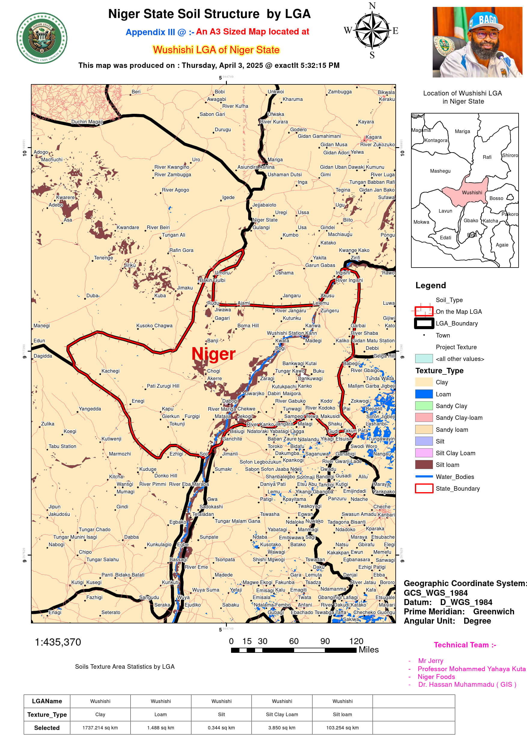
Niger State exhibits a complex mosaic of soil textures that reflect its diverse ecological zones and land use patterns. Clay soils dominate most LGAs, covering extensive areas such as Borgu (9250.899 sq km), Mariga (5928.704 sq km), Mashegu (8499.661 sq km), and Shiroro (4560.554 sq km), particularly in regions with floodplains, hilly terrain, or arid savannas where weathering processes produce fine-textured particles. These clay-rich areas, while fertile, often present drainage challenges. Silt loam textures are widely distributed across agricultural zones, prominently in Lapai (435.160 sq km), Mokwa (792.827 sq km), and Shiroro (614.889 sq km), where they support crop cultivation due to their balanced moisture retention and workability. Sandy loam soils, though less extensive, occur in Agwara (104.962 sq km) and Borgu (208.843 sq km), favoring faster drainage in these riverine and border regions. Transitional textures like silt clay loam appear patchily, notably in Mokwa (92.607 sq km) and Lapai (10.388 sq km), blending fertility with moderate permeability. Loamy soils form smaller but critical pockets in Agaie (388.878 sq km), Katcha (164.699 sq km), and Bosso (124.770 sq km), optimizing conditions for both agriculture and natural vegetation. Unique mixes such as sandy clay-loam in Muya (87.232 sq km) and Shiroro (41.553 sq km) reflect localized geological influences, while sandy clay emerges in Borgu (63.836 sq km) and Magama (96.402 sq km), typical of arid northern fringes. Urbanized areas like Chanchaga and Suleja show limited silt loam (2.495 sq km) and clay (62.838–102.514 sq km), altered by infrastructure. The prevalence of clay in riverine LGAs (Katcha: 1476.469 sq km; Agwara: 1346.650 sq km) contrasts with coarser textures in uplands, underscoring how elevation and hydrology shape soil profiles. This intricate texture distribution—from water-retentive clays in Lavun (2624.720 sq km) to drought-prone sandy loams in Magama (1.816 sq km)—directly impacts farming systems, irrigation needs, and erosion risks across the state.
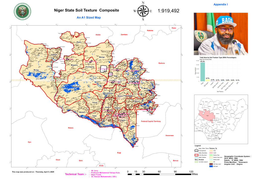
The soil texture distribution across Niger State reveals significant variations in land suitability for different agricultural activities. Sandy loam, which supports well-drained cropping systems, is widely found in LGAs such as Agwara (104.962 sq km) and Borgu (208.843 sq km), offering optimal conditions for tuber and legume cultivation. Similarly, silt loam, known for its moderate water retention, is prominent in regions like Bida, Bosso, and Wushishi, covering extensive areas such as Borgu (703.793 sq km) and Mokwa (792.827 sq km). The presence of silt loam in agricultural hubs like Gurara (256.297 sq km) and Lapai (435.160 sq km) underscores its importance in sustaining staple food crops while supporting livestock grazing. Additionally, silt clay loam, a more structured variant, is distributed in smaller patches across Muya (92.607 sq km) and Shiroro (5.181 sq km), offering potential for controlled irrigation-based farming. These findings highlight the soil’s role in determining crop viability and productivity in both rainfed and irrigated farming systems.
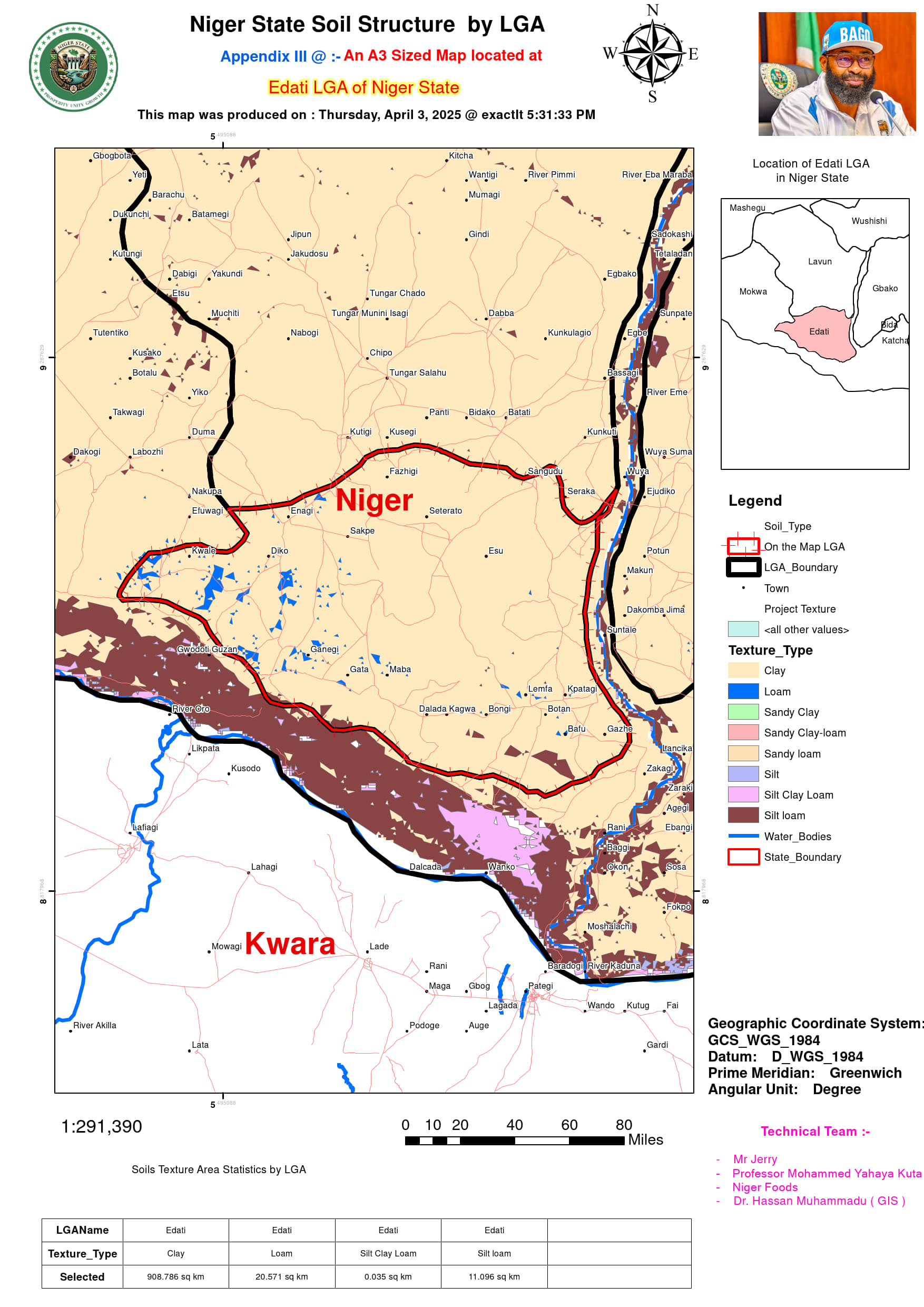
A deeper analysis of clay-dominant areas provides insights into large-scale agricultural potentials. The prevalence of clay soil in LGAs such as Lavun (2624.720 sq km), Mariga (5928.704 sq km), and Mashegu (8499.661 sq km) suggests the possibility of expanding wetland agriculture and large-scale mechanized farming. Clay’s water-holding capacity makes it suitable for rice production, particularly in flood-prone regions like Mokwa (4230.274 sq km) and Edati (908.786 sq km). Meanwhile, loamy soils, which balance drainage and fertility, are concentrated in Agaie (388.878 sq km), Bosso (124.770 sq km), and Katcha (164.699 sq km), facilitating diverse agricultural practices, including horticulture and arable farming. Areas with mixed sandy clay-loam compositions, such as Shiroro (41.553 sq km) and Muya (87.232 sq km), suggest potential for agroforestry and rotational cropping. By integrating this soil profile with climate considerations, the state can optimize land use planning, ensuring efficient resource allocation for food security and commercial agriculture.
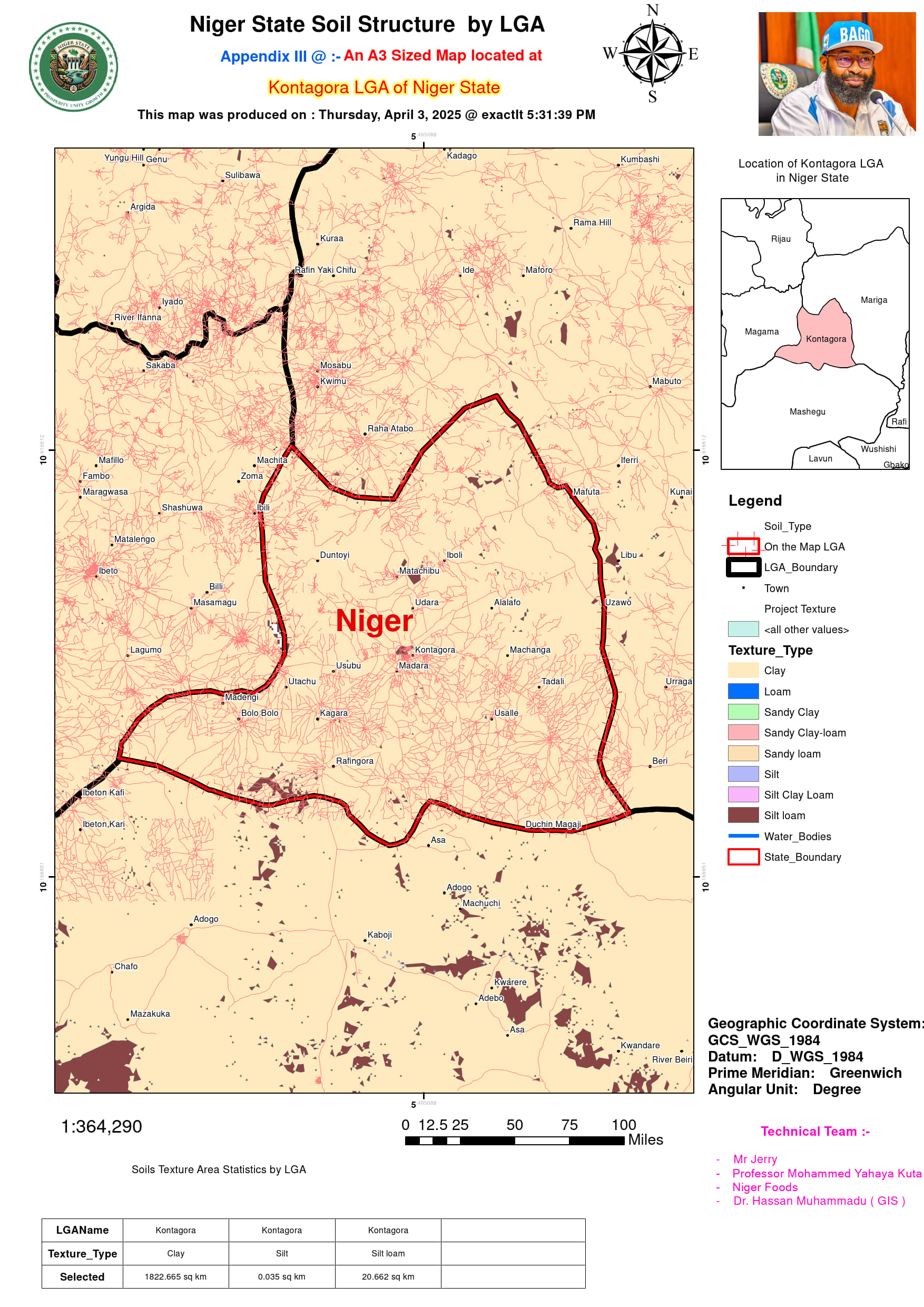
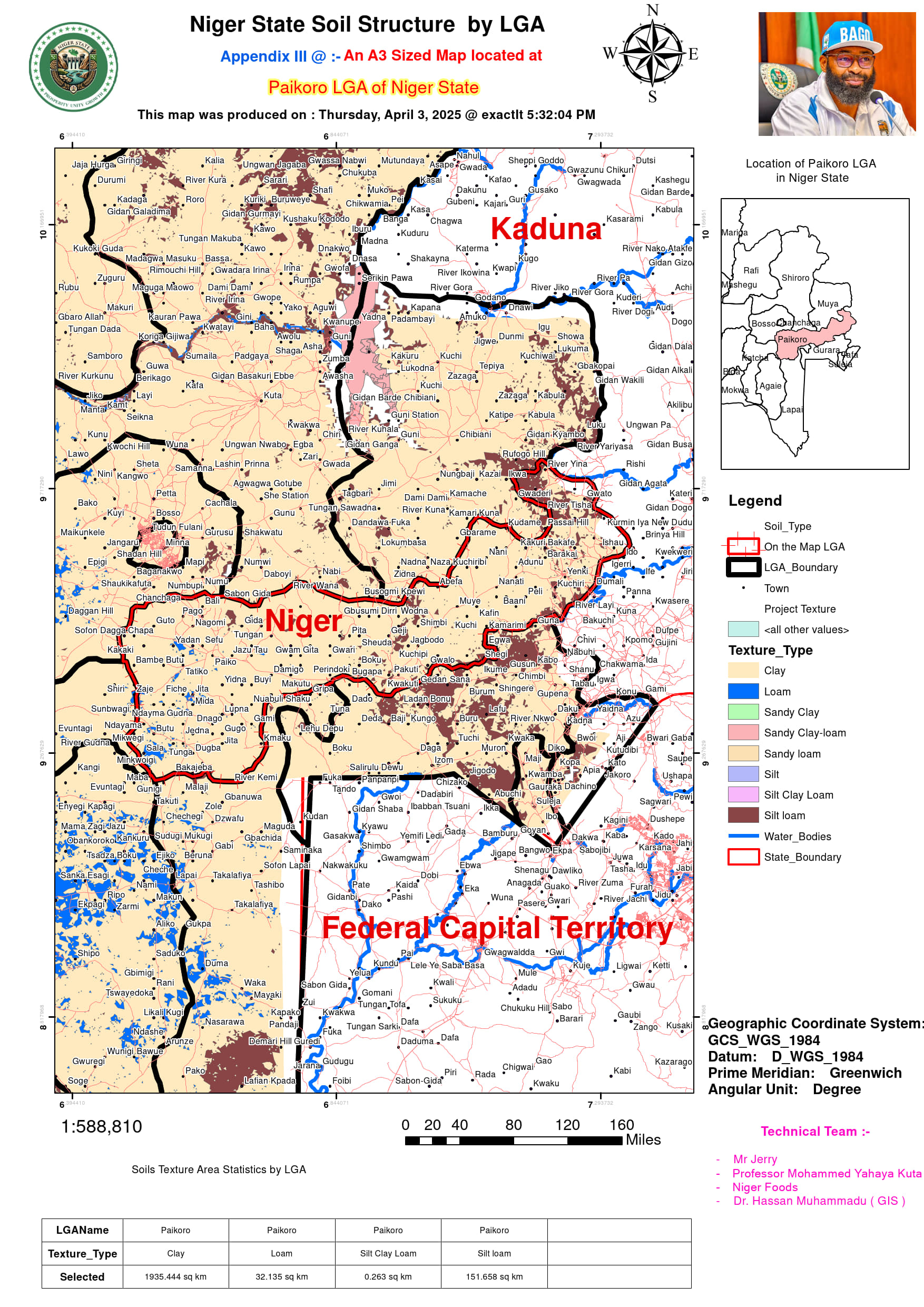
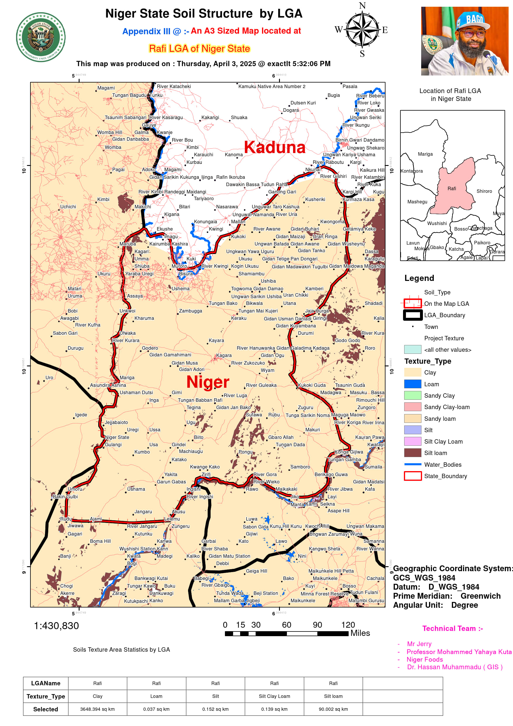
The combination of silt and clay loams in areas like Kontagora (20.662 sq km), Paikoro (151.658 sq km), and Rafi (90.002 sq km) indicates potential for integrated farming systems that combine crop cultivation with pasture development. These soils offer a balance between moisture retention and aeration, making them ideal for sustainable mixed farming. In contrast, highly concentrated clay regions such as Borgu (9250.899 sq km), Mashegu (8499.661 sq km), and Magama (3770.218 sq km) suggest opportunities for wetland rice cultivation, dam-fed irrigation projects, and even aquaculture ventures. The expansive clay-rich terrains of Lavun, Rafi, and Wushishi further reinforce the viability of large-scale irrigation schemes that could enhance food production and reduce seasonal farming dependency.
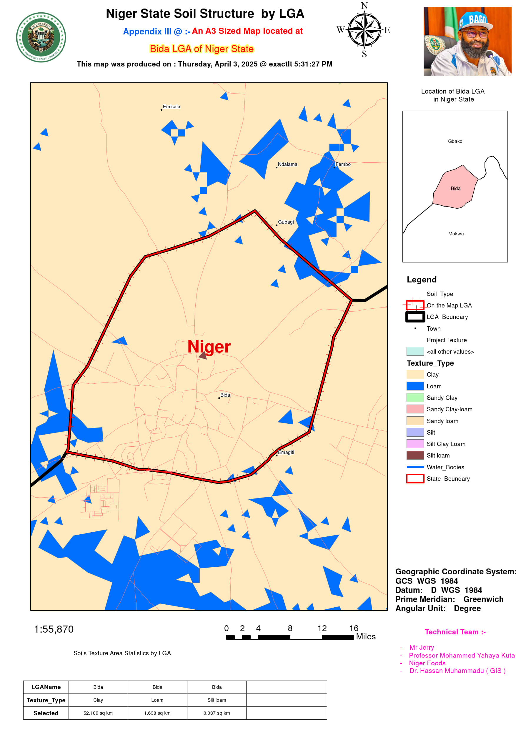
Additionally, the presence of sandy clay loam in Muya (87.232 sq km) and Shiroro (41.553 sq km) introduces opportunities for controlled farming practices, such as agroforestry, which integrates trees with crops to improve soil fertility and prevent erosion. The availability of smaller pockets of loamy and silt-based soils in LGAs like Bida (1.638 sq km), Edati (20.571 sq km), and Rijau (0.037 sq km) suggests localized agricultural zones suited for high-value crop production, including vegetables and fruits. As Nigeria advances its livestock reforms, areas with extensive clay soils—such as Mariga, Paikoro, and Kontagora—could be leveraged for pasture development and controlled grazing systems. This strategic land use approach would not only optimize agricultural output but also mitigate conflicts over grazing land. A holistic soil-based agricultural strategy, integrating irrigation, conservation practices, and sustainable land management, will be key to maximizing Niger State’s agricultural potential.
