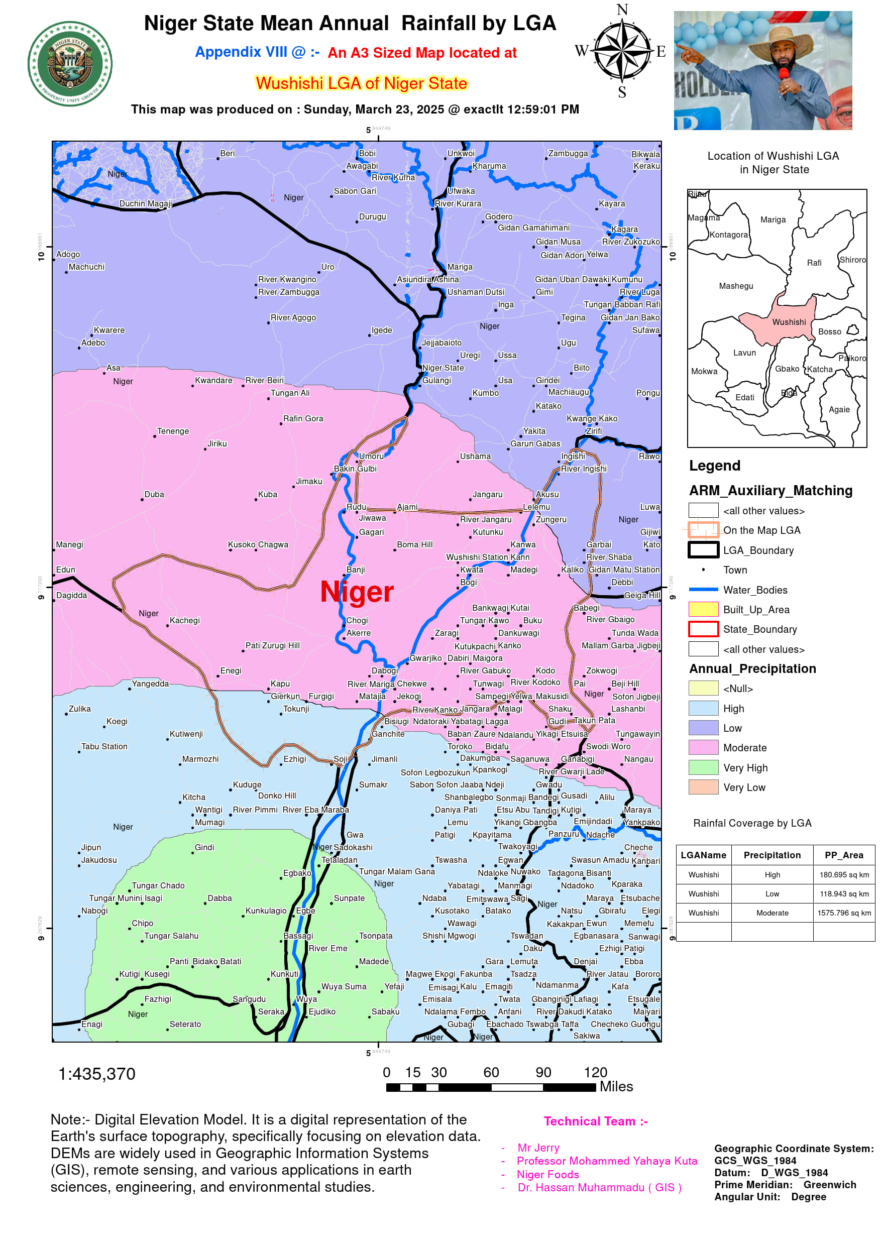
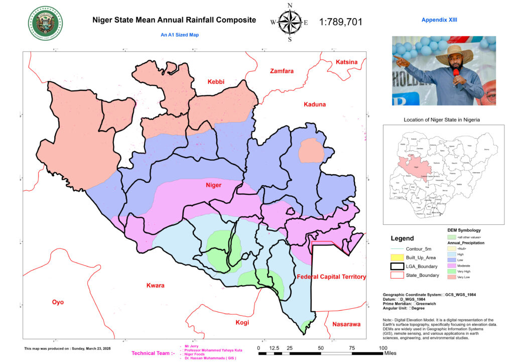
Rainfall Patterns Seasonal Distribution
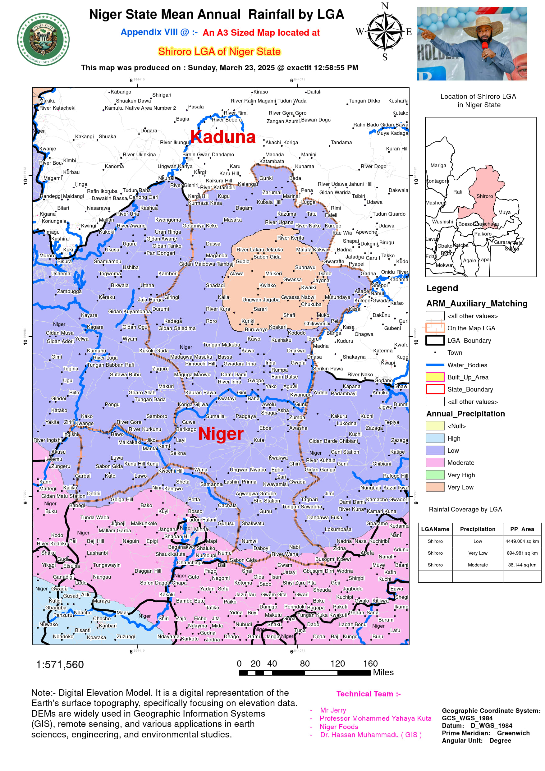
Niger State experiences distinct wet and dry seasons shaped by regional climatic patterns. The wet season (April–October) begins with rainfall onset in April, first affecting southern areas like Shiroro and Lapai before progressing northward. Peak rainfall occurs between June and September, driven by moisture-laden southwesterly monsoon winds from the Atlantic Ocean. July and August are the wettest months, often recording over 250 mm of rainfall monthly, with precipitation tapering off by late October. The dry season (November–March) is characterized by minimal rainfall, with December to February marked by the dry, dusty harmattan winds. Spatially, rainfall distribution varies significantly: southern zones (e.g., Shiroro, Lapai, Minna) receive higher annual totals (1,400–1,600 mm) due to proximity to the Niger River and forested ecosystems, while northern areas (e.g., Kontagora, Borgu, Rijau) transition toward semi-arid conditions with lower precipitation (1,100–1,300 mm annually).
Rainfall Distribution and Regional Variability in Niger State
- Spatial Rainfall Patterns and Climatic Influences
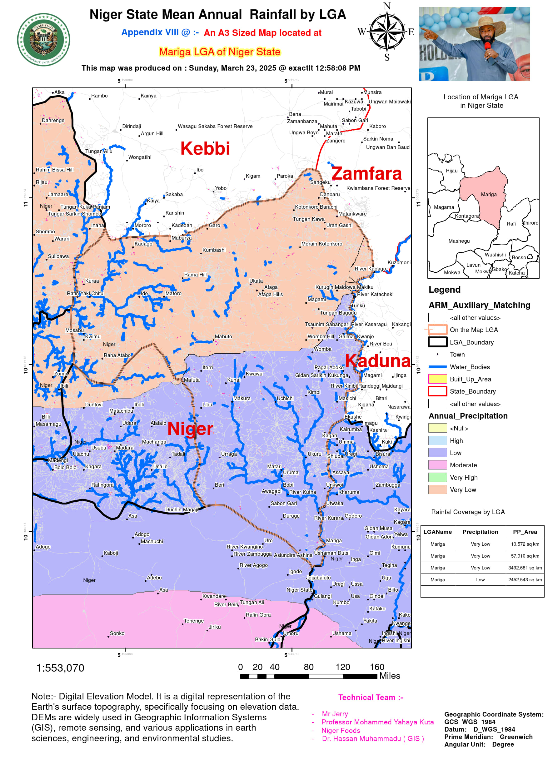
Rainfall distribution in Niger State varies significantly due to factors such as elevation, proximity to water bodies, and vegetation cover. Based on historical records from the Nigerian Meteorological Agency (NiMet) and CHIRPS satellite data, rainfall across the state ranges from a minimum of 500 mm/year in Mariga to a maximum of 1,800 mm/year in Shiroro, reflecting the diverse climatic conditions.
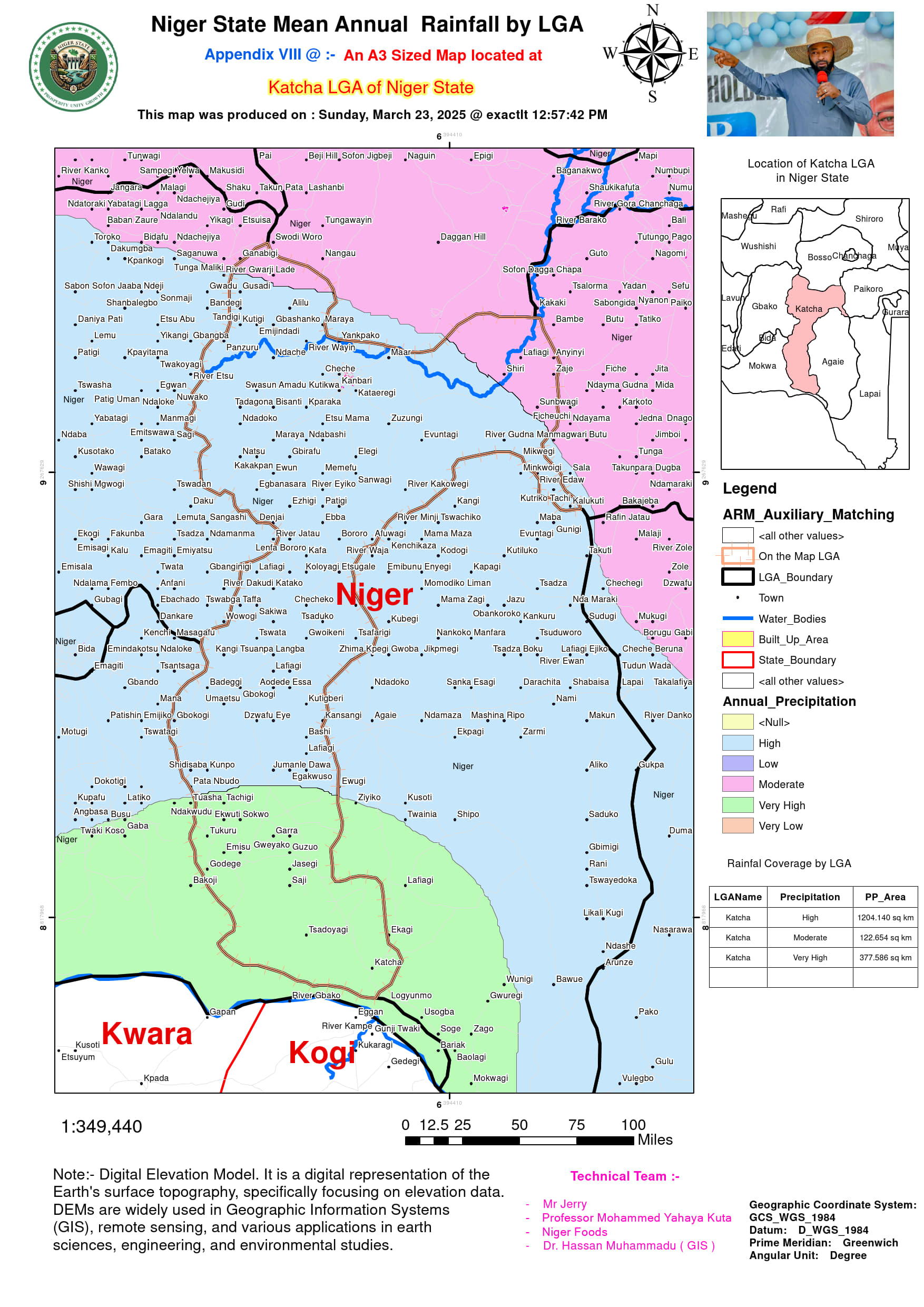
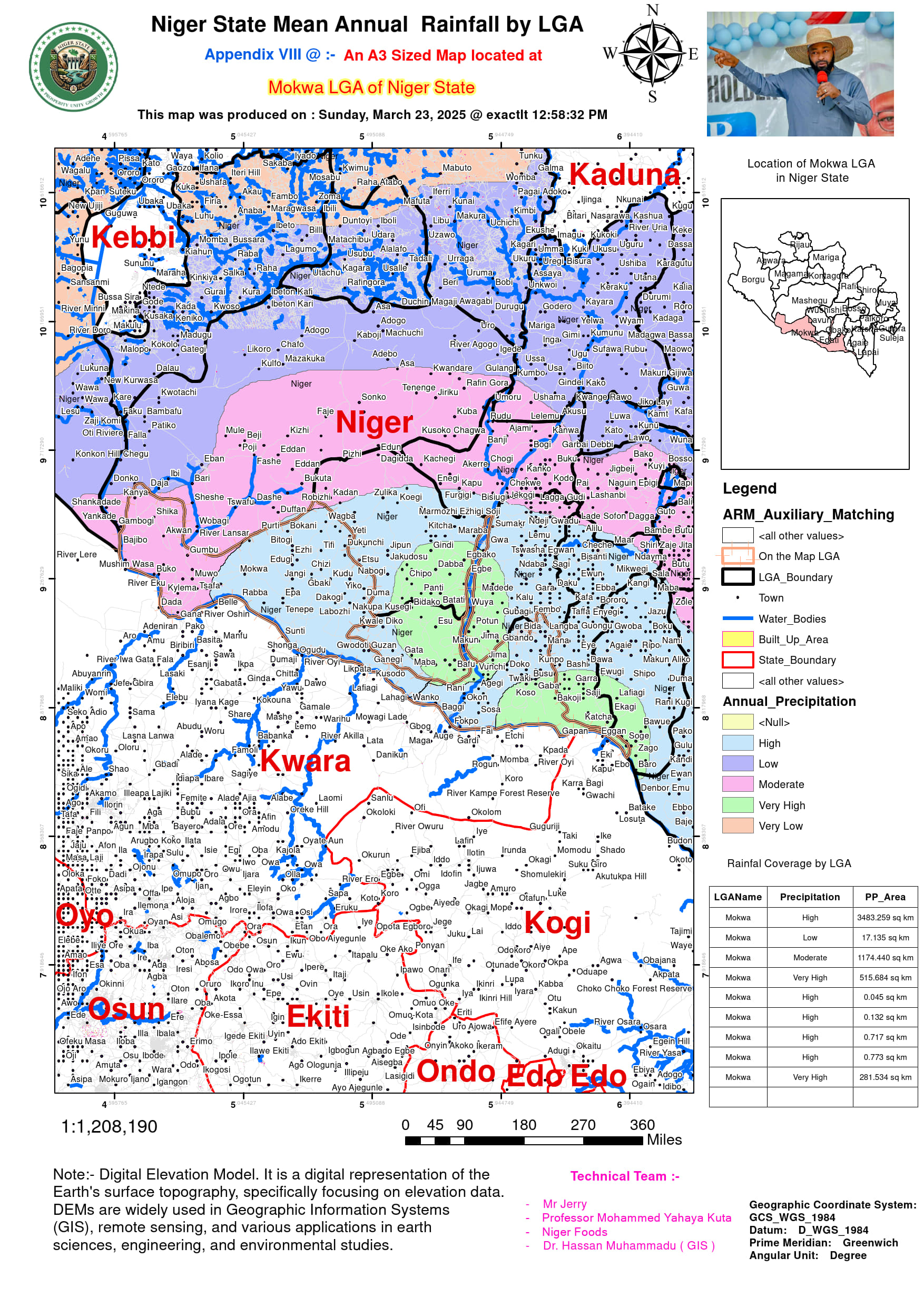
- High Rainfall Zones (Above 1,400 mm/year): LGAs such as Shiroro, Mokwa, and Katcha experience the highest levels of precipitation due to their proximity to water bodies and floodplains. The Shiroro Dam influences rainfall retention and contributes to increased atmospheric moisture, while the Mokwa floodplains receive consistent rainfall suitable for aquatic agriculture.
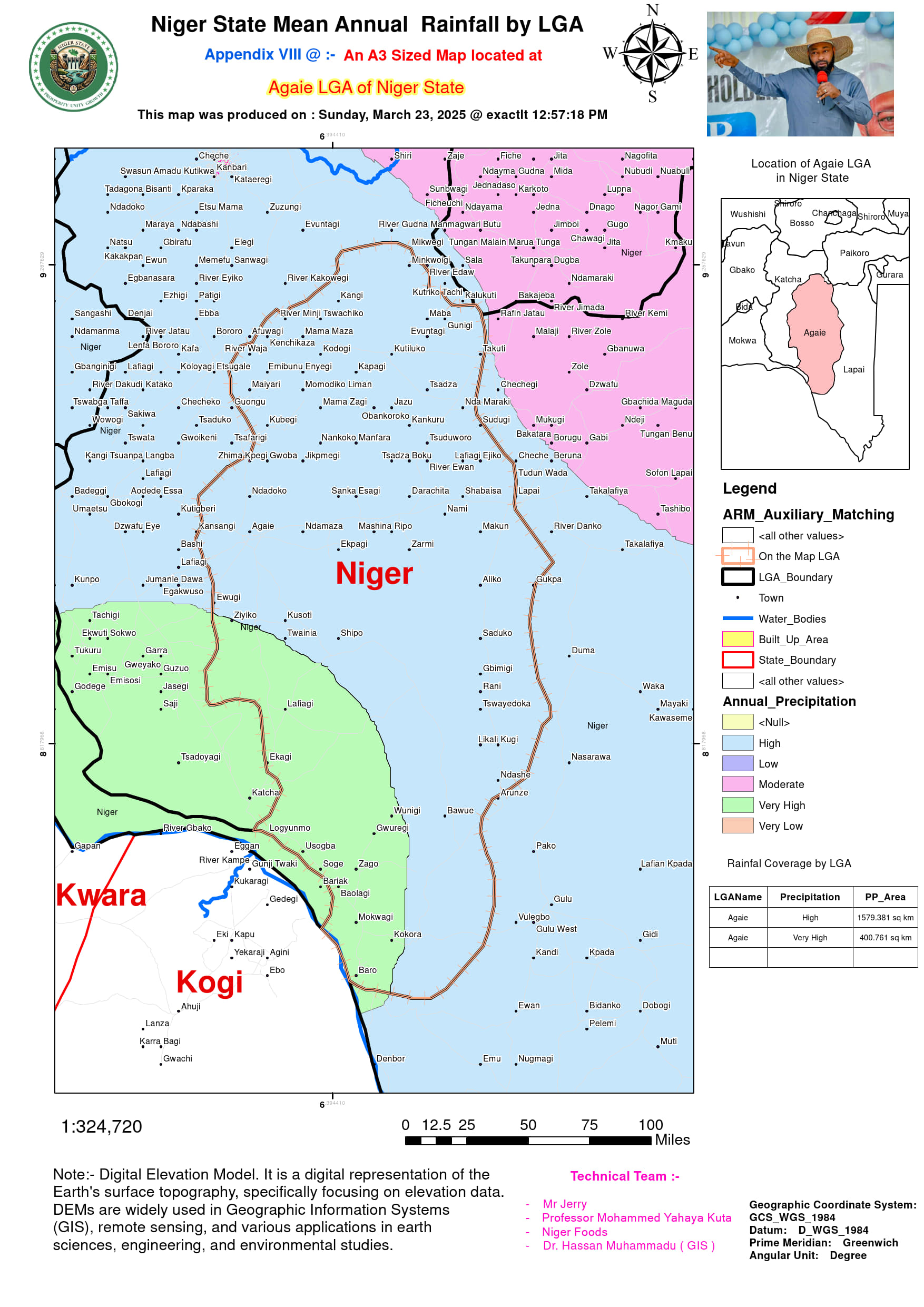
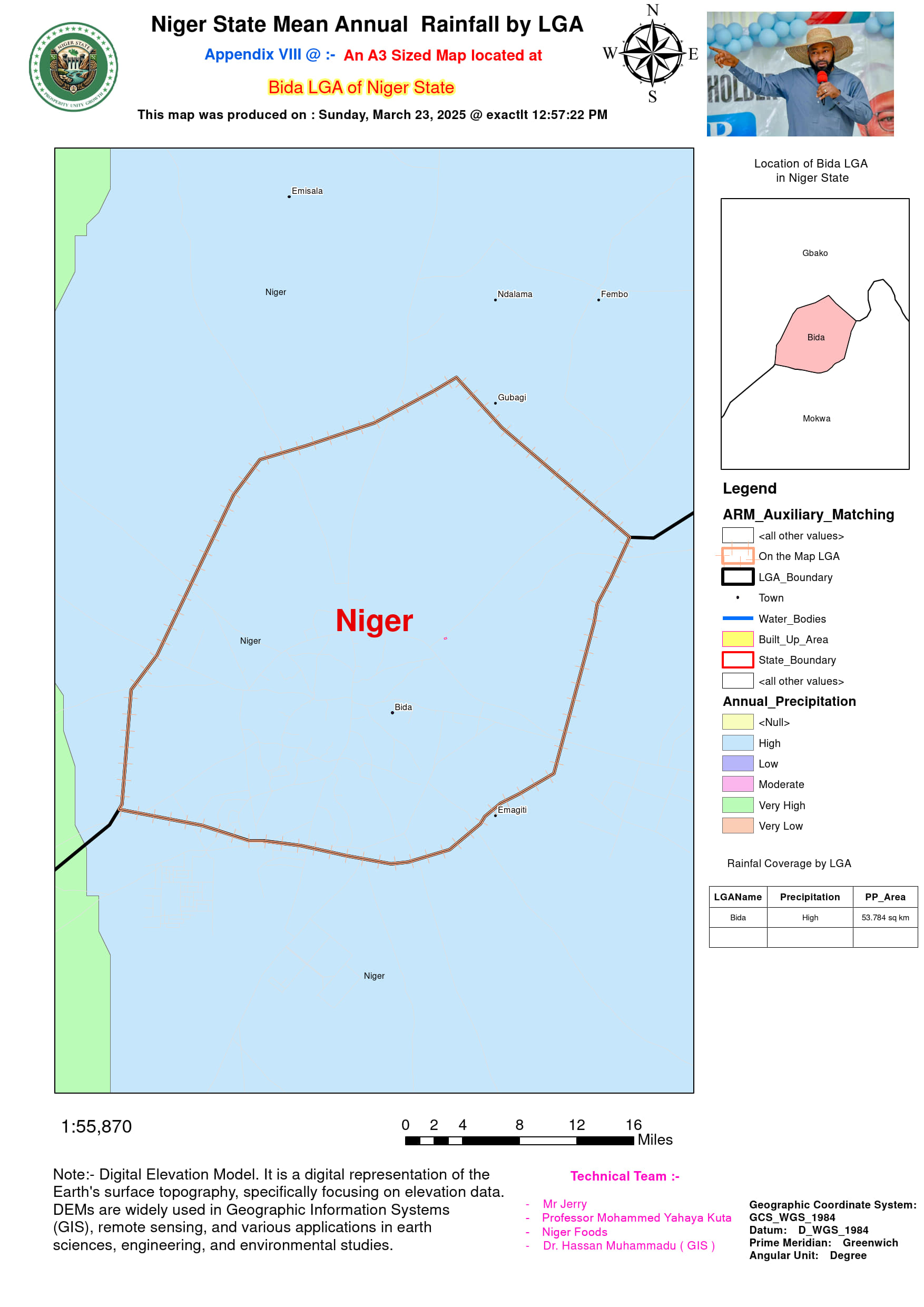
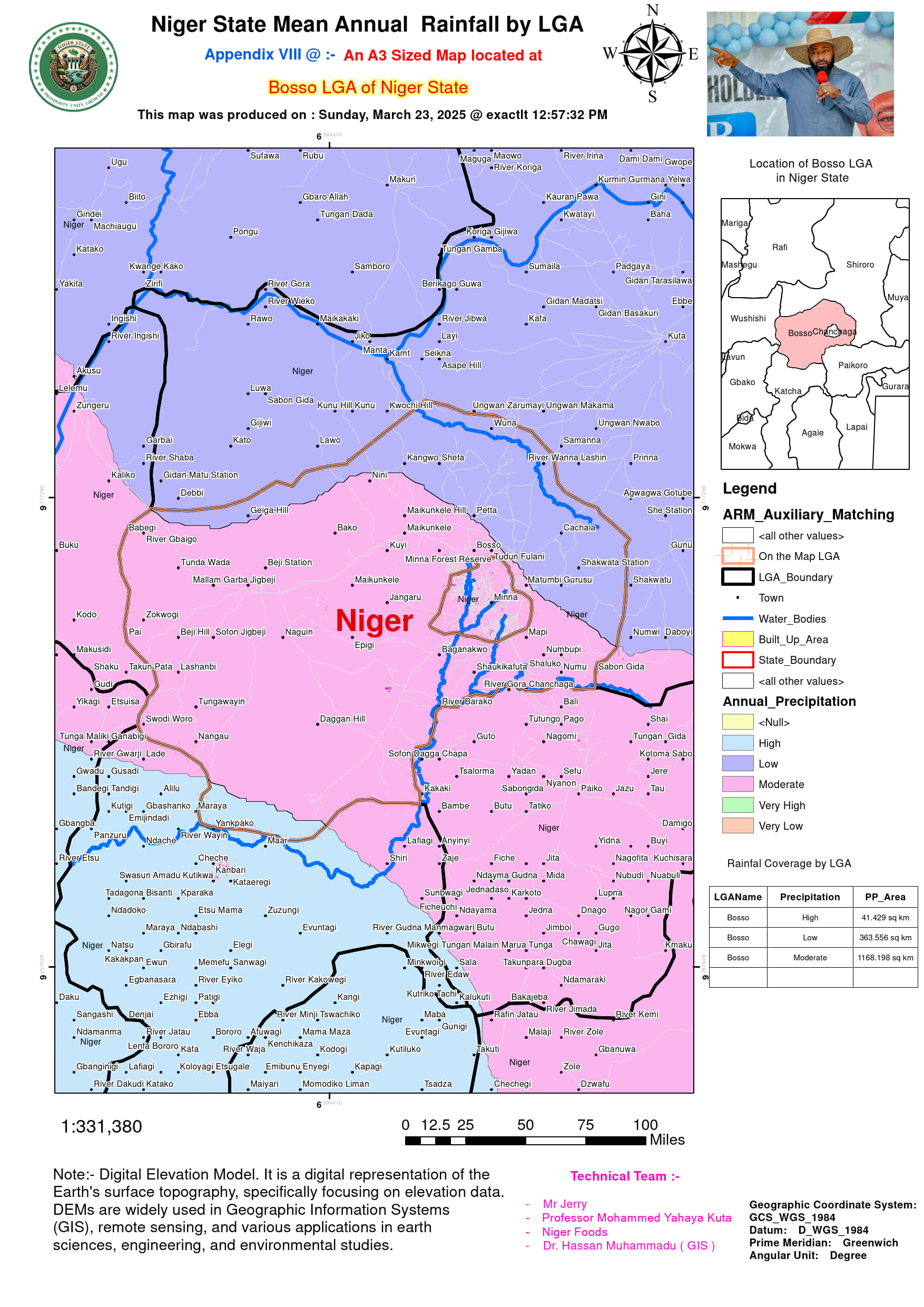
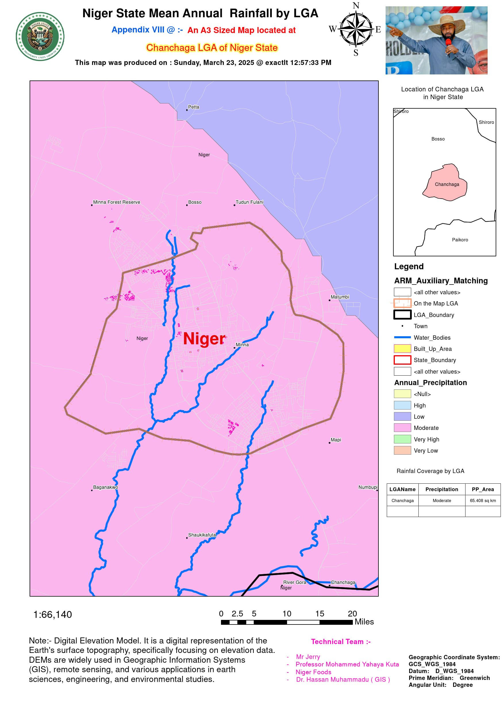
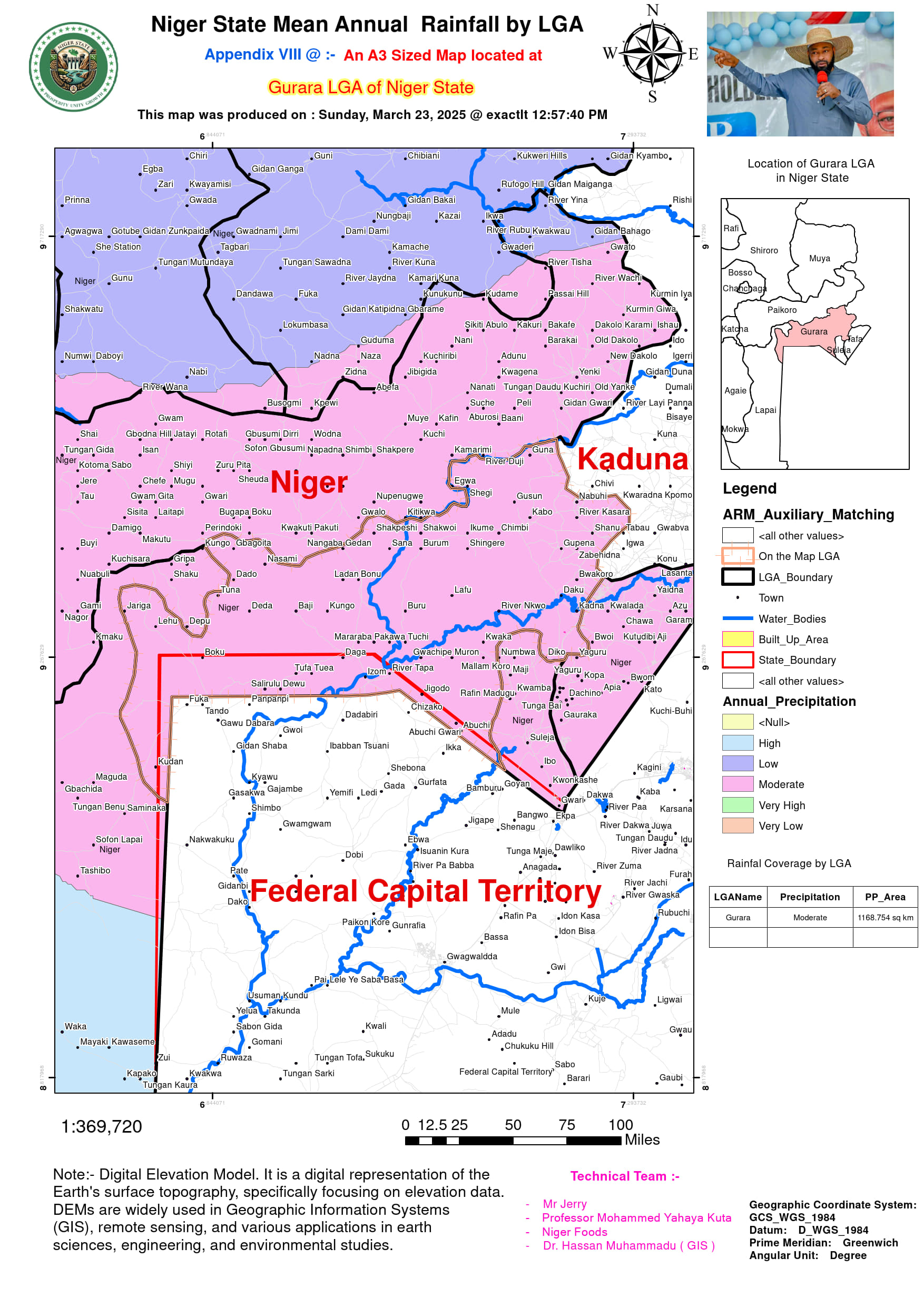
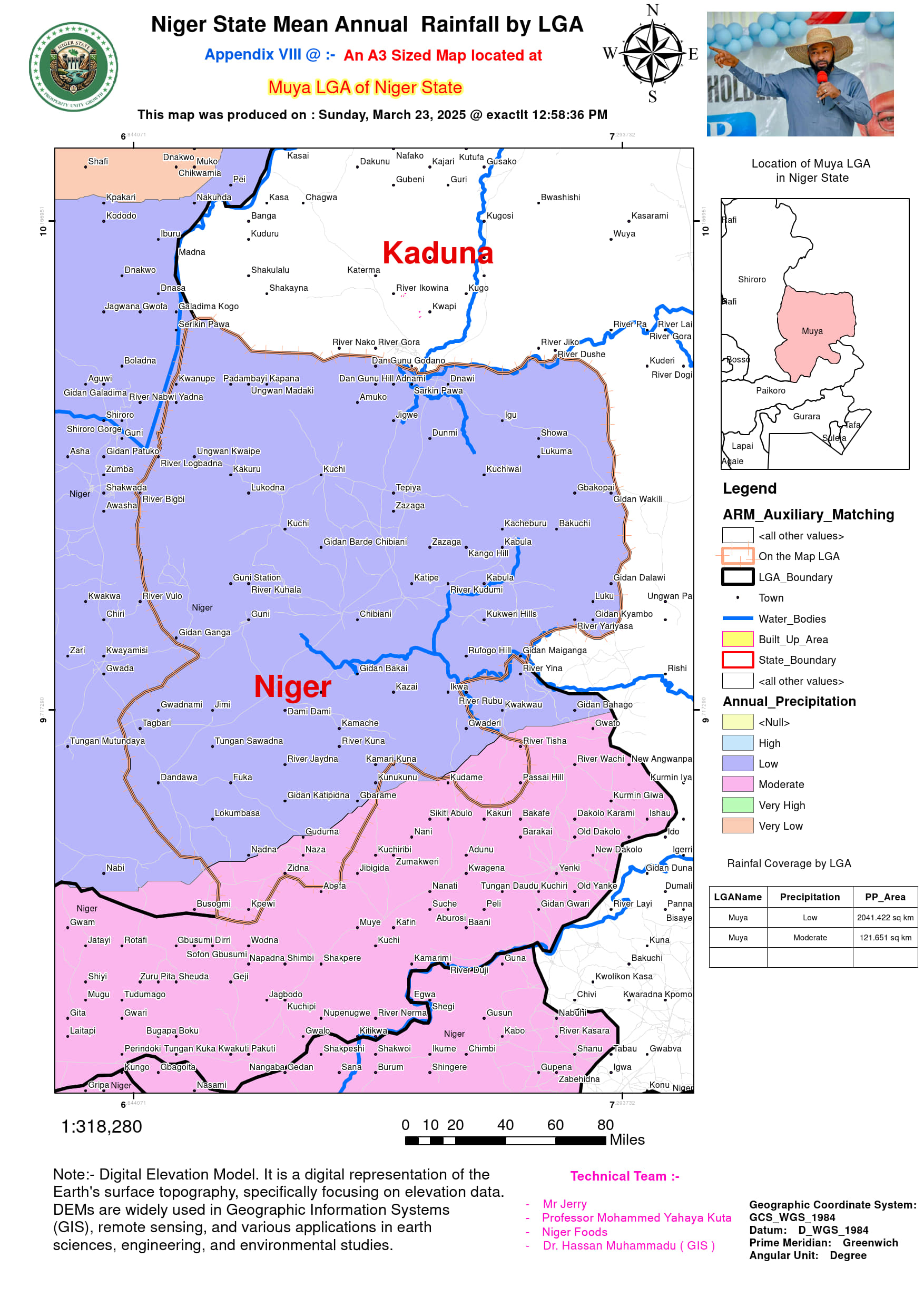
- Moderate Rainfall Zones (1,100–1,400 mm/year): LGAs including Bida, Muya, Gurara, and Chanchaga fall within the central rainfall range, benefitting from balanced precipitation and a mix of upland and lowland influences.
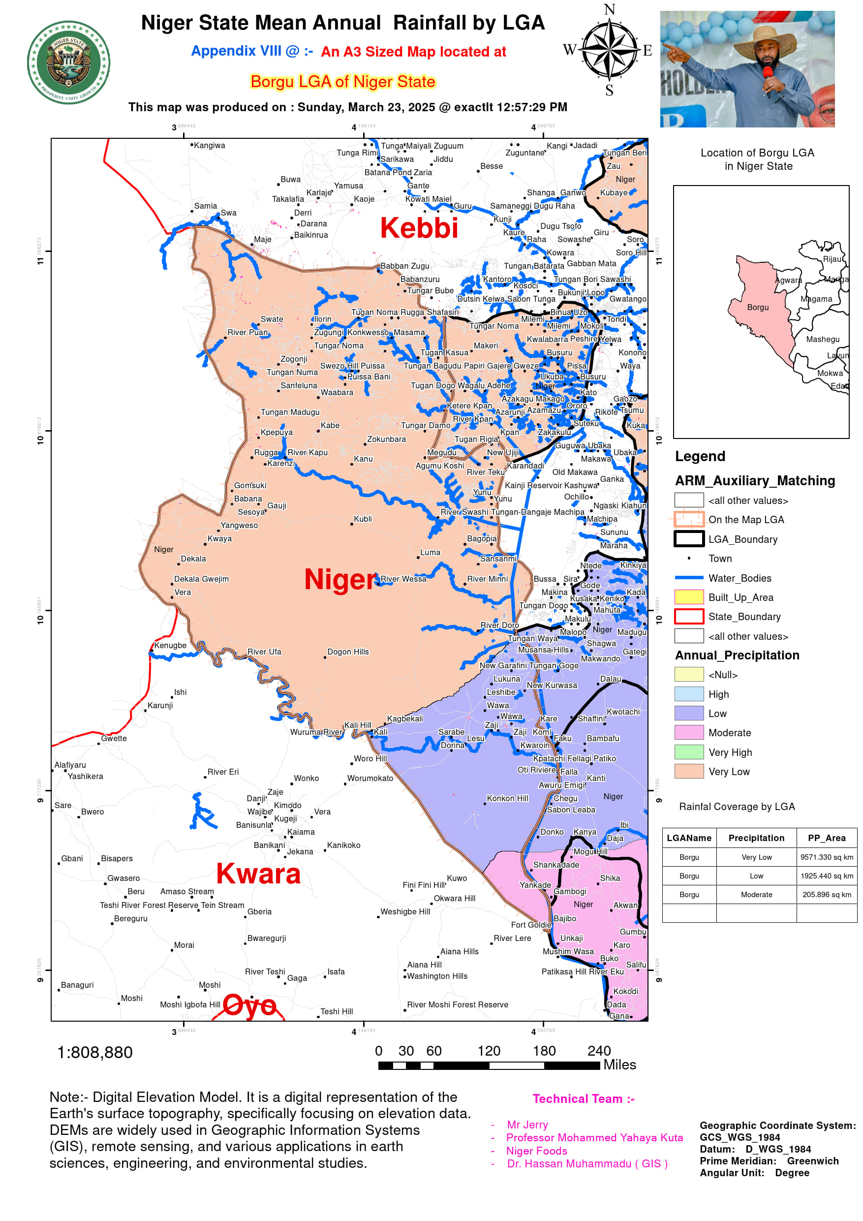
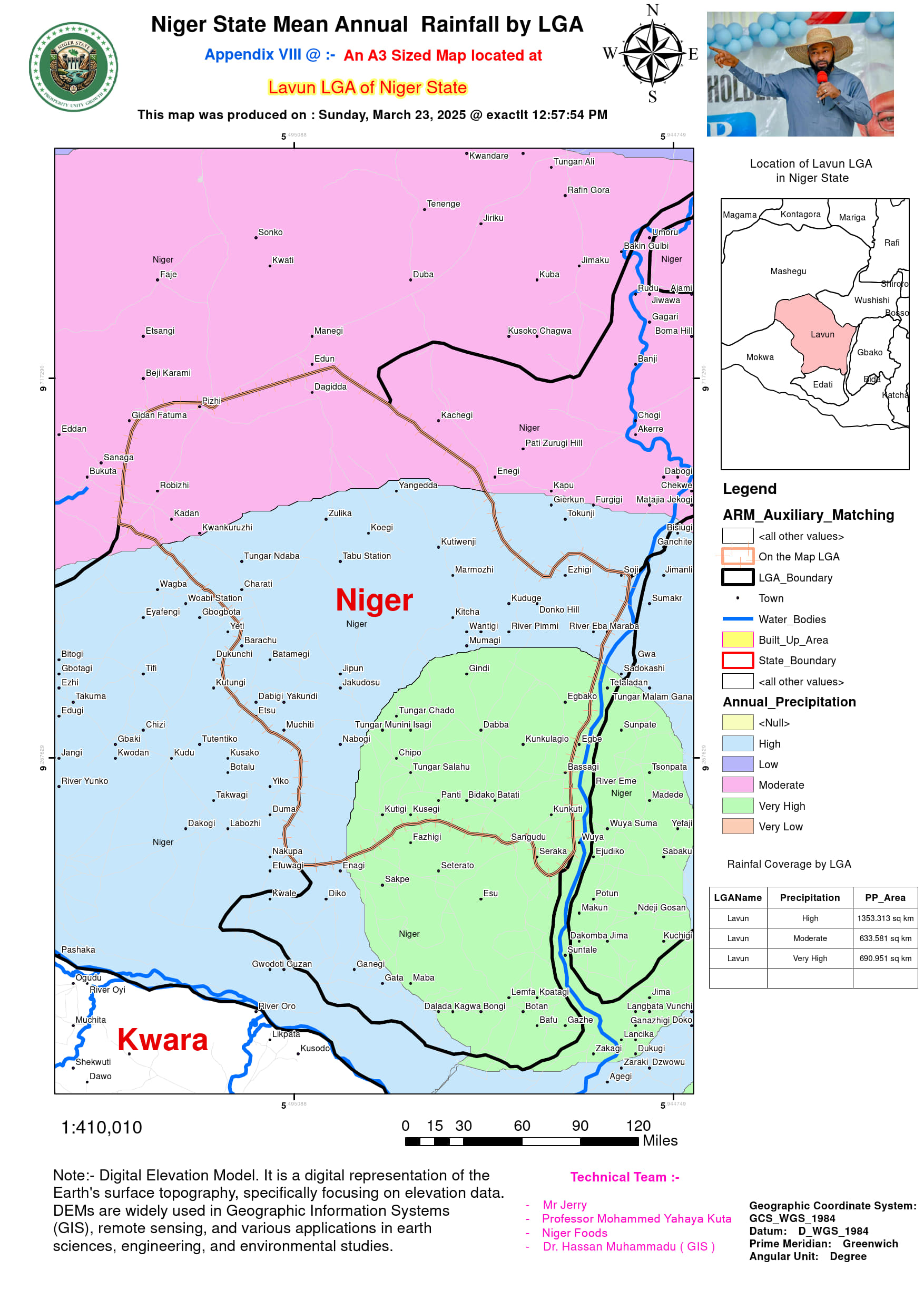
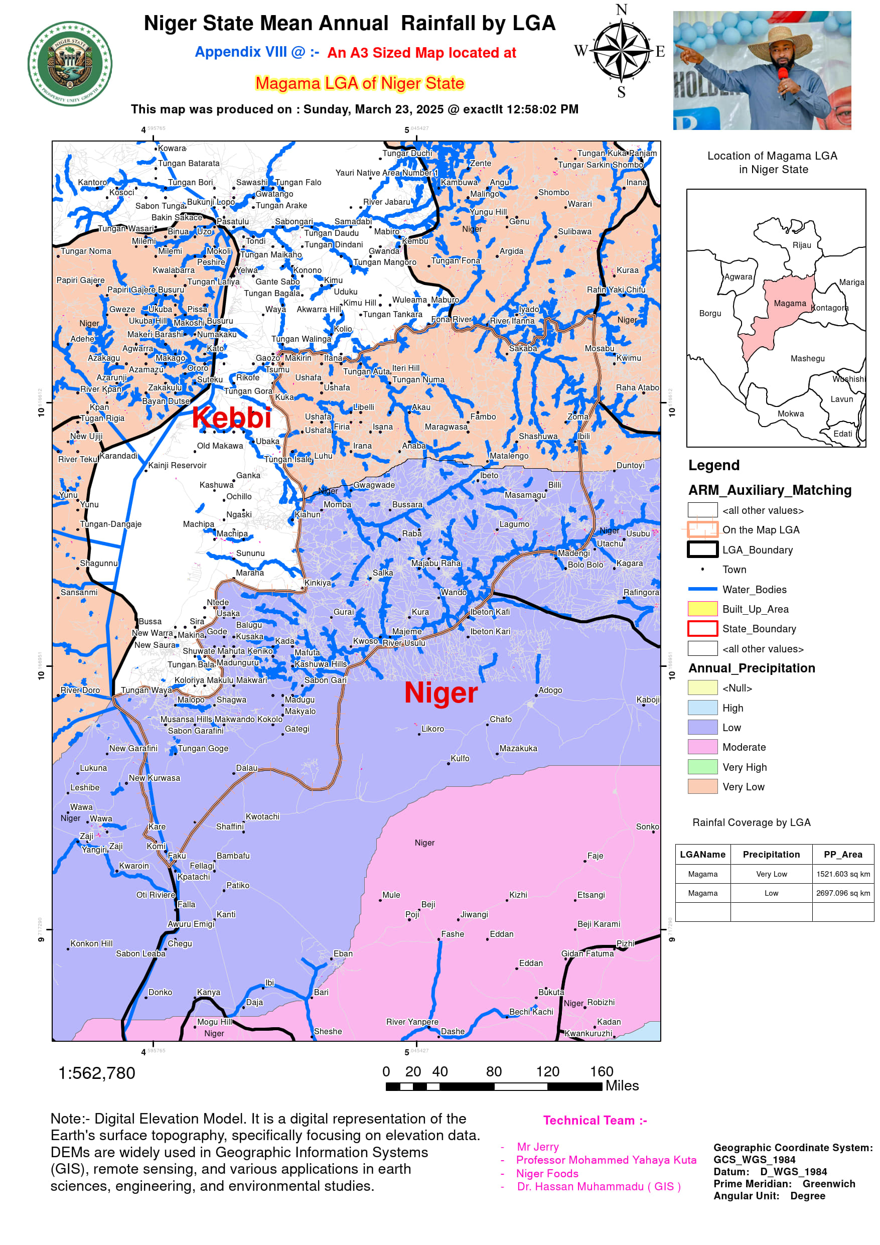
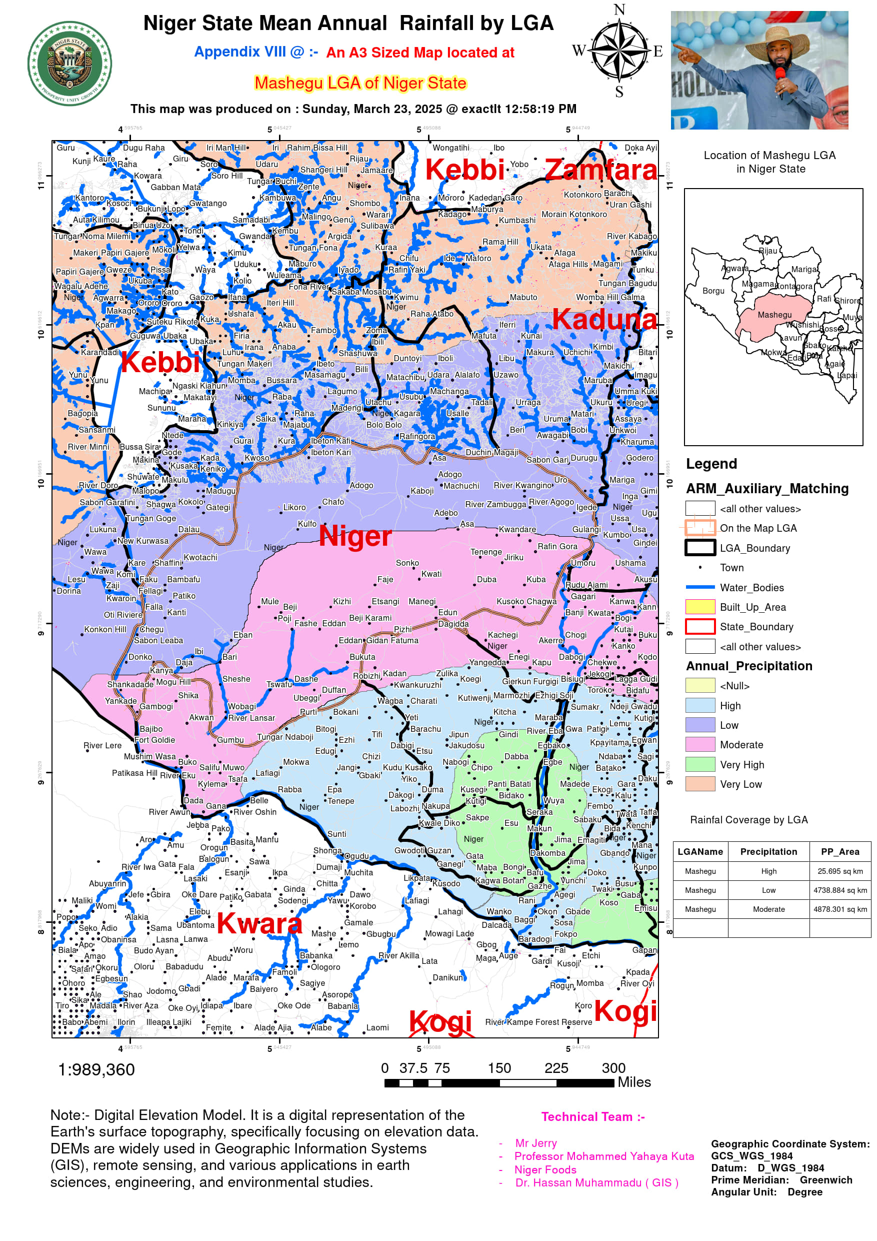
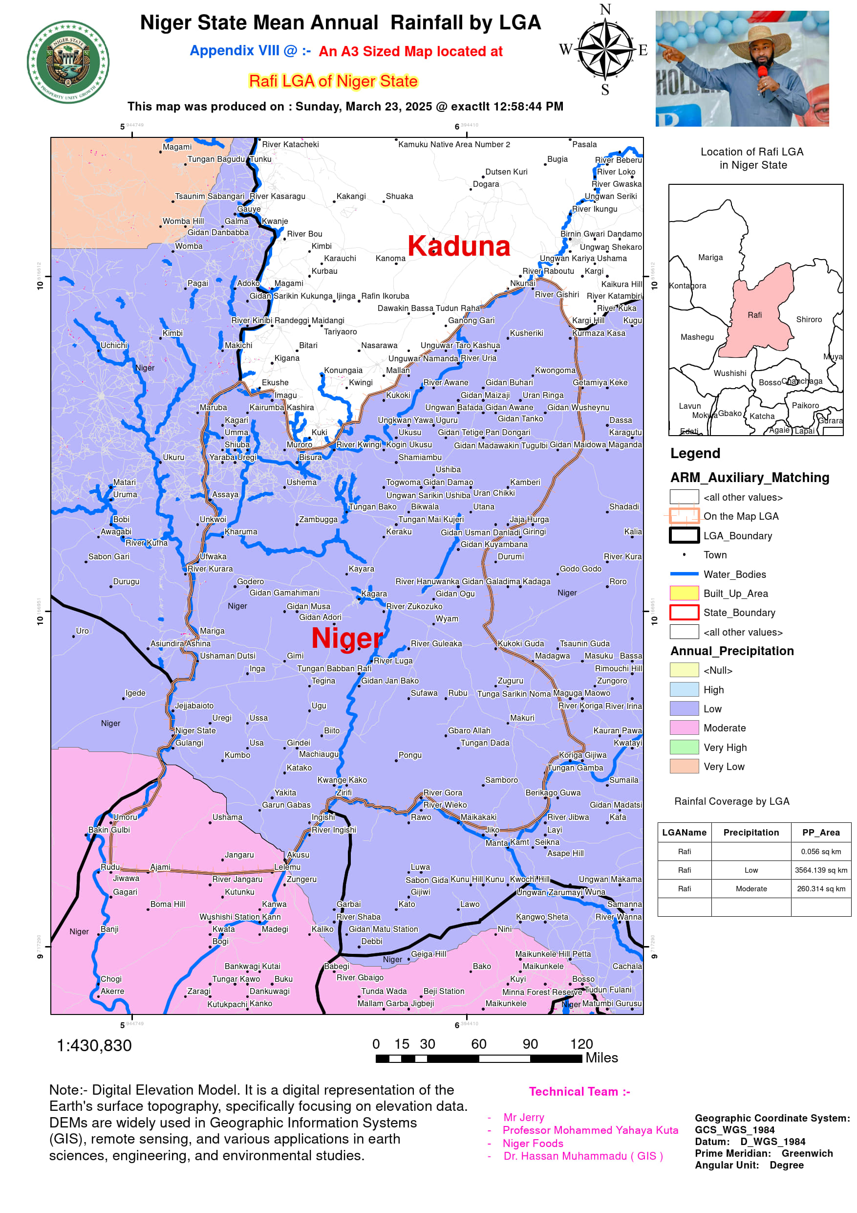
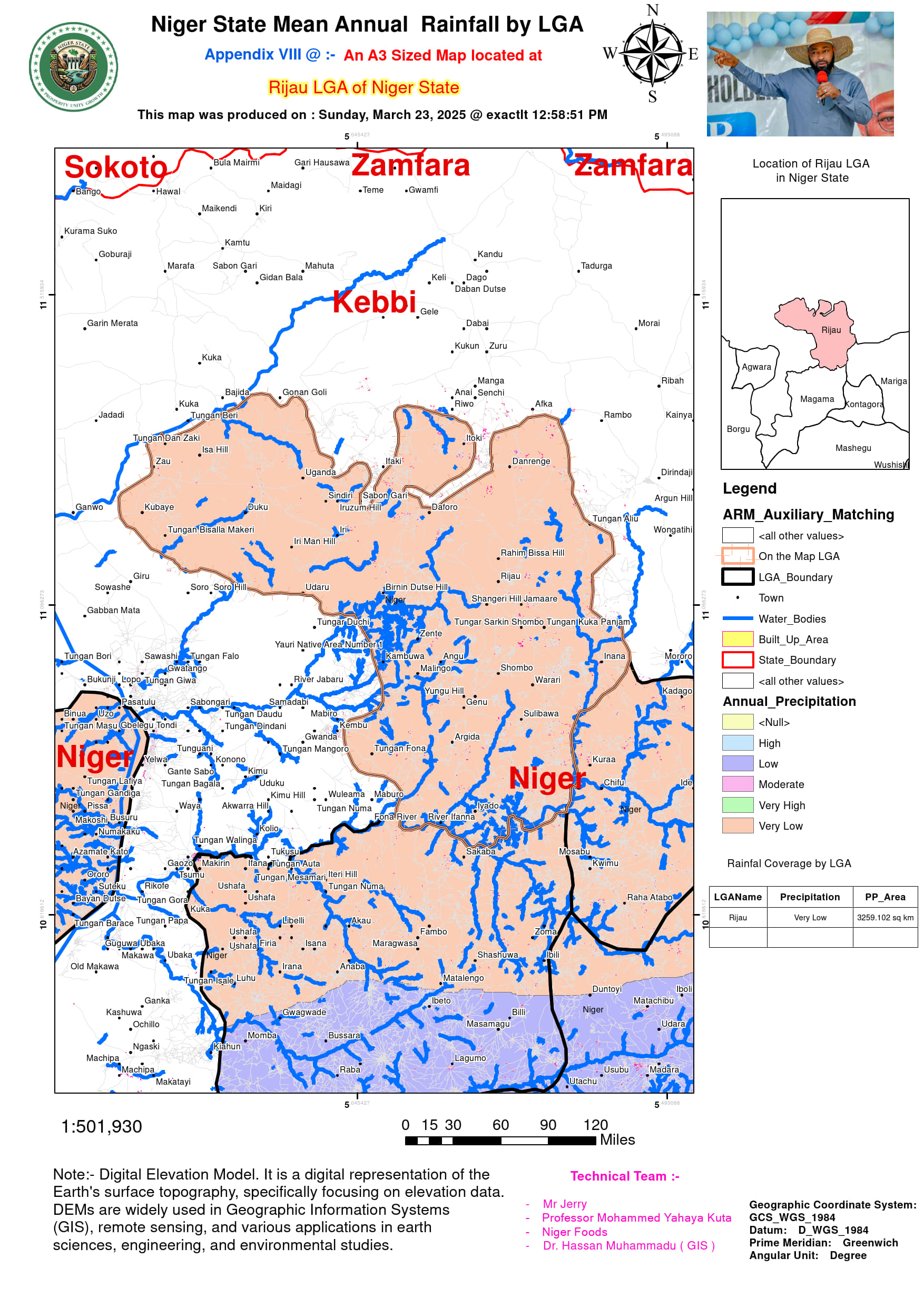
- Low Rainfall Zones (Below 900 mm/year): LGAs such as Borgu, Magama, Mariga, Rafi, and Rijau receive the least rainfall, with annual means between 725 mm and 900 mm. These areas fall within the arid and semi-arid northern regions, where sandy and rocky soils struggle to retain moisture, making rain-fed agriculture challenging.
This variation in rainfall has profound implications for agriculture, water resource management, and investment potential in Niger State.
- Topographical Influence on Rainfall Variability
Rainfall patterns in Niger State are closely linked to topography, as shown by Digital Elevation Models (DEMs) and contour maps.
- Highland Rainfall Amplification: Elevated areas such as Muya, Shiroro, and Gurara tend to experience more rainfall due to orographic lifting, where moist air masses ascend hillsides and condense into precipitation. This explains why Shiroro (1,500 mm) and Muya (1,300 mm) receive significantly more rainfall than nearby lowlands.
- Floodplain Rainfall Retention: LGAs such as Mokwa and Katcha, located in the Niger River Basin, experience prolonged wet conditions due to frequent flooding and water table saturation, making them ideal for irrigated rice farming and fisheries.
- Arid Zone Rain Shadow Effect: Northern LGAs such as Magama, Mariga, and Rafi receive less rainfall due to their location in the Sahelian dry belt, where rain-bearing winds weaken before reaching these areas.
This topographical impact has significant implications for agricultural zoning and water infrastructure planning across Niger State.
- Agricultural Suitability and Investment Potential by Rainfall Zone
Rainfall distribution defines the types of crops that can thrive, irrigation needs, and investment opportunities in different LGAs.
- High Rainfall LGAs (Above 1,400 mm/year)
Shiroro & Mokwa: Best suited for hydroelectric power, rice farming, and aquaculture, leveraging abundant water resources.
Investment Potential: Expansion of Shiroro Dam hydroelectric projects, irrigation schemes, and commercial fisheries.
- Moderate Rainfall LGAs (1,100–1,400 mm/year)
Bida, Muya, Chanchaga, Gurara: Favorable for maize, yam, and vegetable cultivation, supported by moderate soil moisture.
Investment Potential: Agro-processing industries, rain-fed farming mechanization, and sustainable forestry projects.
- Low Rainfall LGAs (Below 900 mm/year)
Borgu, Magama, Mariga, Rafi: Require drought-resistant crops such as millet, sorghum, and groundnuts.
Investment Potential: Solar-powered irrigation, water conservation initiatives, and commercial livestock ranching.
Understanding these rainfall-driven opportunities can guide sustainable agricultural policies and private sector investments across the state.
- Urbanization and Rainfall Management Challenges
The impact of rainfall on urban centers such as Suleja, Minna (Chanchaga), and Bida is increasingly shaped by human activities.
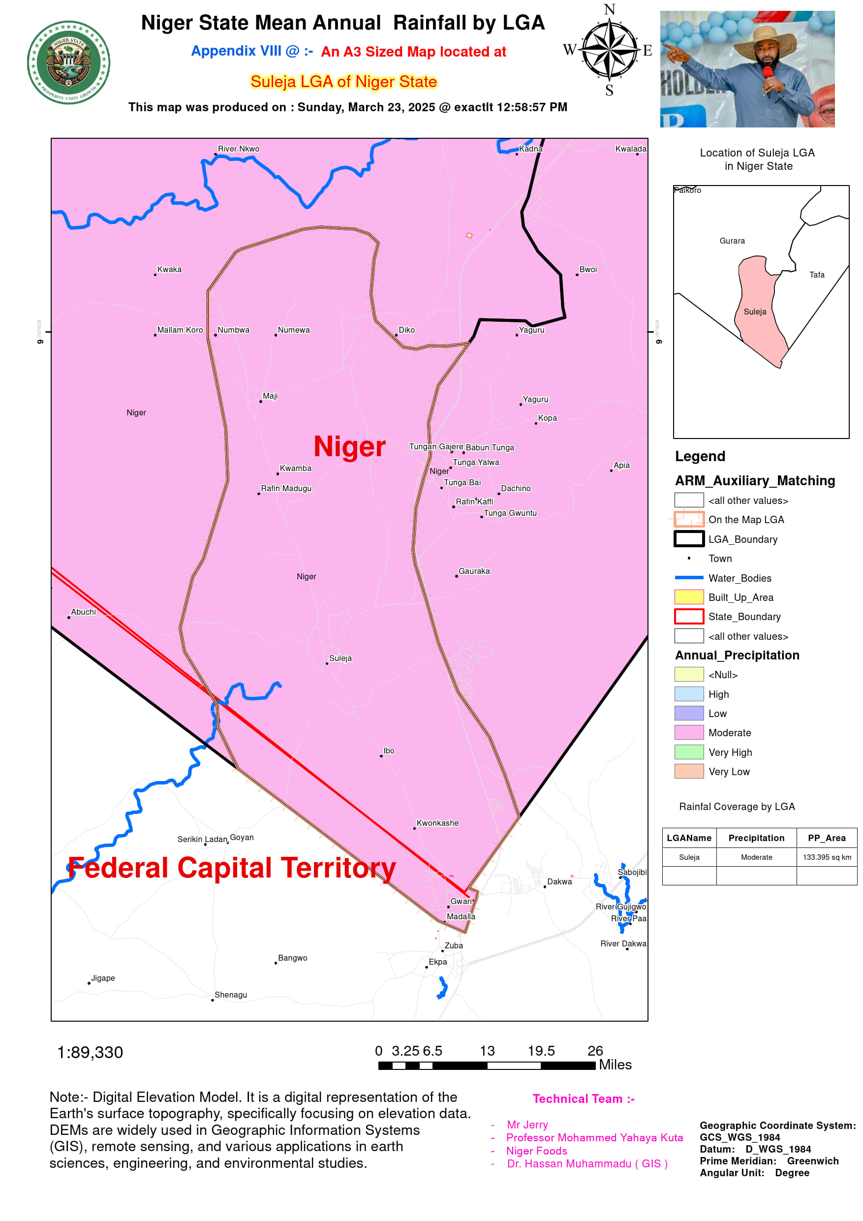
- Impervious Surfaces & Runoff Intensification: Cities like Suleja and Minna have experienced rapid urbanization, reducing natural infiltration and increasing flood risks.
- Drainage Infrastructure Deficits: Despite receiving between 1,200 mm and 1,500 mm of rainfall annually, urban LGAs lack proper stormwater drainage, leading to periodic flooding.
- Investment Potential: Public-Private Partnerships (PPPs) in urban drainage systems, permeable road construction, and rainwater harvesting.
This underscores the need for climate-resilient infrastructure to manage increasing urban precipitation in Niger State.
- Future Rainfall Trends and Climate Adaptation Strategies
Projected climate models indicate a potential shift in rainfall intensity and distribution due to global warming.
- Higher Rainfall Volatility: The increase in extreme weather events may lead to longer dry spells in arid LGAs and more intense downpours in flood-prone areas like Mokwa and Katcha.
- Adaptation Measures:
- Expansion of rainwater harvesting systems in low-rainfall LGAs.
- Strengthening of early warning systems using NiMet and CHIRPS data for flood and drought preparedness.
- Incentivizing climate-smart agriculture, particularly in areas where rainfall is declining.
.
| StateName | LGAName | MinRainfall (mm/yr) | MaxRainfall (mm/yr) | MeanRainfall (mm/yr) | Data_Source |
|---|---|---|---|---|---|
| Niger | Agaie | 800 | 1,400 | 1,100 | NiMet (2010–2020) |
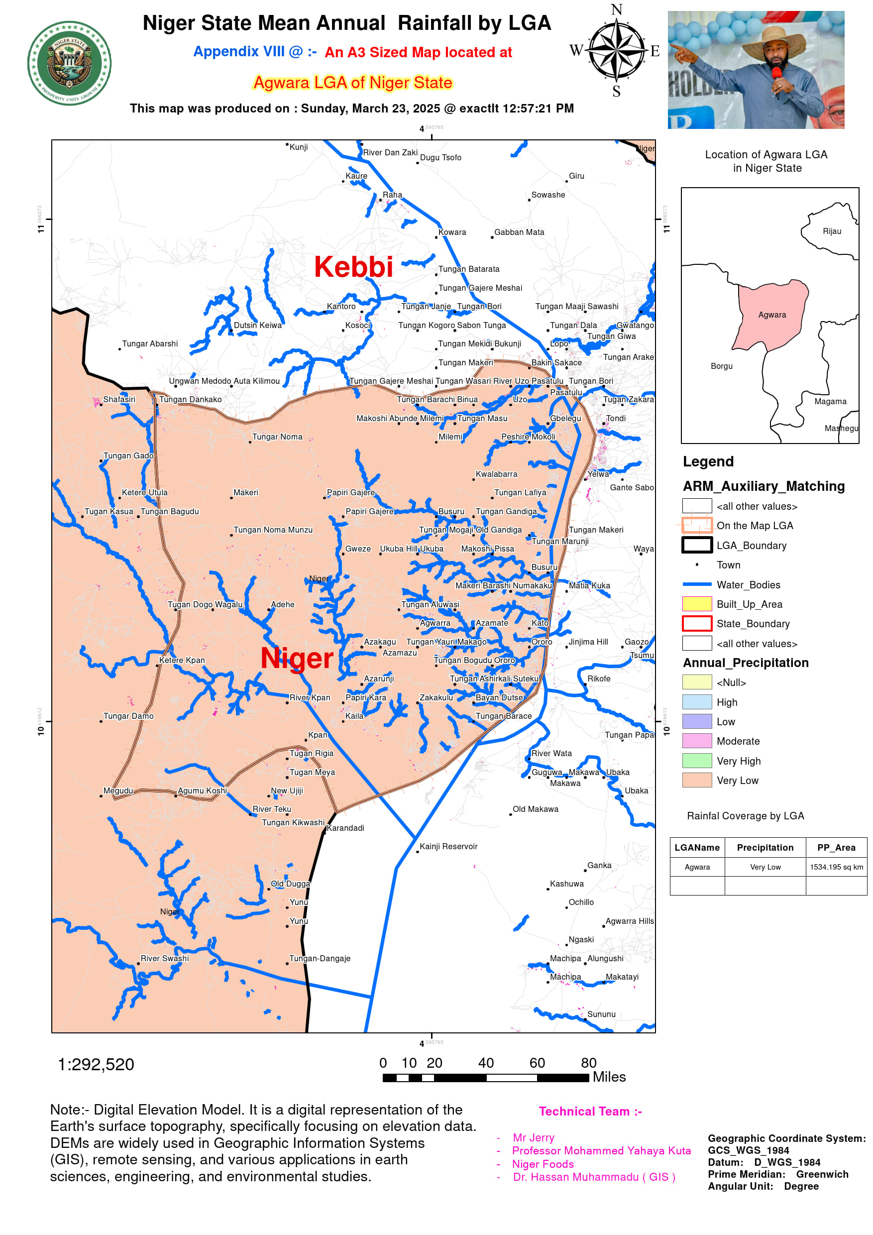
| Niger | Agwara | 850 | 1,450 | 1,150 | CHIRPS + NiMet |
| Niger | Bida | 1,000 | 1,600 | 1,300 | NiMet Station Data |
| Niger | Borgu | 600 | 1,100 | 850 | CHIRPS (Arid Zone) |
| Niger | Bosso | 900 | 1,500 | 1,200 | NiMet |
| Niger | Chanchaga | 950 | 1,550 | 1,250 | Minna Station (NiMet) |
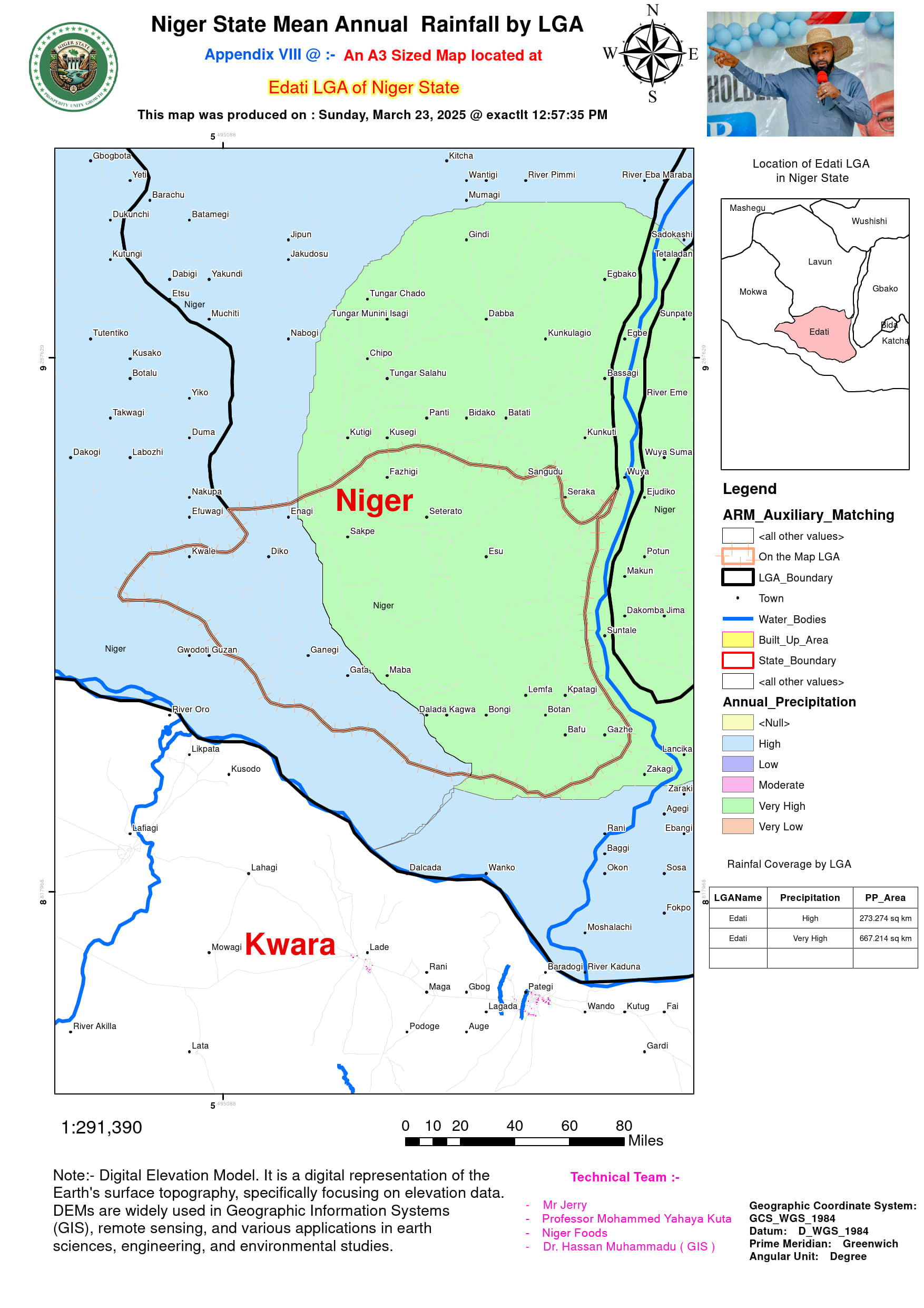
| Niger | Edati | 850 | 1,400 | 1,125 | CHIRPS |
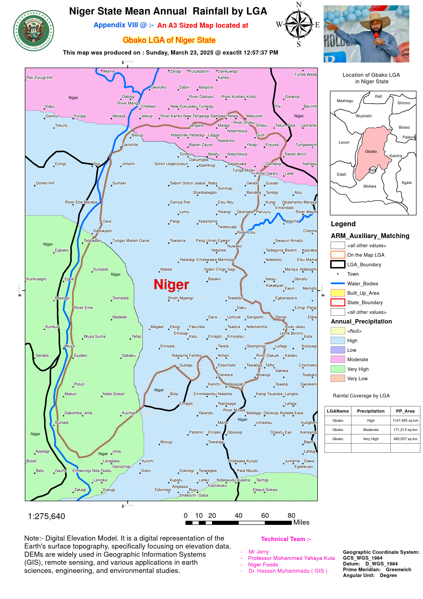
| Niger | Gbako | 900 | 1,450 | 1,175 | NiMet |
| Niger | Gurara | 950 | 1,500 | 1,225 | CHIRPS + Topography Adjustment |
| Niger | Katcha | 1,050 | 1,650 | 1,350 | Riverine Bias (NiMet) |
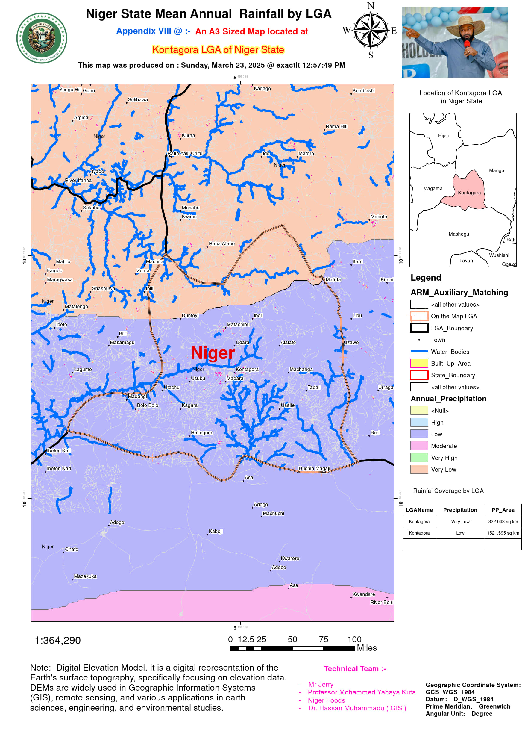
| Niger | Kontagora | 700 | 1,200 | 950 | Northern Savanna (CHIRPS) |
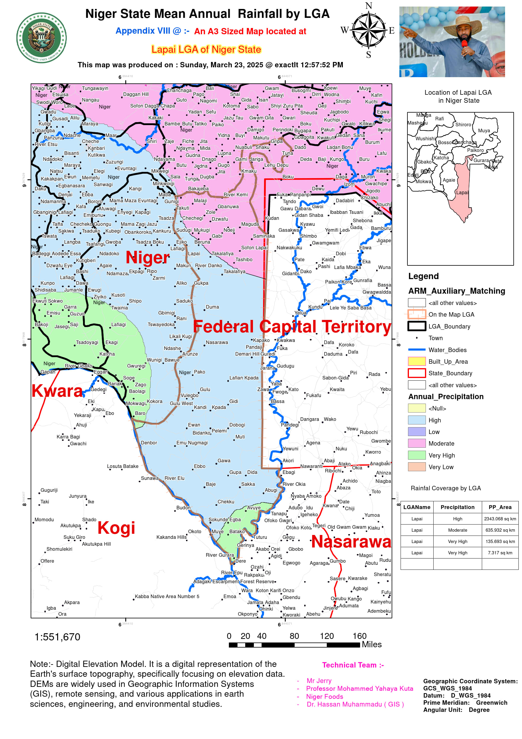
| Niger | Lapai | 880 | 1,480 | 1,180 | NiMet |
| Niger | Lavun | 820 | 1,420 | 1,120 | CHIRPS |
| Niger | Magama | 550 | 1,000 | 775 | Sahel Zone (NiMet) |
| Niger | Mariga | 500 | 950 | 725 | CHIRPS (Arid) |
| Niger | Mashegu | 580 | 1,050 | 815 | NiMet |
| Niger | Mokwa | 1,100 | 1,700 | 1,400 | Floodplain (NiMet) |
| Niger | Muya | 1,000 | 1,600 | 1,300 | Hilly Upland (CHIRPS) |
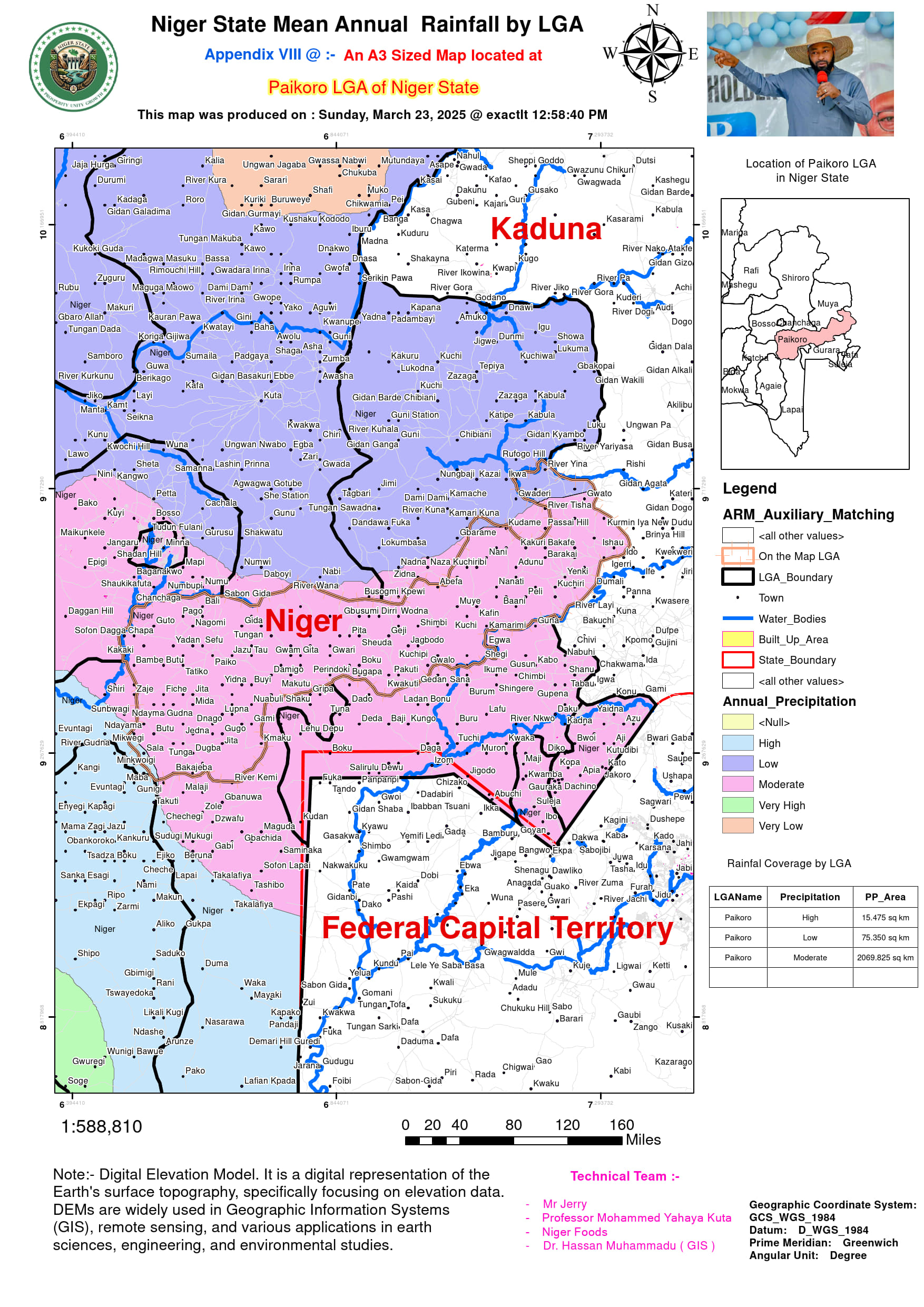
| Niger | Paikoro | 920 | 1,520 | 1,220 | NiMet |
| Niger | Rafi | 650 | 1,150 | 900 | Northern Arid (CHIRPS) |
| Niger | Rijau | 600 | 1,100 | 850 | Rocky Semi-Arid (NiMet) |
| Niger | Shiroro | 1,200 | 1,800 | 1,500 | Dam Influence (NiMet + CHIRPS) |
| Niger | Suleja | 1,000 | 1,600 | 1,300 | Suburban (NiMet) |
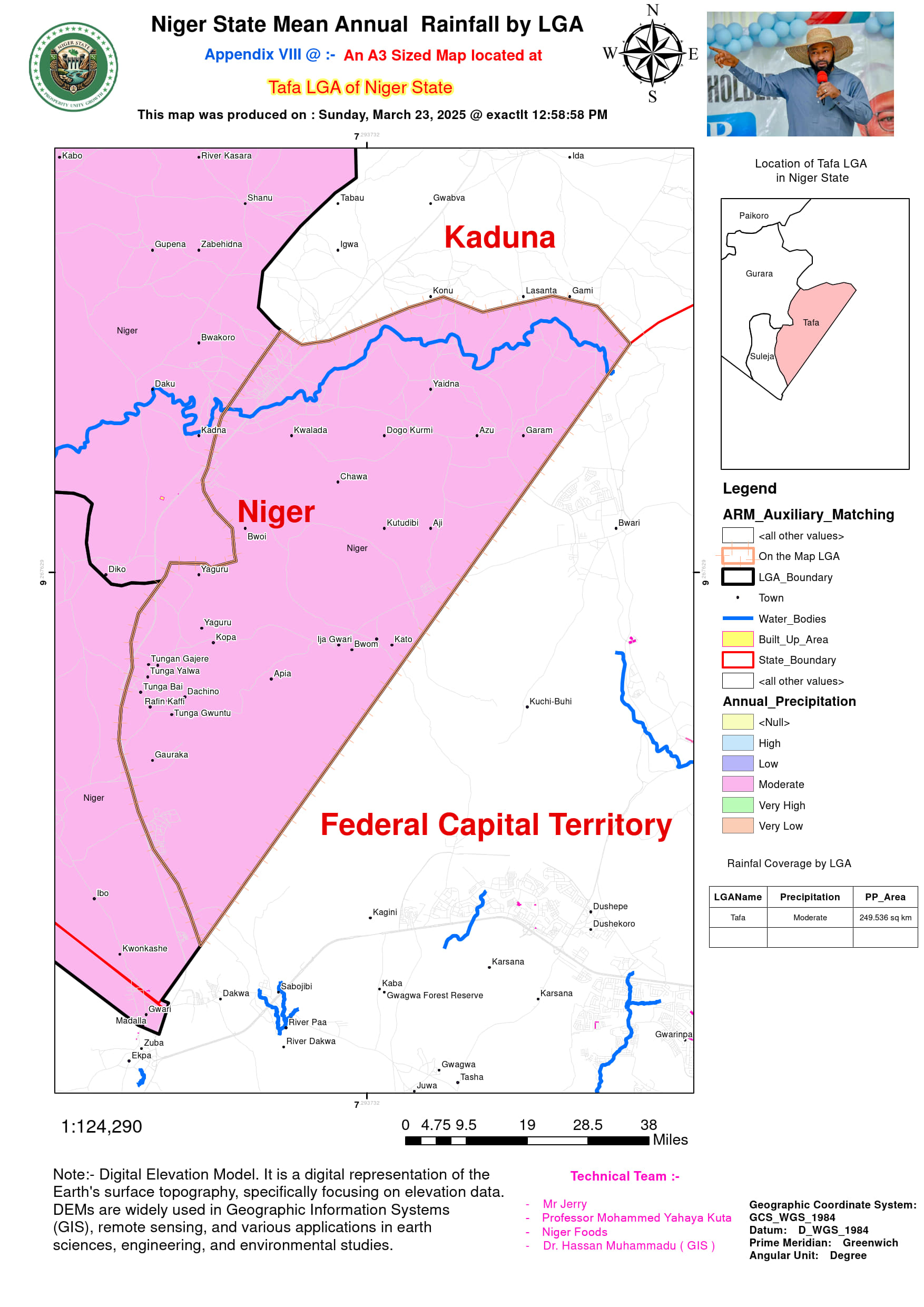
| Niger | Tafa | 980 | 1,580 | 1,280 | NiMet |
| Niger | Wushishi | 950 | 1,550 | 1,250 | Grasslands (CHIRPS) |
