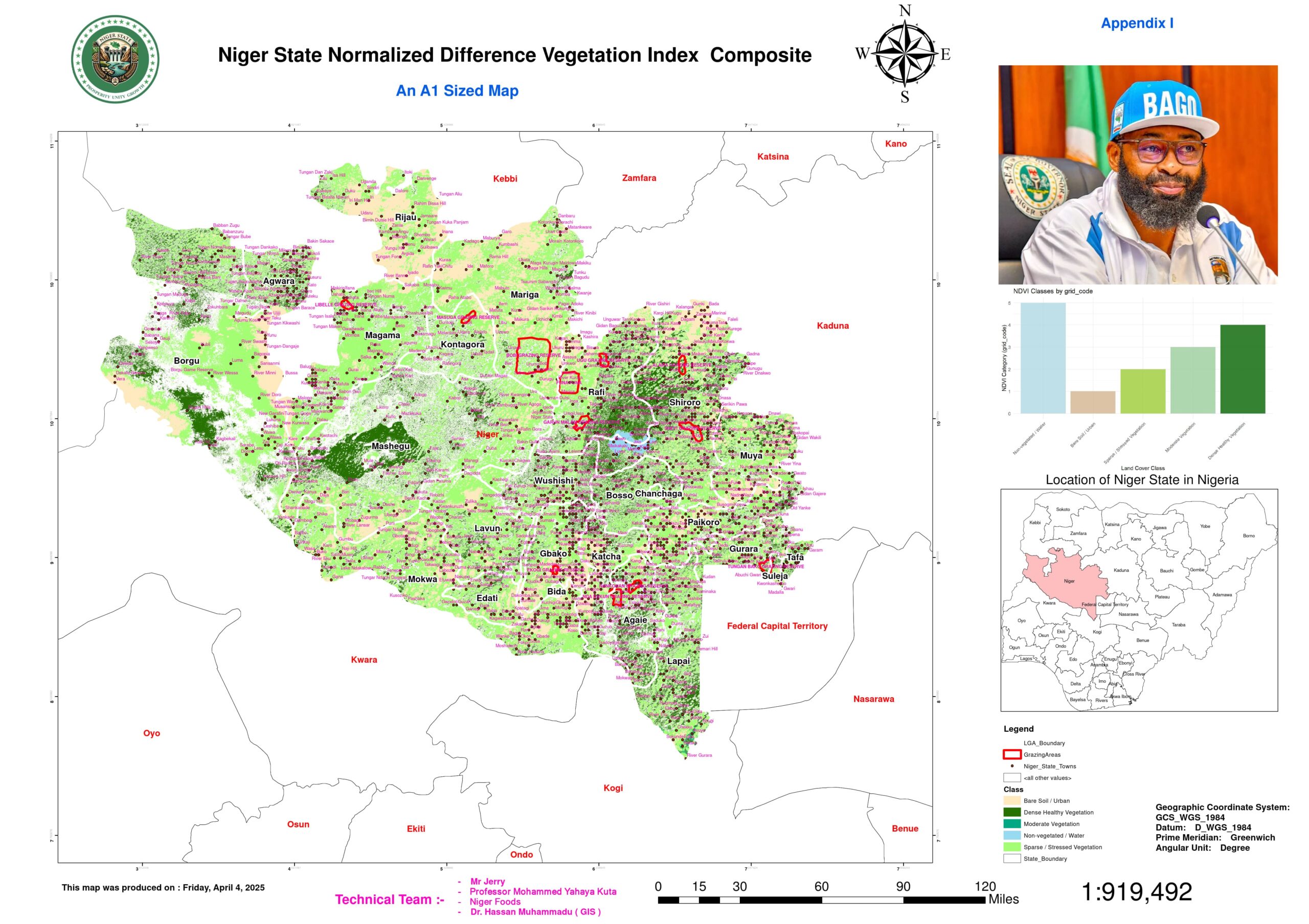
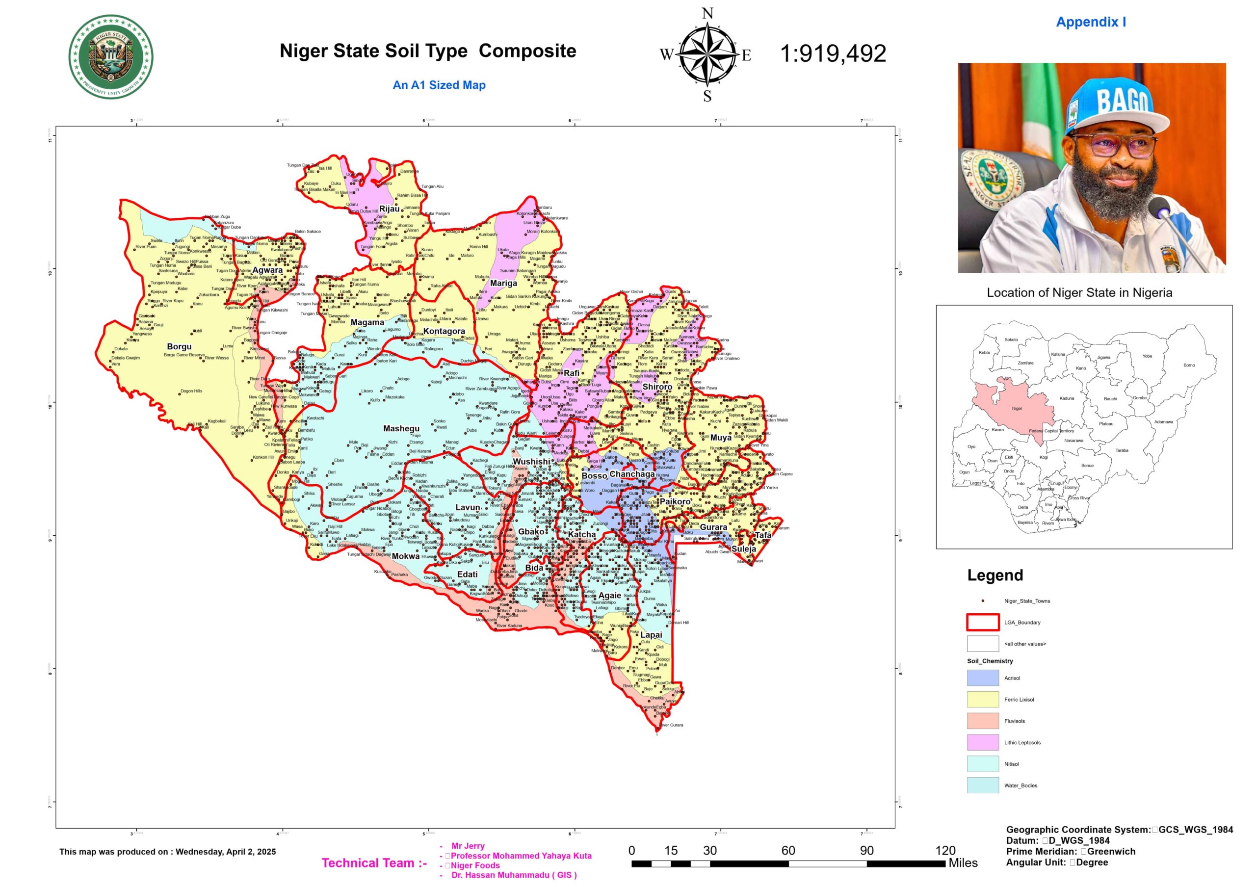
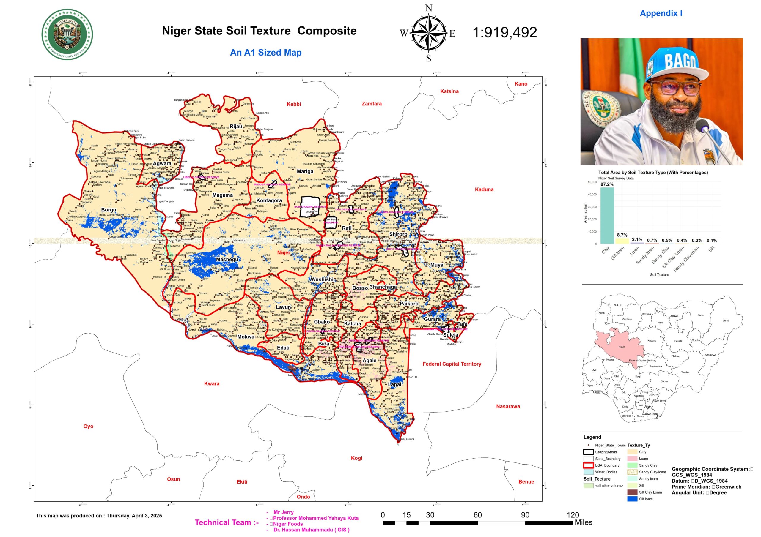
This geospatial and agricultural analysis of Niger State establishes a data-driven framework for optimizing sustainable livestock and crop production through integrated spatial intelligence and agro-economic modeling. By leveraging advanced geospatial tools, the study maps critical variables affecting agricultural productivity, land-use efficiency, and environmental sustainability. A suite of interactive dashboards provides granular insights into agro-environmental dynamics, combining hydrological modeling, soil classification, and infrastructure analysis to guide decision-making. These include the Town Distribution Dashboard for population-driven agricultural planning, the Drainage Network and Natural Water Storage Dashboards for irrigation and water resource management, and the Road Network and Grazing Reserves Dashboards for logistical efficiency and pastoral land optimization. Additionally, the Soil Distribution Dashboard enables precision farming, while the Built-up Area Dashboard monitors urban expansion’s impact on farmland availability.
With 85% of Niger State’s land classified as arable, this spatial intelligence framework integrates agronomic, climatic, and economic indicators to enhance productivity, mitigate post-harvest losses, and promote climate-smart agriculture. The Rainfall Distribution Dashboard supports resilient farming, while cost-benefit analysis maps help evaluate the economic viability of agricultural interventions. Aligning with global sustainability goals—including SDGs 1 (No Poverty), 2 (Zero Hunger), 5 (Gender Equality), and 13 (Climate Action)—this study offers a transformative blueprint for food security and equitable agrarian development. Designed for policymakers, agribusiness investors, and development stakeholders, it bridges empirical field data with cutting-edge spatial analytics, positioning Niger State as a model for sustainable agricultural resilience and economic empowerment in West Africa.


