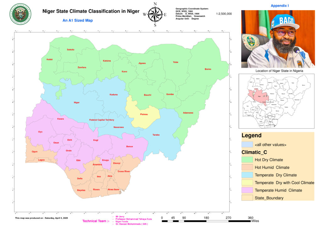
Climatic Classification Maps
Niger State occupies a unique climatic transition zone between Nigeria’s humid tropical south and the arid Sahelian north, resulting in distinct wet and dry seasons that shape agriculture, water resources, and settlement patterns. The state’s temperature profile varies between 26°C and 34°C annually, making it warmer than the southern states but cooler than the extreme northern regions like Sokoto and Maiduguri. During the hot dry season (February to April), temperatures rise to 38°C–42°C, similar to northern states, while the Harmattan period (December to January) brings cooler nights, with temperatures dropping to 16°C–20°C. Comparatively, Niger State is warmer than Lagos and Enugu but remains cooler than Sokoto and Maiduguri, making it a moderate climate zone in the national context.
Rainfall patterns also highlight Niger State’s transitional nature, with annual precipitation ranging from 1,200 mm in the south to 800 mm in the north. This is significantly less than the Niger Delta region, which receives over 2,500 mm annually, but more than Sokoto, which experiences as little as 600 mm. The rainy season lasts from April to October, shorter than in the south but longer than in the arid Sahel regions. Meanwhile, the dry season spans November to March, harsher than in southern states but less extreme than in northeastern Nigeria. Humidity levels fluctuate accordingly, with riverine areas like Agwara and Mokwa experiencing high humidity (70–85%) during the rains, while northern LGAs such as Rijau and Magama see drops to 20–40% during Harmattan. The interplay between the southwest monsoon winds during the wet season and the northeast trade winds in the dry season influences seasonal conditions, making Niger more humid than Sokoto but less so than coastal cities like Port Harcourt.
The state’s diverse agro-climatic zones further define its ecological and agricultural potential. The Southern Guinea Savanna, covering areas like Agaie and Lapai, enjoys a long growing season of six to seven months, similar to Kwara and southern Kaduna. The Northern Guinea Savanna, covering Bida and Kontagora, has moderate rainfall and a five-to-six-month growing season, aligning with northern Benue and Plateau. The Sudan Savanna, found in Rijau and Magama, has a shorter rainy season of four to five months and is prone to drought, resembling climatic conditions in Kano and Jigawa. Climatic challenges such as drought risk in the north, seasonal flooding in riverine areas like Mokwa and Katcha, and heat stress affecting labor productivity are critical concerns. Climate change has further exacerbated these issues, leading to declining rainfall in northern areas and erratic precipitation patterns disrupting farming. These environmental dynamics make Niger State’s climate a critical factor in national food security, water management, and sustainable development planning.
