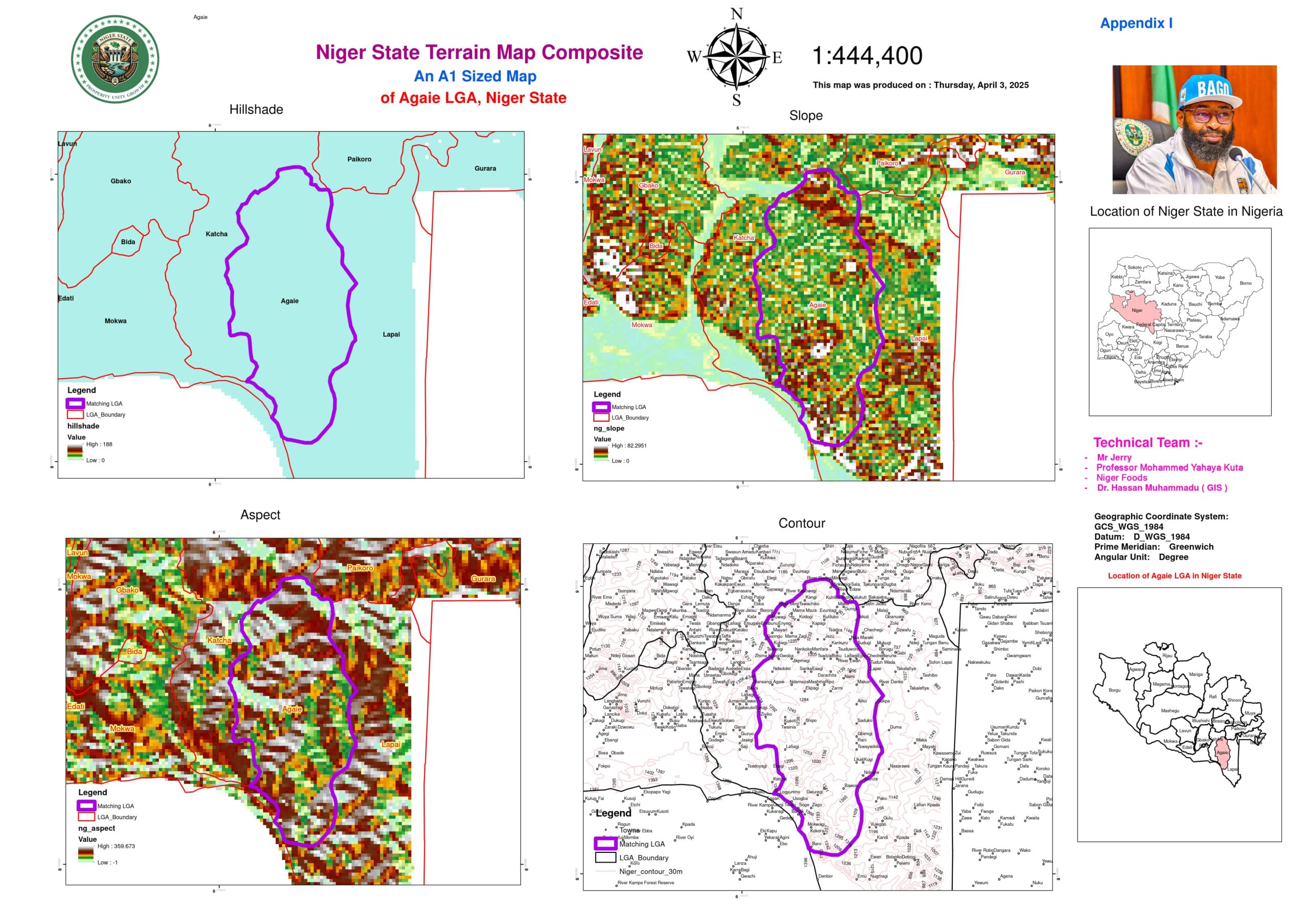
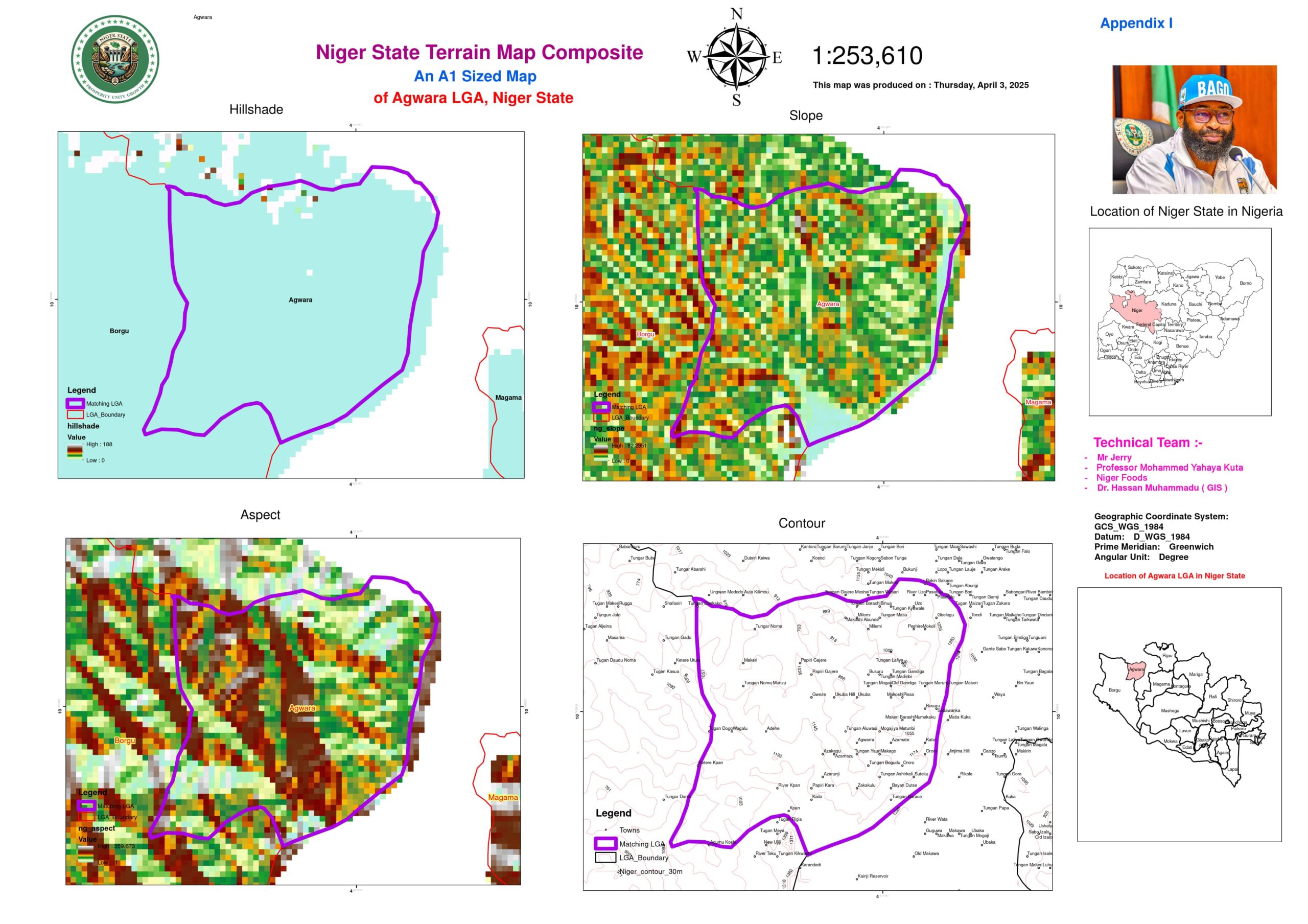
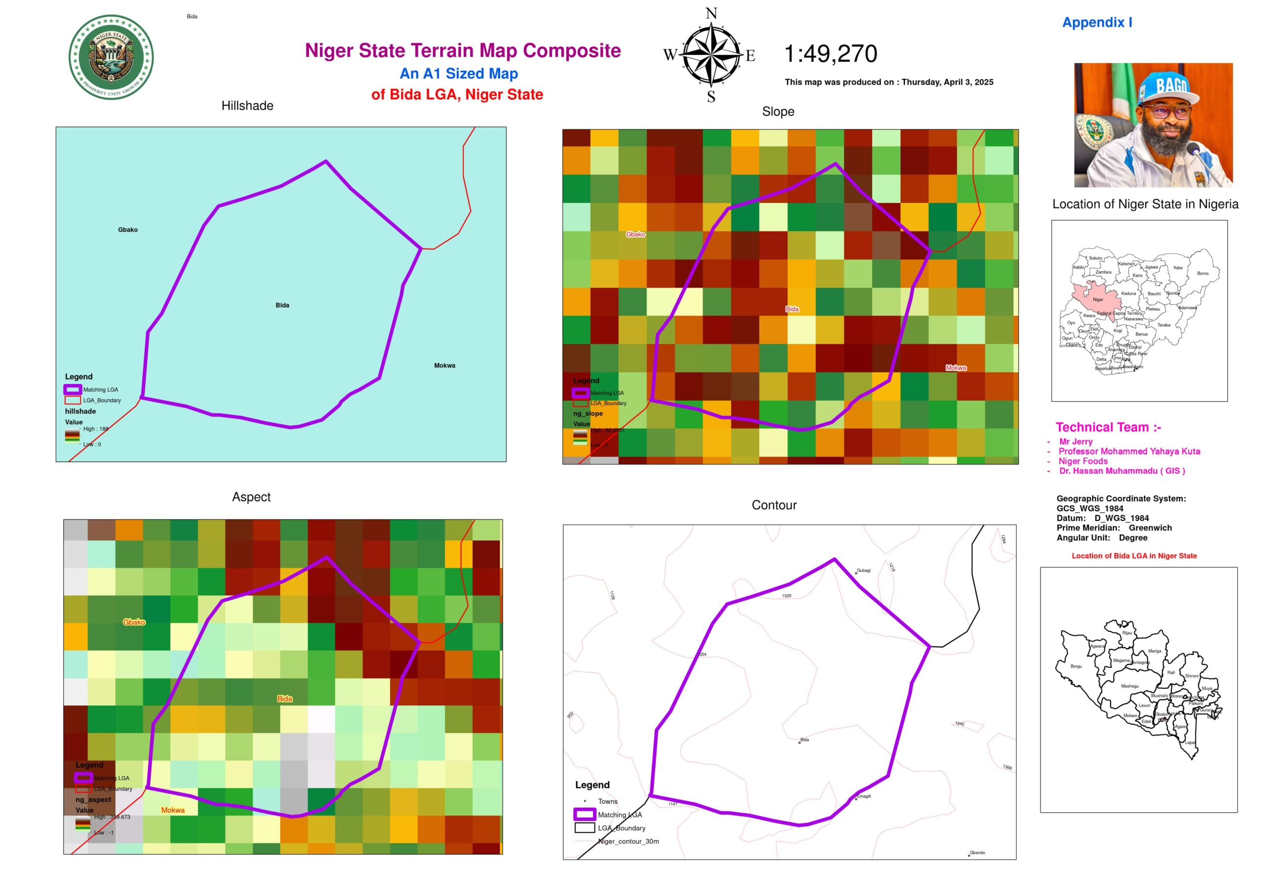
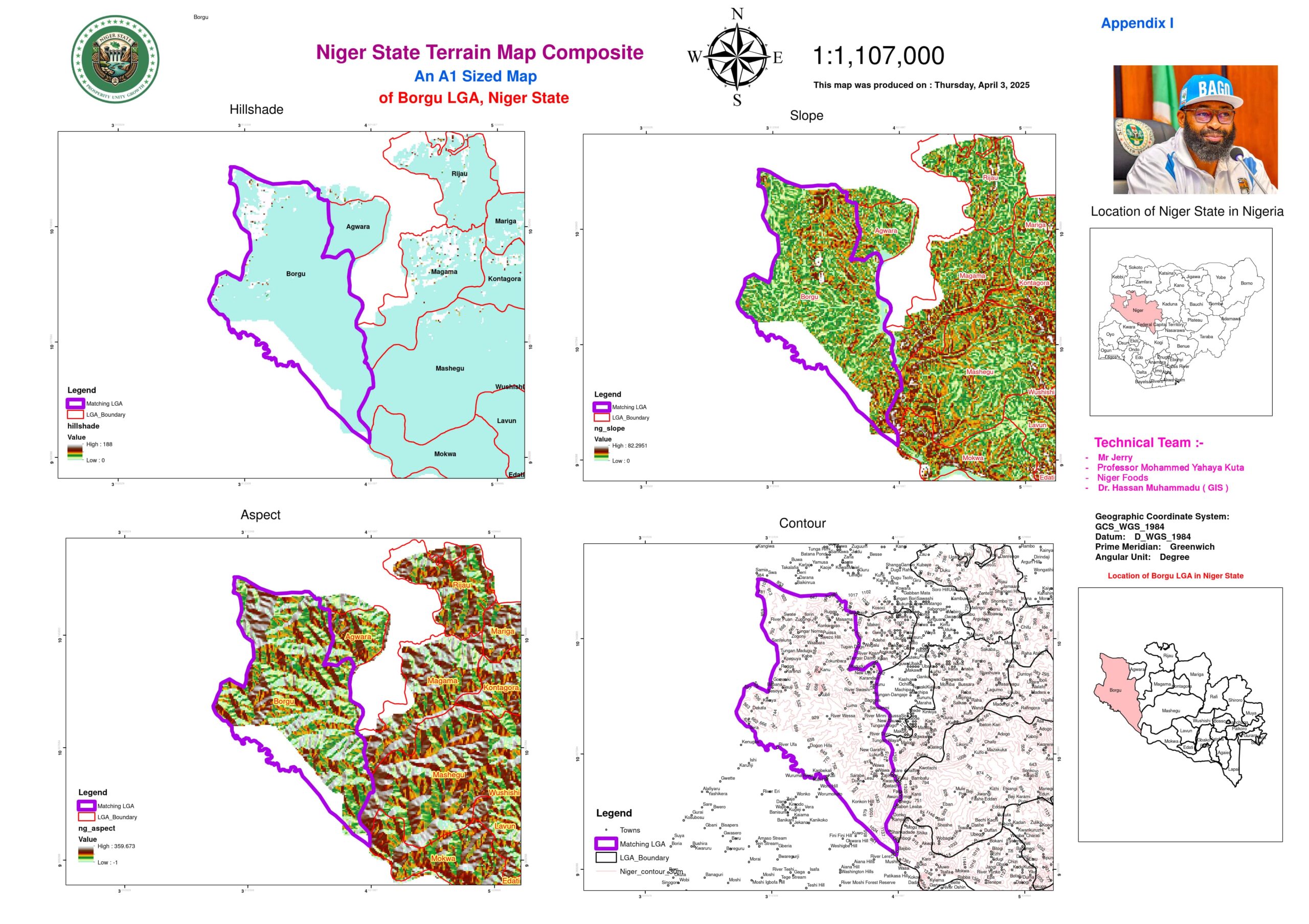
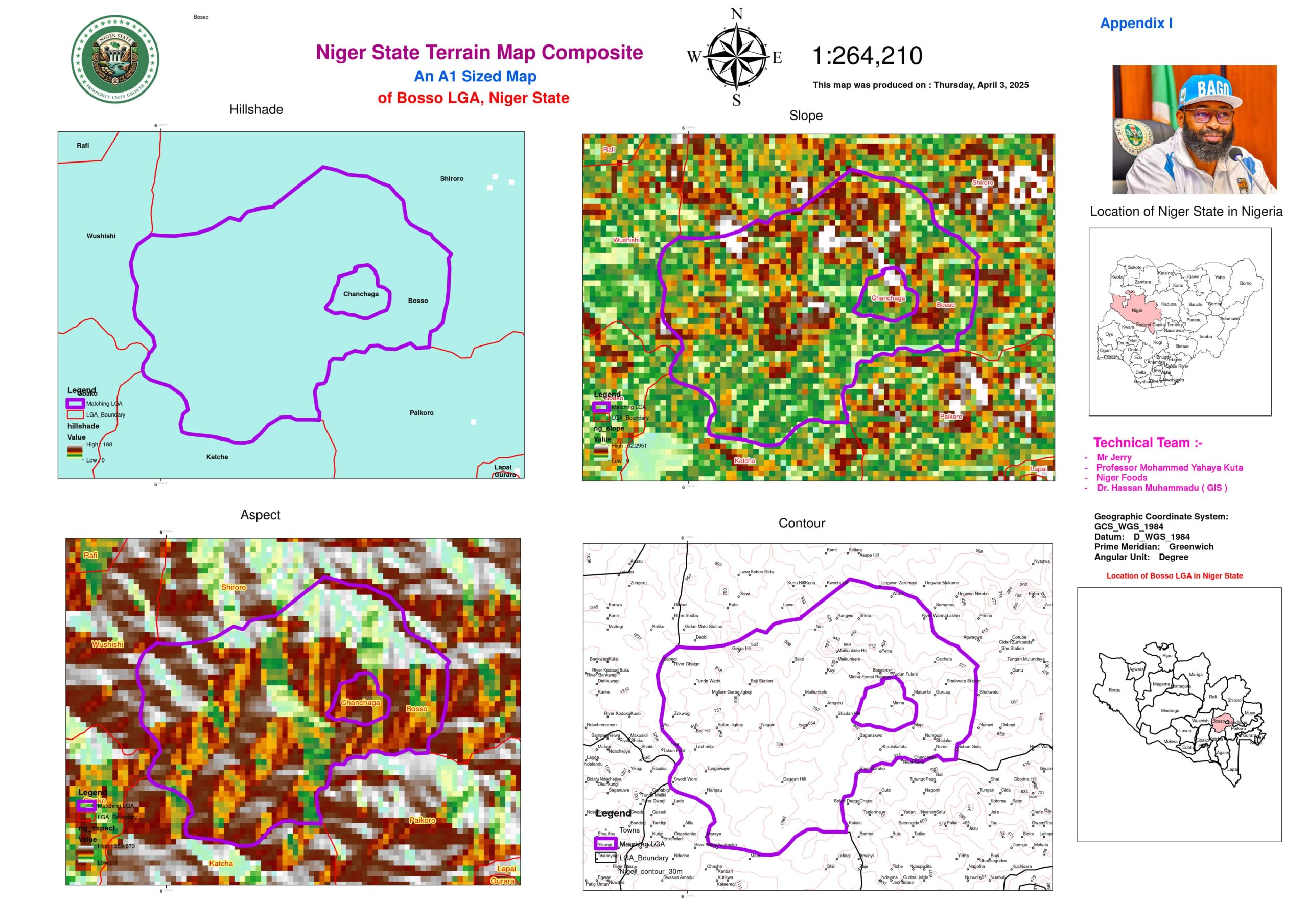
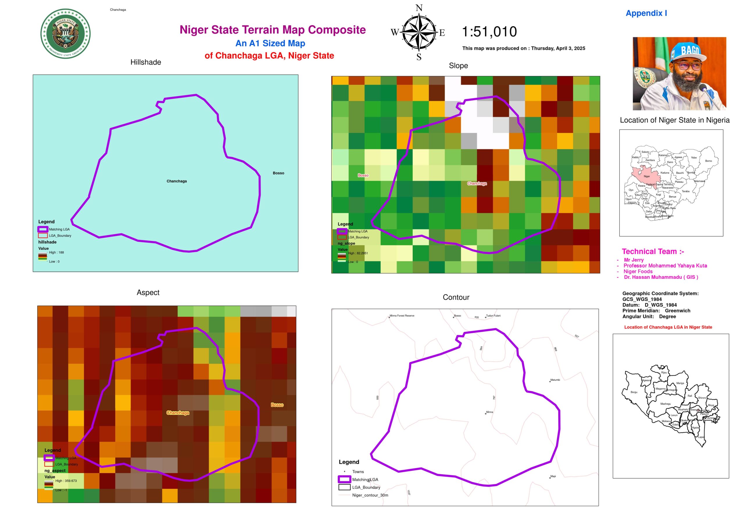
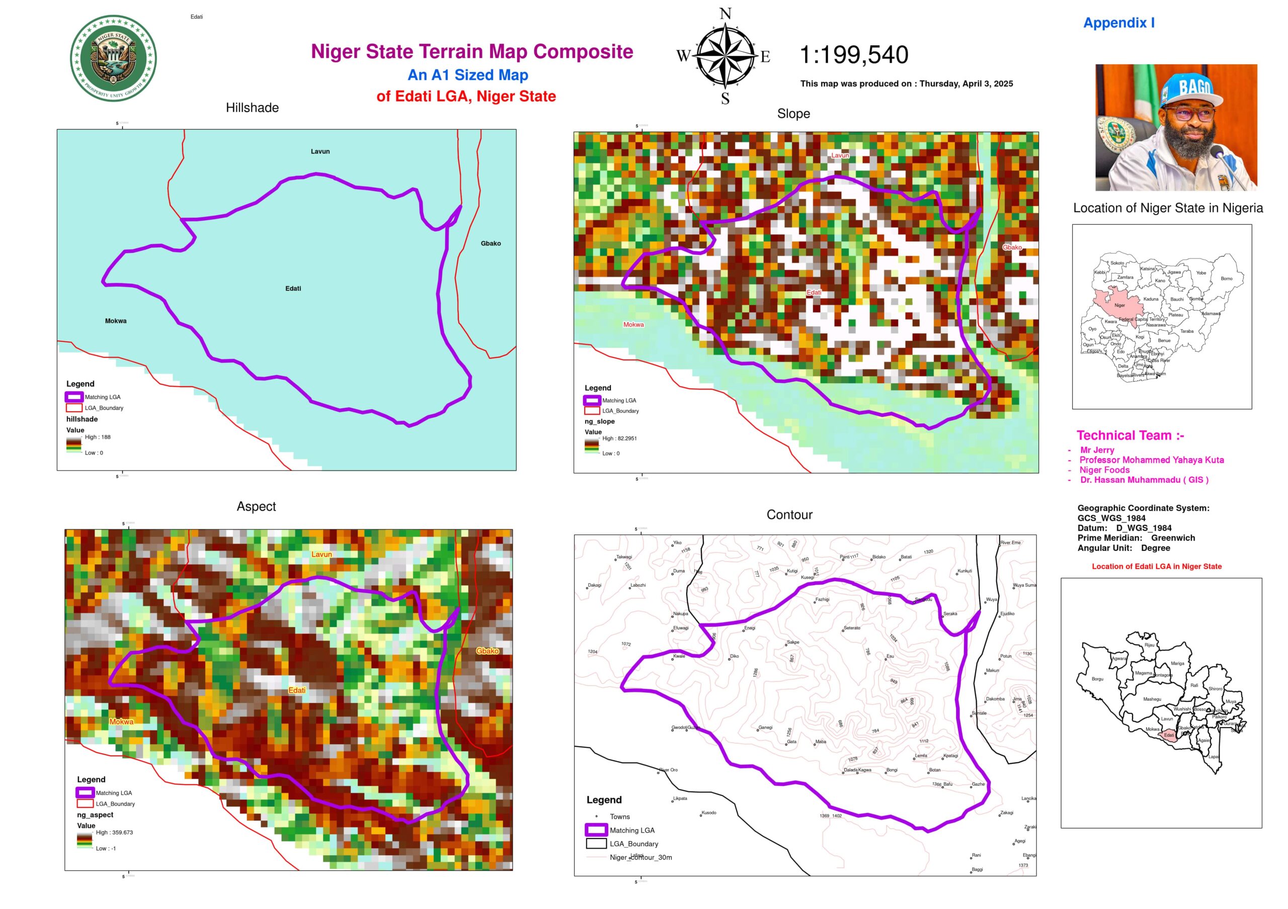
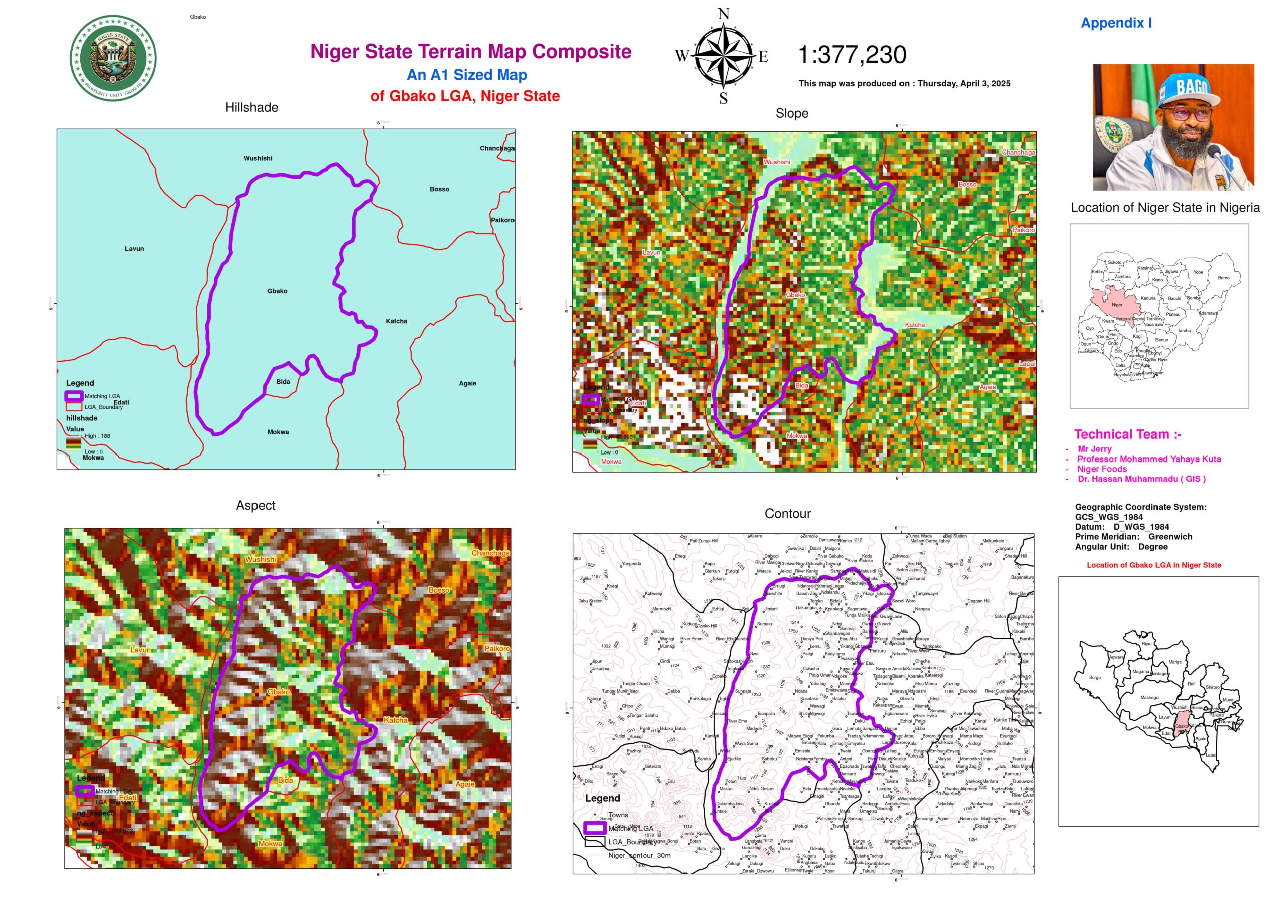
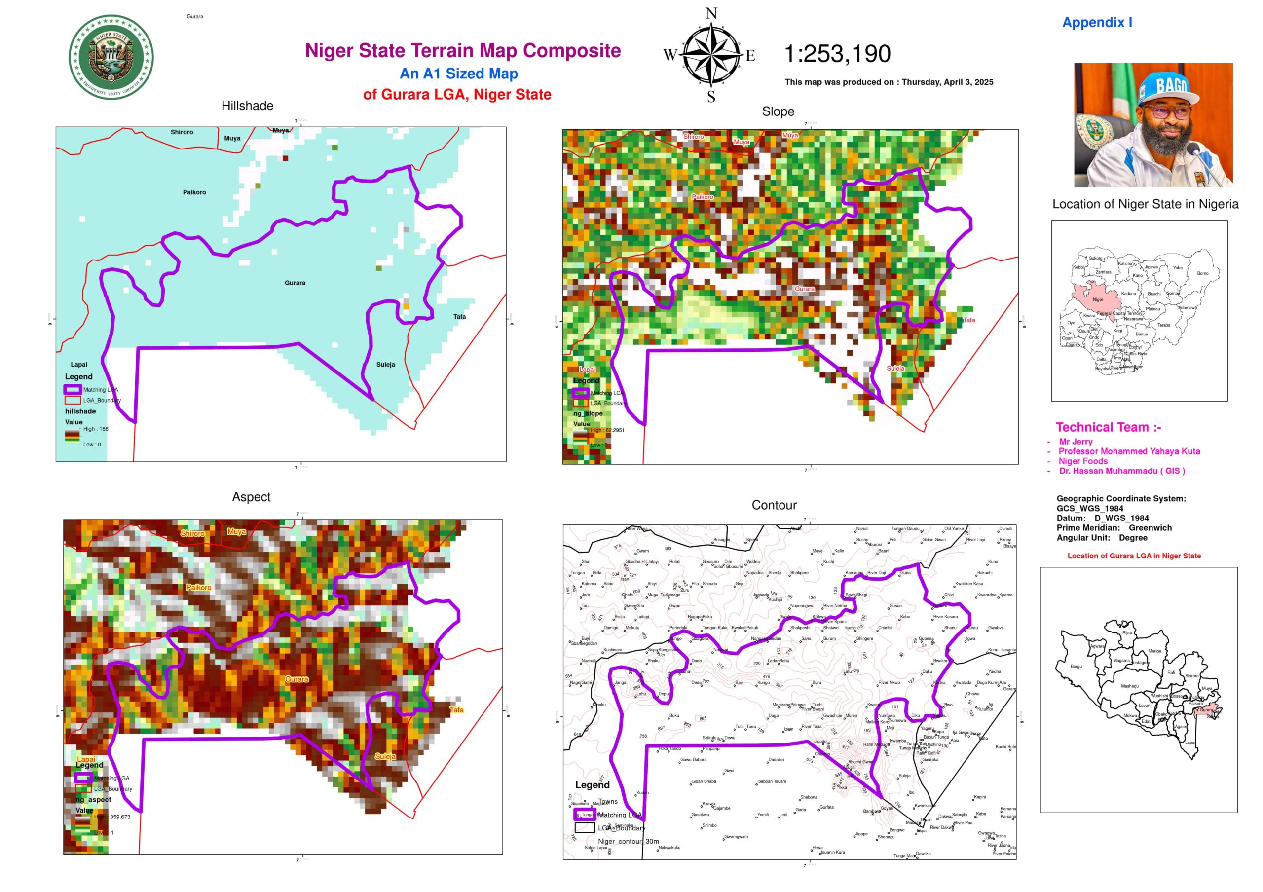
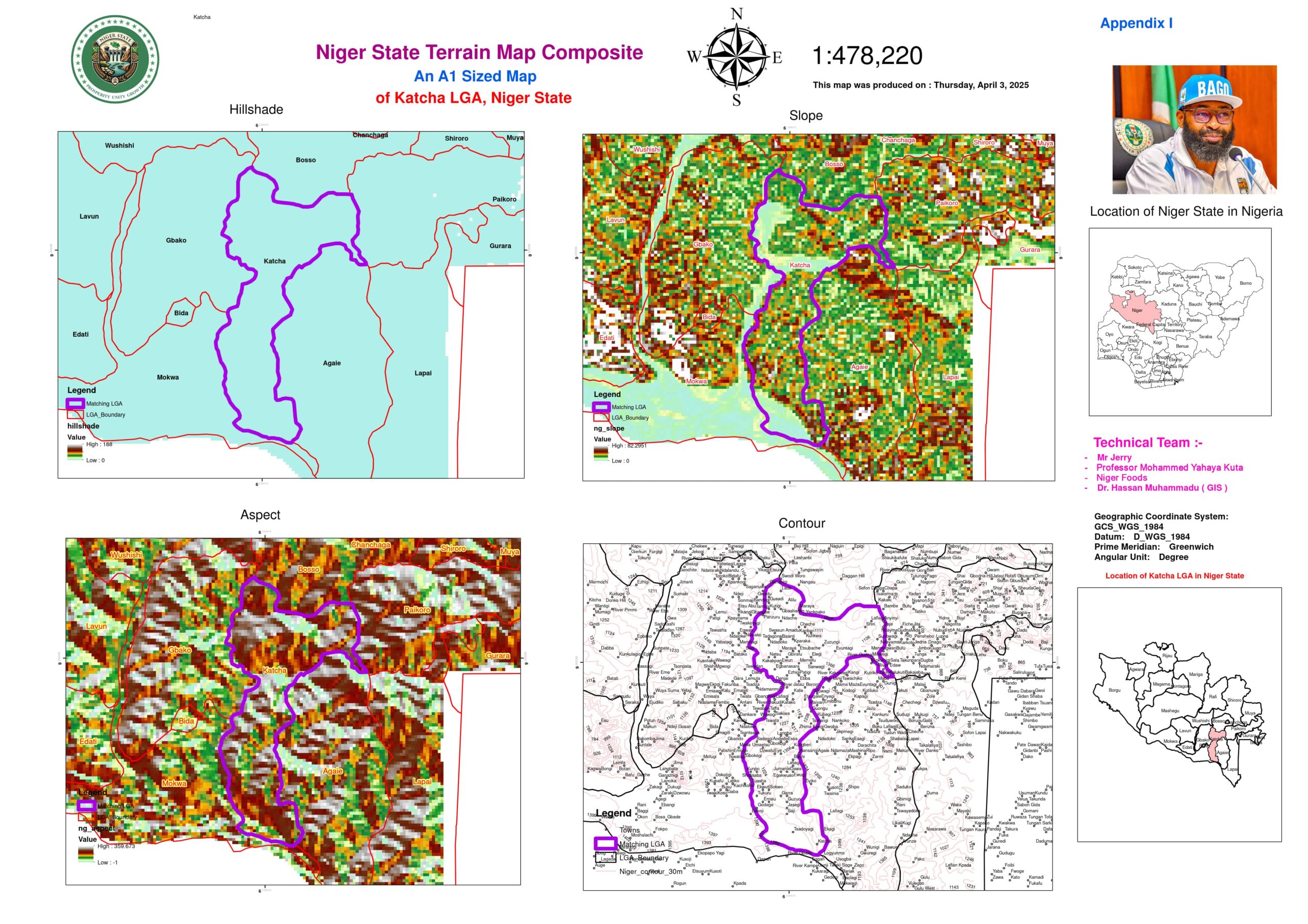
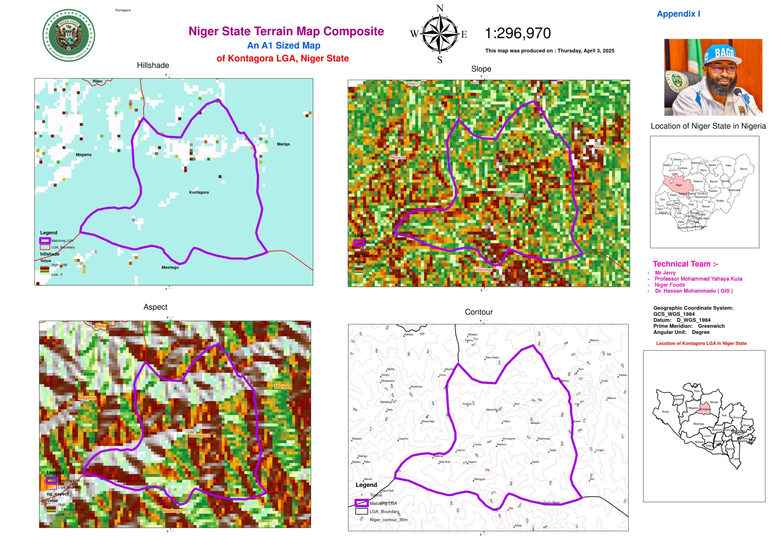
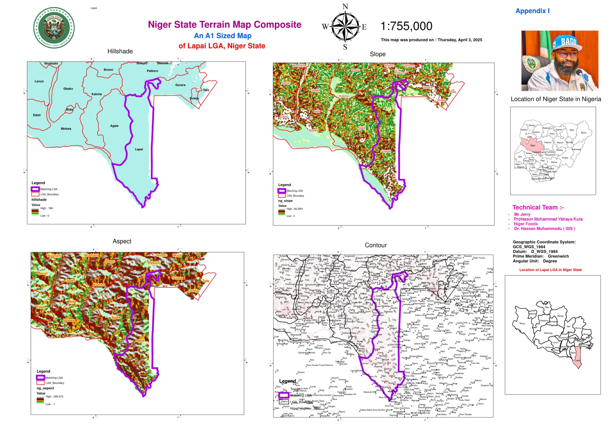
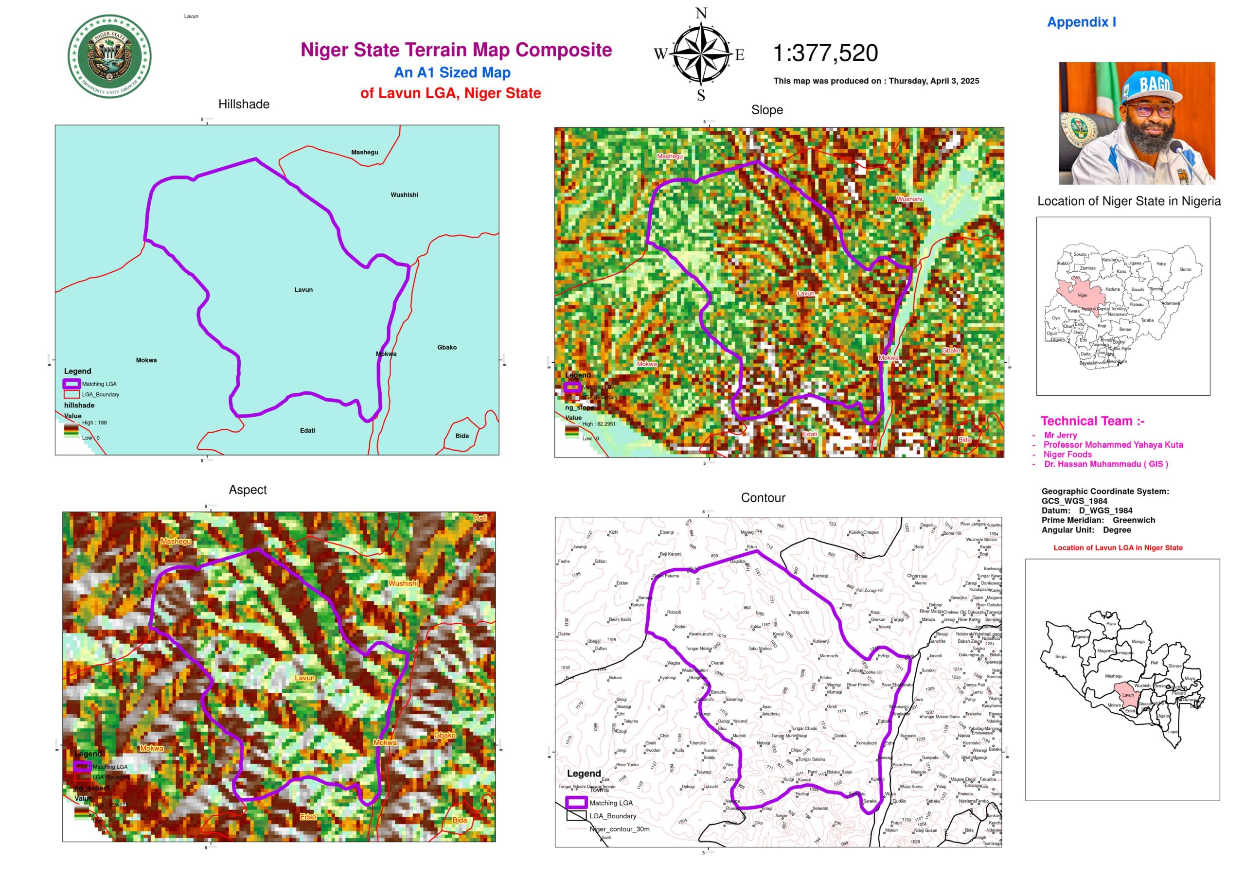
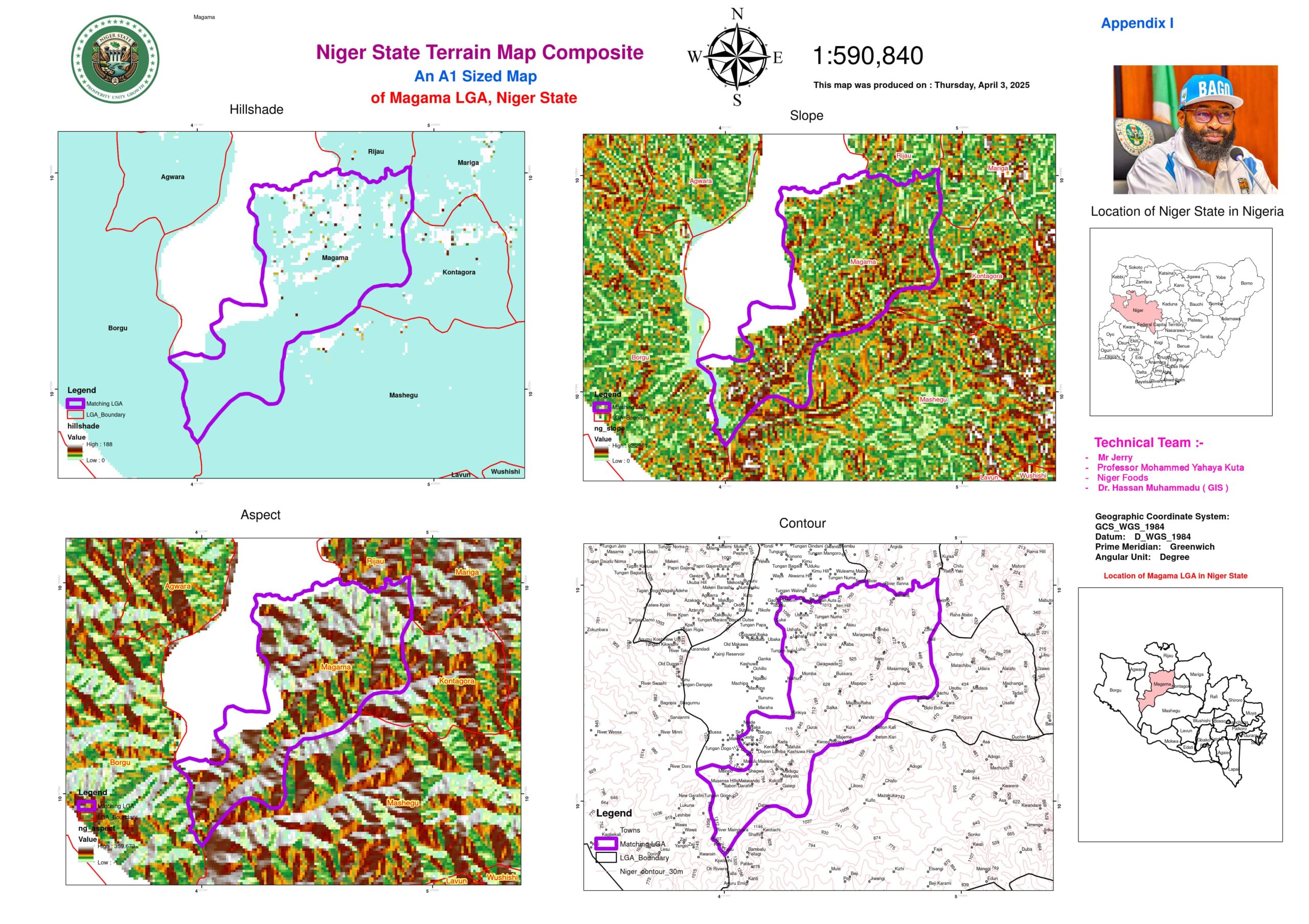
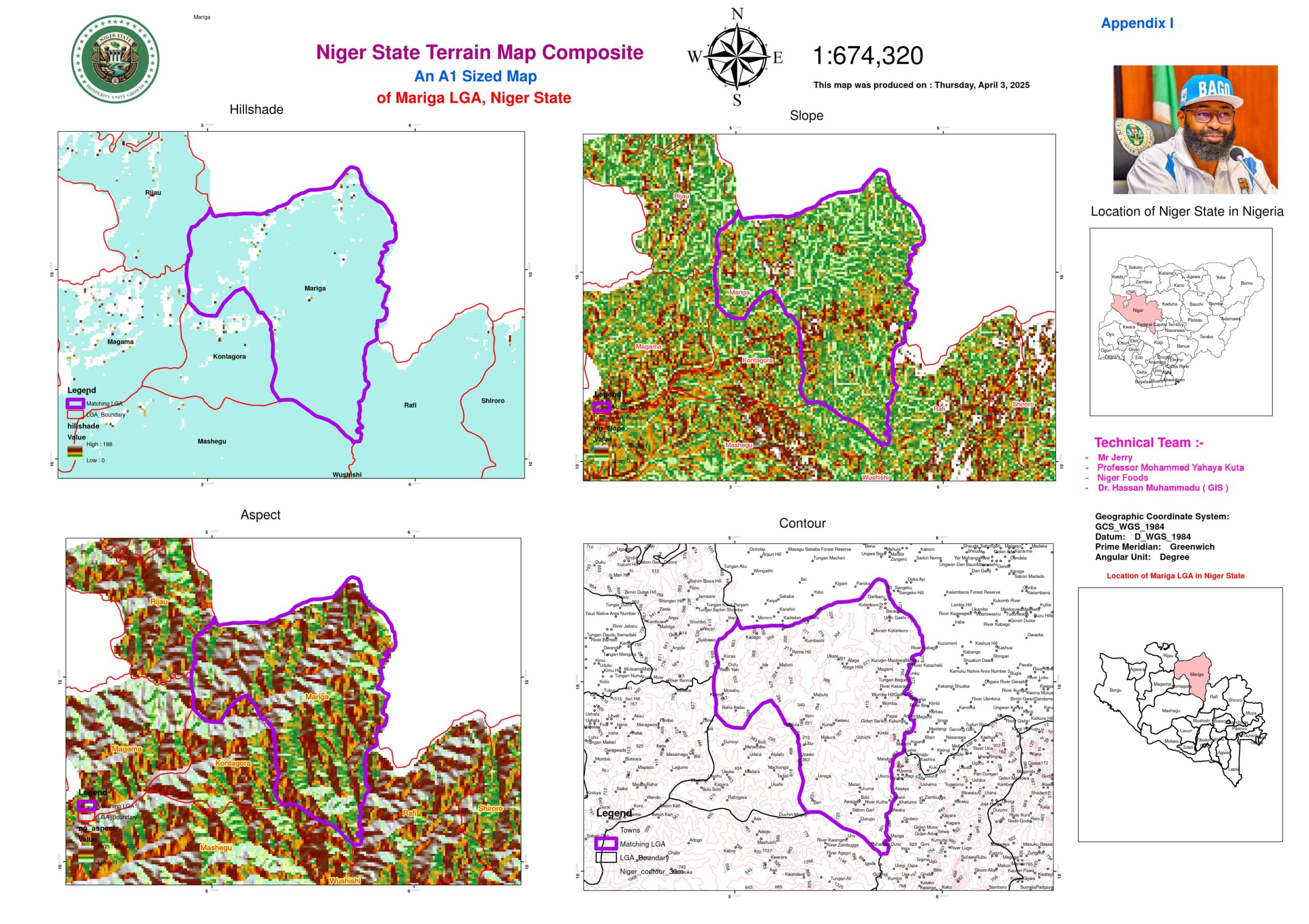
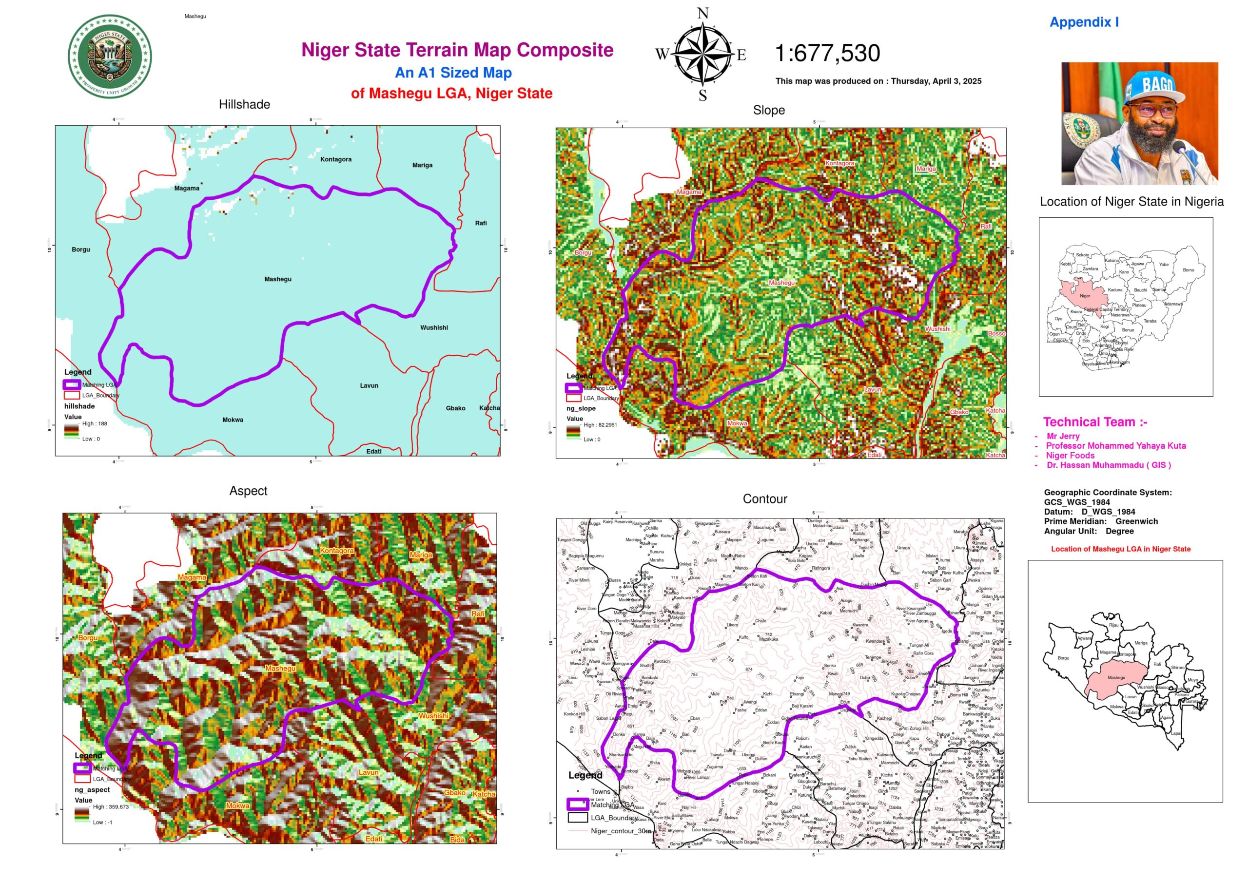
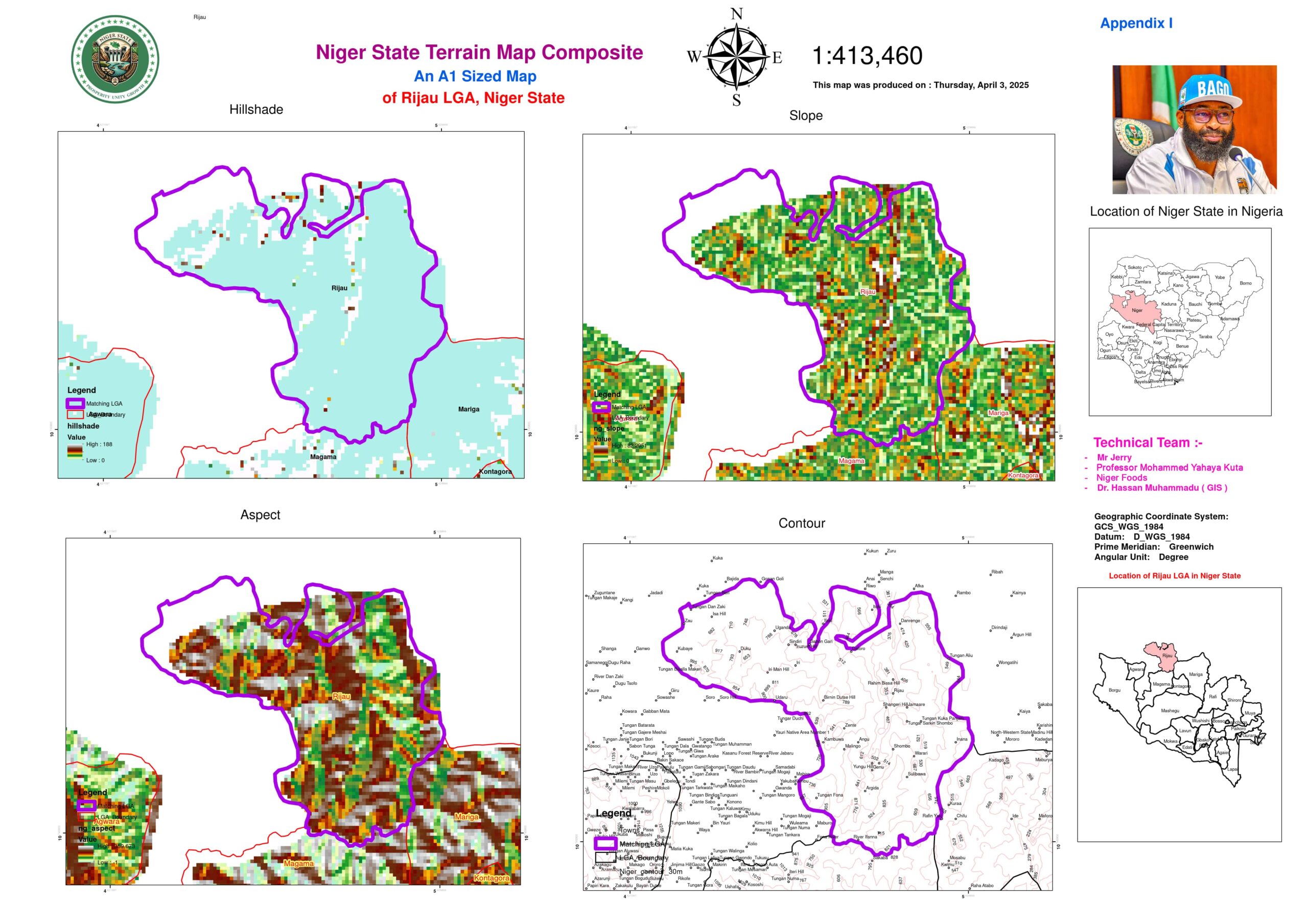
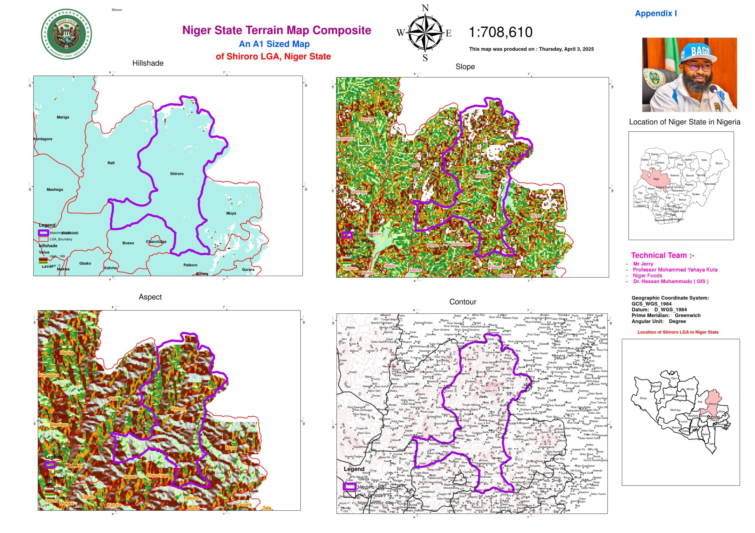
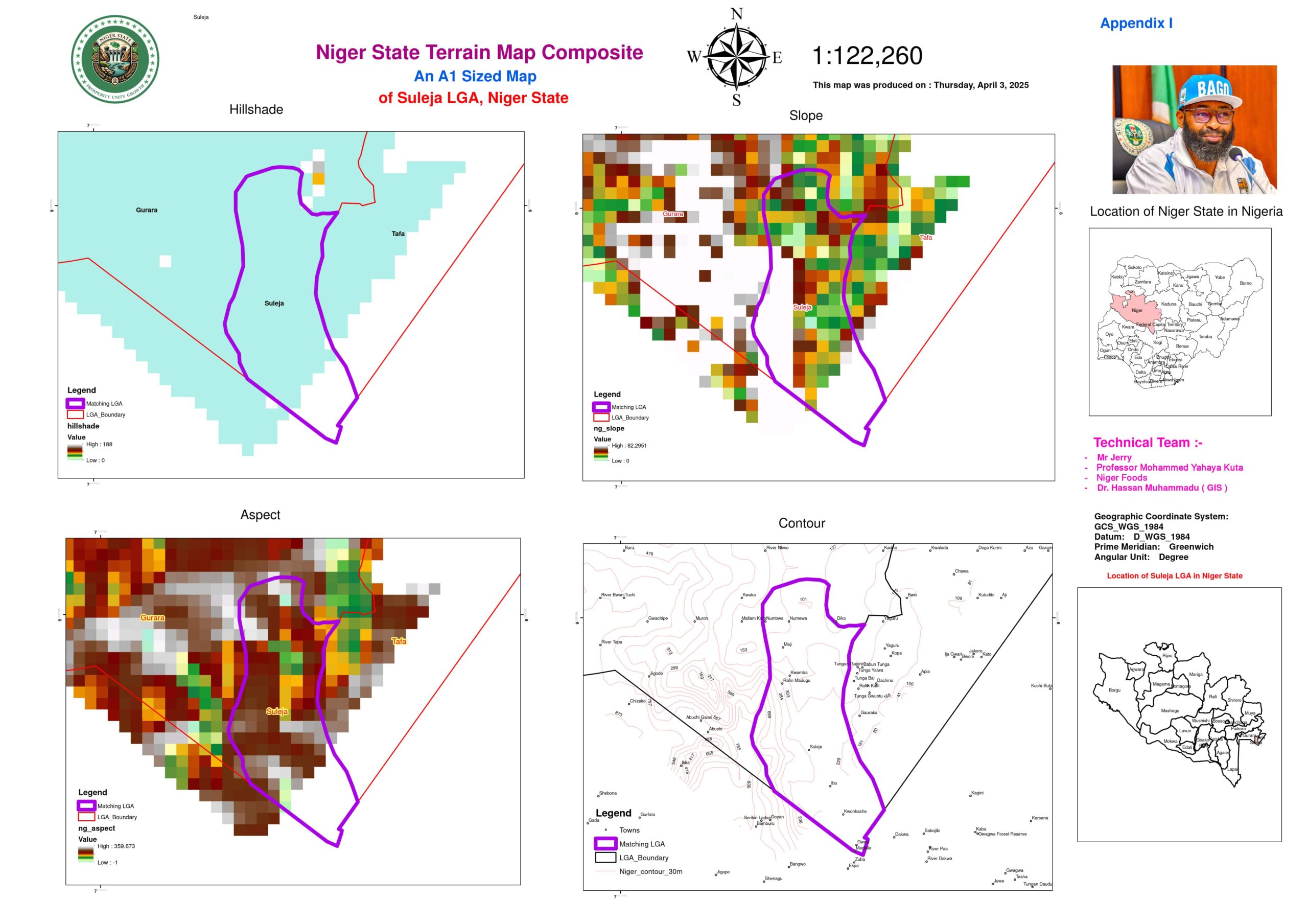
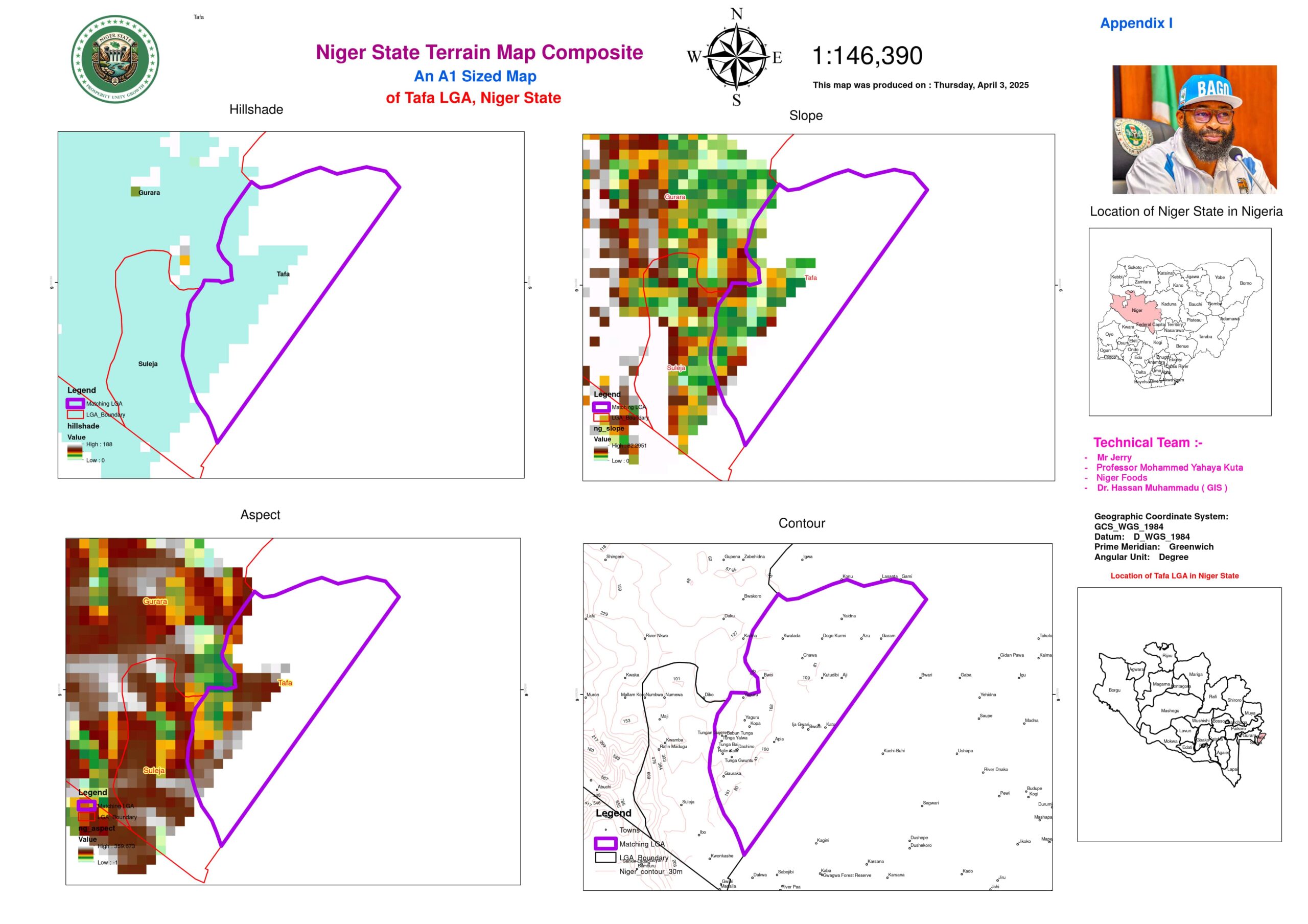
Comprehensive Terrain, Drainage, and Investment Potential Assessment of Niger State Using Digital Elevation Models (DEMs)
Niger State’s topographical and drainage characteristics play a pivotal role in its agricultural productivity, urban development, and hydrological sustainability. This study integrates Digital Elevation Models (DEMs), contour data, and drainage patterns to assess the state’s terrain variations, hydrological adequacy, and investment opportunities. The interplay between elevation, soil drainage, and human activity significantly influences land suitability, erosion risk, water retention, and economic potential. Through a detailed DEM analysis, the state’s LGAs (Local Government Areas) are classified into high, mid, and low-elevation zones, each presenting distinct drainage characteristics and investment prospects.
Elevation and Drainage Dynamics
Key Observations from Contour Data
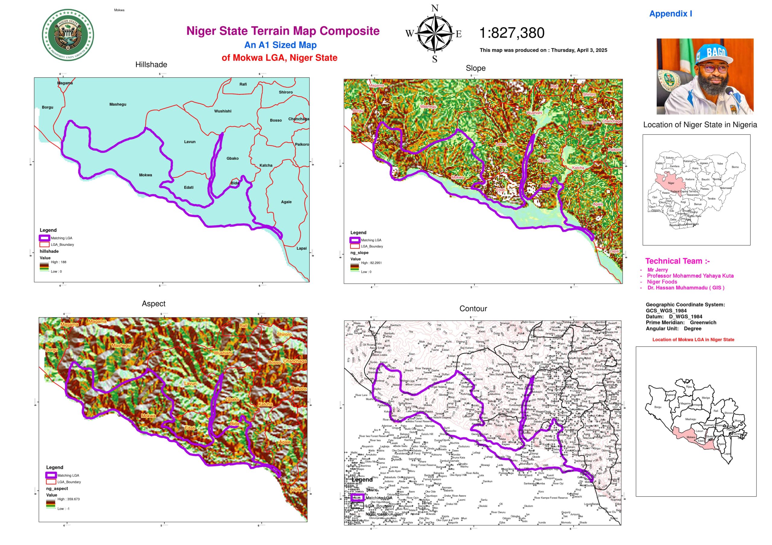
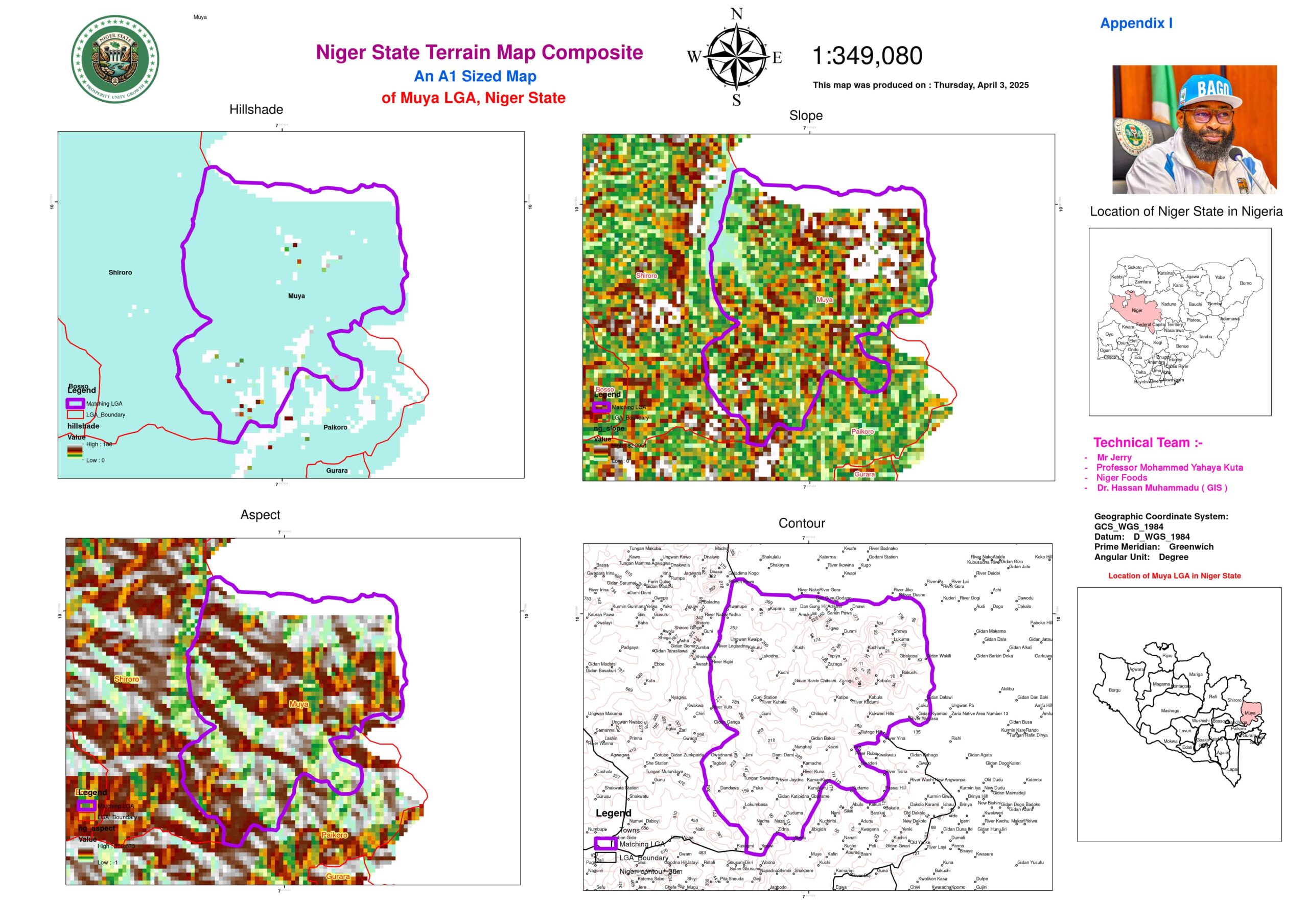
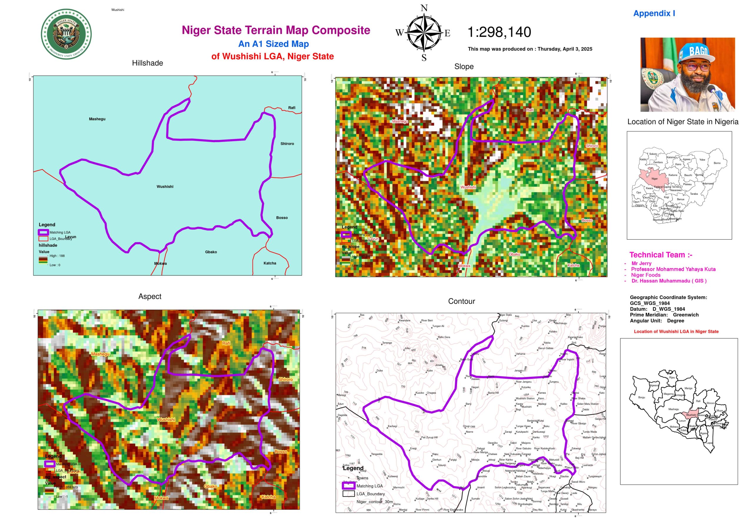
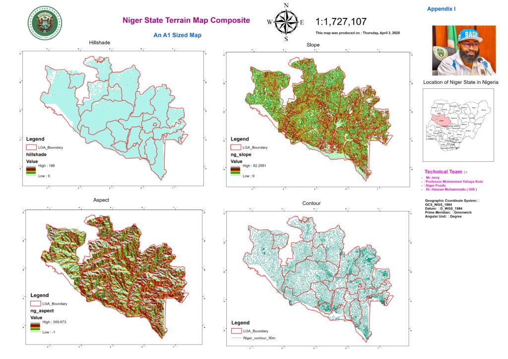
Elevation directly influences the drainage efficiency of an area. LGAs in Niger State exhibit significant variations in elevation, ranging from over 600 meters in the Shiroro and Muya regions to below 300 meters in the floodplains of Bida and Mokwa. The contour distribution provides insights into water flow direction, erosion potential, and water retention capabilities.
High-Elevation LGAs (600–660m):
- Shiroro (660m): Home to the Shiroro Dam, this region experiences rapid runoff due to its steep slopes. The high elevation results in cooler temperatures, which reduce evaporation and support hydropower operations. However, the rapid drainage requires soil conservation techniques to prevent land degradation.
- Muya (660m): The hilly terrain enhances runoff, reducing waterlogging issues, but necessitates erosion control strategies to prevent excessive soil loss and siltation of nearby water bodies.
Mid-Elevation LGAs (300–600m):
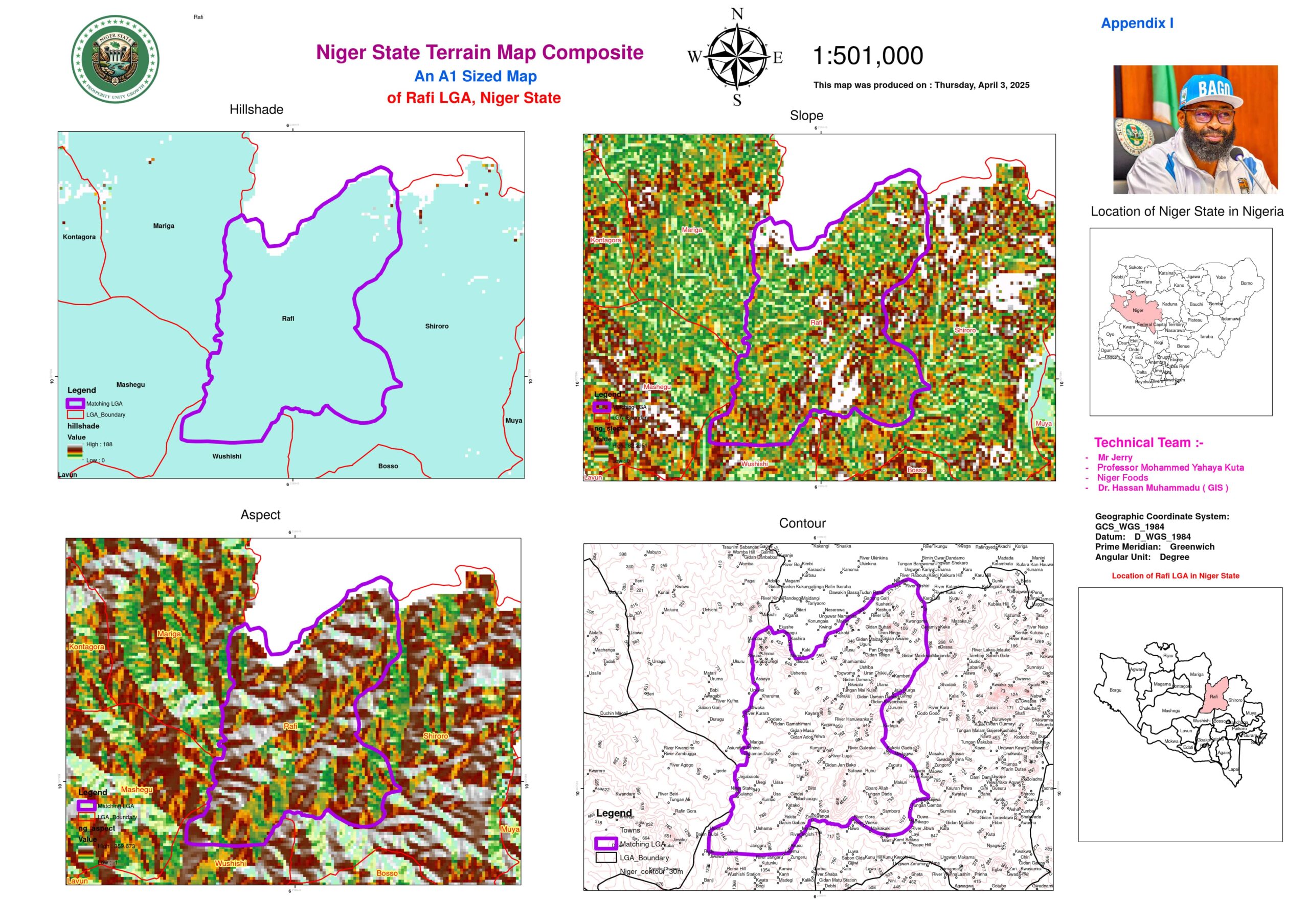
- Borgu, Magama, Rafi: These LGAs, situated in the 300-600m range, have excessively drained sandy soils, leading to rapid water loss and reduced soil moisture retention. This makes them ideal for drought-resistant agricultural investments and groundwater recharge initiatives.
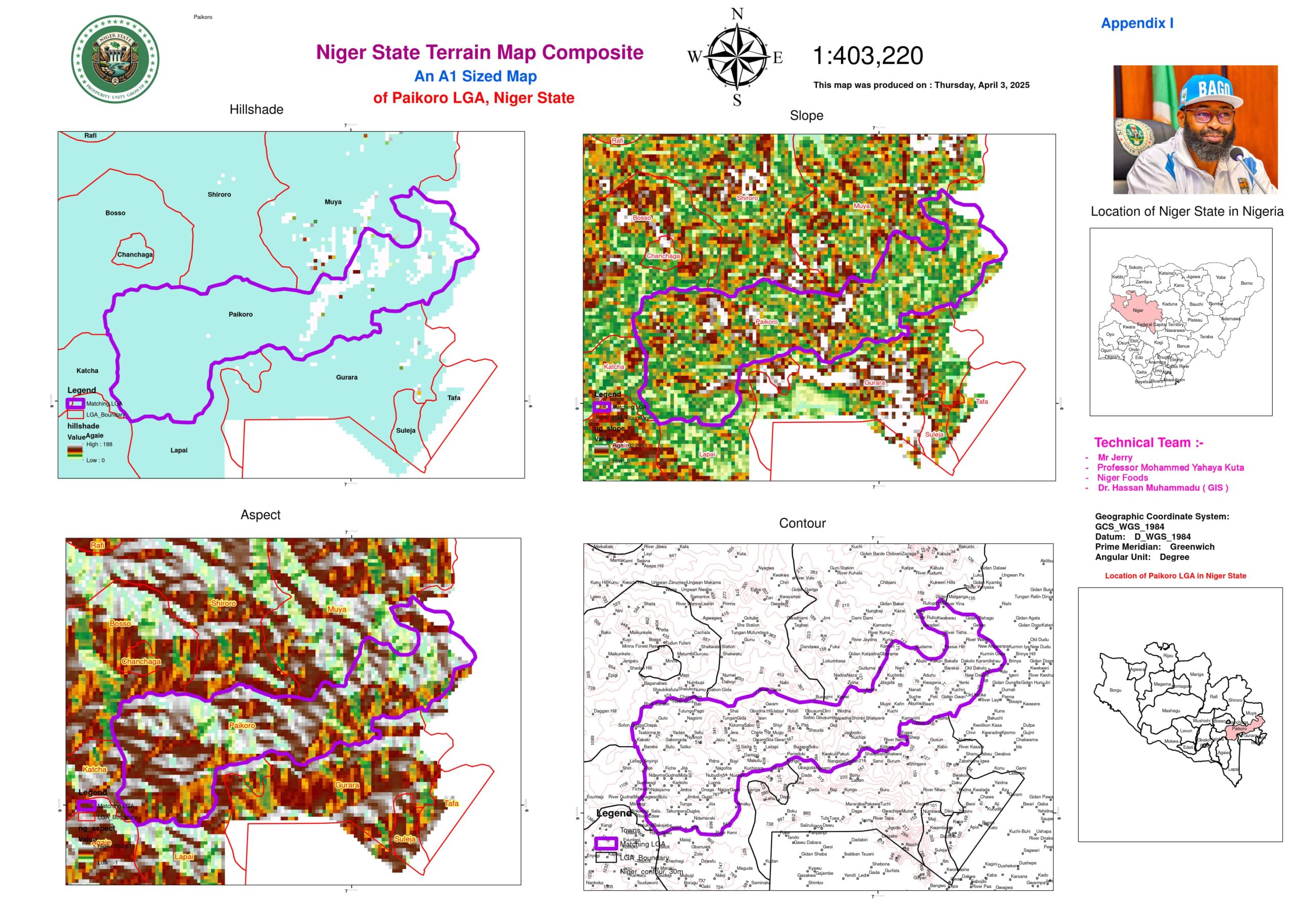
- Lapai, Paikoro: These transitional zones exhibit moderate drainage, making them suitable for diversified agriculture that balances irrigation and water conservation techniques.
Low-Elevation LGAs (<300m):
- Bida, Mokwa, Katcha: Located in floodplains, these LGAs have clay-rich soils that hinder natural drainage, leading to prolonged water retention and frequent waterlogging. Controlled drainage infrastructure is essential to optimize agricultural productivity.
- Suleja, Tafa: Urbanization exacerbates surface runoff in these low-lying LGAs, necessitating advanced stormwater drainage systems and permeable infrastructure to manage excessive water accumulation.
Drainage Efficiency by Elevation
A detailed analysis of drainage characteristics across different elevation zones helps identify strategic intervention areas:
- High Elevation (>500m): Rapid runoff and high erosion risk require investment in terracing, afforestation, and sediment control. LGAs such as Shiroro, Muya, and Gurara need soil stabilization projects to prevent land degradation.
- Mid Elevation (300–500m): These areas experience moderate drainage and possess sandy soils that necessitate controlled irrigation. Borgu, Rafi, and Kontagora offer opportunities for agroforestry and groundwater management systems.
- Low Elevation (<300m): Poor natural drainage due to clay soils results in chronic waterlogging in LGAs such as Bida, Mokwa, and Katcha. These regions require artificial drainage systems and smart water management solutions to mitigate flood risks.
Soil Drainage and Terrain Synergy
The interaction between soil properties and elevation plays a crucial role in land use planning. The DEM analysis highlights the following trends:
- Excessively Drained Soils (High Elevation LGAs – Borgu, Magama): Sandy soils facilitate rapid drainage, but without proper water retention mechanisms, agriculture can be unviable. Investments in soil moisture retention strategies and irrigation enhancement can transform these regions into agricultural hubs.
- Moderately Drained Soils (Mid Elevation LGAs – Lapai, Paikoro): Loamy soils provide balanced infiltration, making these areas suitable for mixed farming and agribusiness expansion.
- Poorly Drained Soils (Low Elevation LGAs – Bida, Mokwa): Clay-rich soils retain excessive water, making these LGAs prone to flooding. Smart drainage solutions and controlled irrigation investments can enhance their agricultural potential.
Climate and Topography Interactions
Elevation influences climate patterns across Niger State, affecting land suitability for various economic activities:
- Arid High Zones (Borgu, Magama): The high elevation and limited rainfall make these areas ideal for solar energy farms, drought-resistant crop research, and climate-smart agricultural investments.
- Riverine Low Zones (Katcha, Mokwa): Prolonged wet conditions in these regions create opportunities for commercial rice farming, integrated fish farming, and water-intensive agribusiness ventures.
- Contour Data Correlation:
- Shiroro (660m): The cooler temperatures support the efficient functioning of the Shiroro Dam, making it a strategic location for further hydropower investment.
- Bida (150m): The combination of high temperatures and low elevation exacerbates waterlogging, necessitating urban drainage interventions.
Urbanization and Drainage Challenges
Urban development modifies natural drainage patterns, leading to increased surface runoff and flooding. DEM analysis of urbanized LGAs such as Minna (Chanchaga), Suleja, and Tafa reveals that contour modifications have disrupted the natural water flow, necessitating modern stormwater management solutions.
- Suleja, Tafa (510–540m): Urban expansion has led to extensive land leveling, disrupting natural drainage pathways. This necessitates investments in permeable pavements and retention basins to mitigate runoff.
- Chanchaga (Minna, 330m): The urban heat island effect alters hydrological cycles, increasing runoff by approximately 40% compared to rural areas. Strategic green infrastructure development, including urban forestry and sustainable drainage systems, is needed to balance urban water flows.
Investment Opportunities by Terrain
Niger State’s elevation-driven drainage patterns create diverse investment opportunities across different regions:
High-Elevation Zones
- Hydroelectric Power: Expansion of the Shiroro Dam to increase Nigeria’s renewable energy capacity.
- Ecotourism: Development of hillside resorts in Muya to attract tourism and generate revenue.
- Soil Conservation: Investment in terracing and afforestation programs to control erosion and maintain soil fertility.
Mid-Elevation Zones
- Agroforestry: Expansion of cashew and groundnut farming in Kontagora’s savanna landscape.
- Solar Farms: Utilization of Rafi’s arid plains for large-scale solar energy production.
- Water Resource Management: Construction of groundwater recharge facilities to support sustainable agriculture.
Low-Elevation Zones
- Aquaculture: Expansion of fish farming projects in Mokwa’s floodplains to boost food security.
- Urban Drainage Public-Private Partnerships: Implementation of stormwater drainage systems in Suleja to prevent flooding and improve urban infrastructure resilience.
