Normalized Difference Vegetation IndexPDF Maps
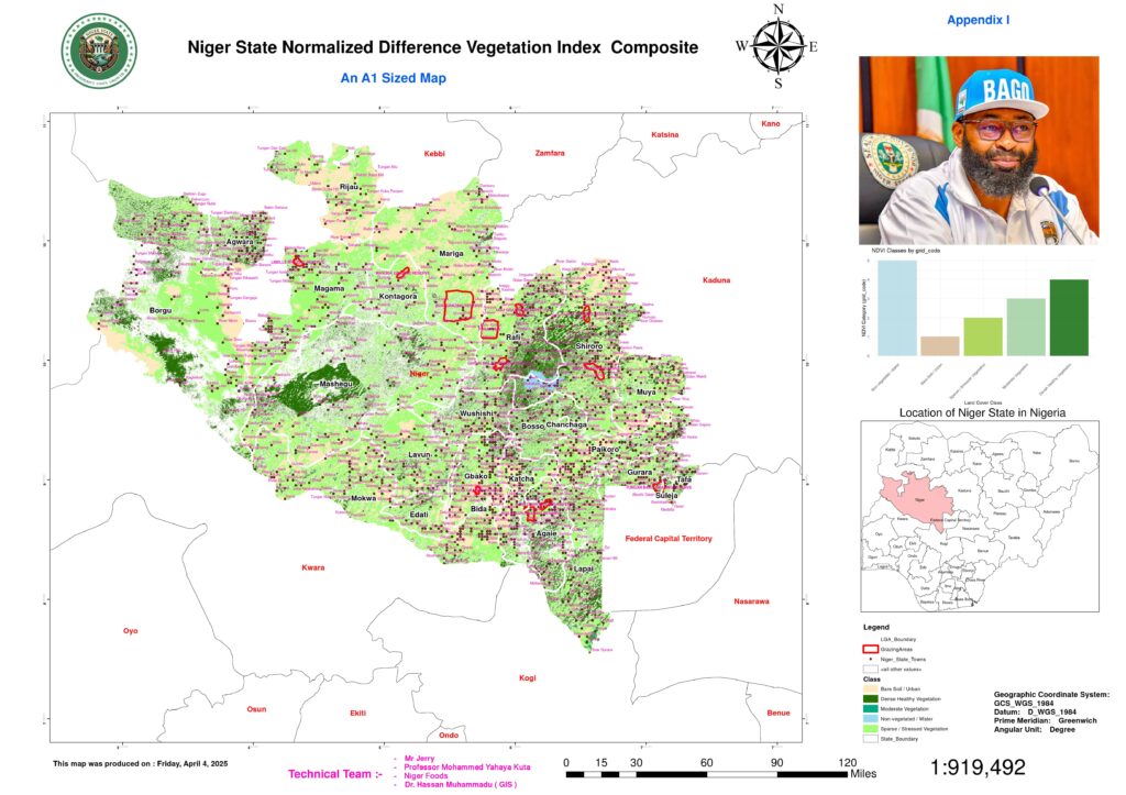
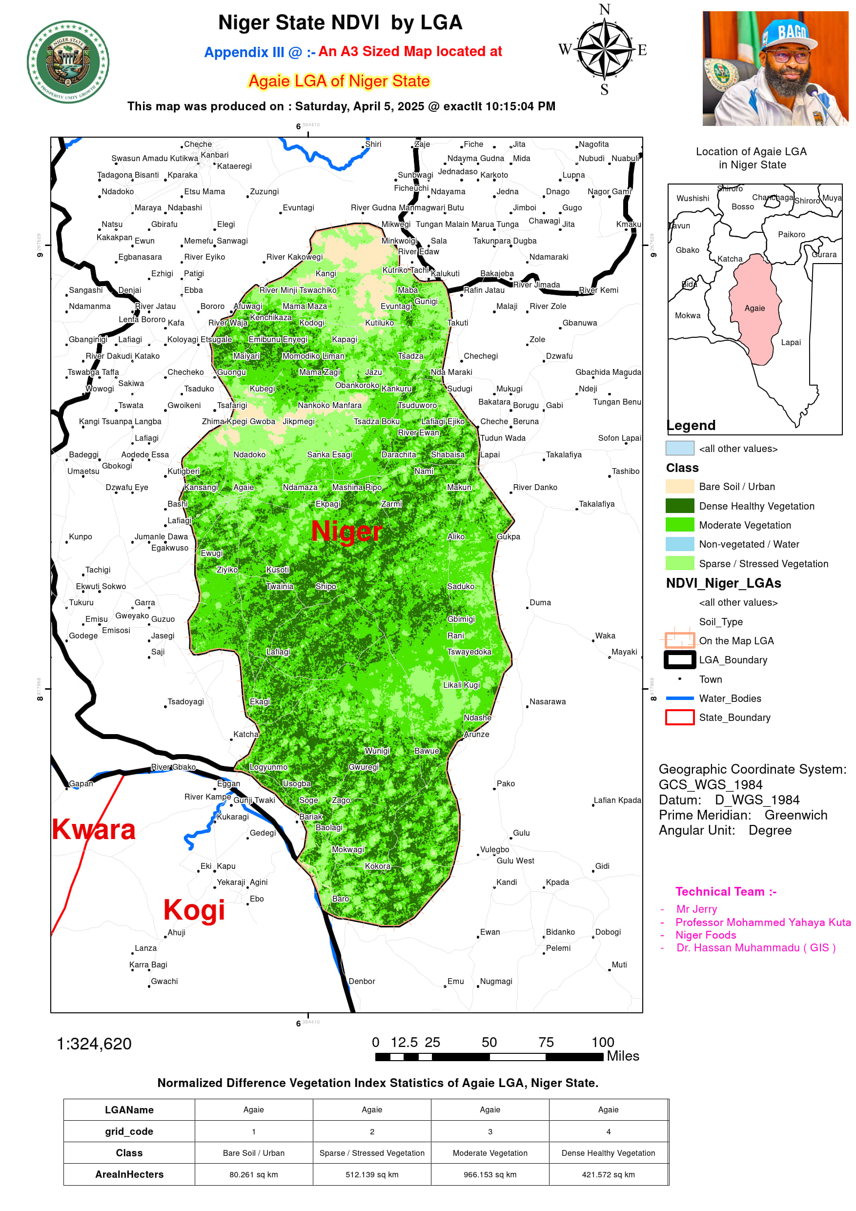
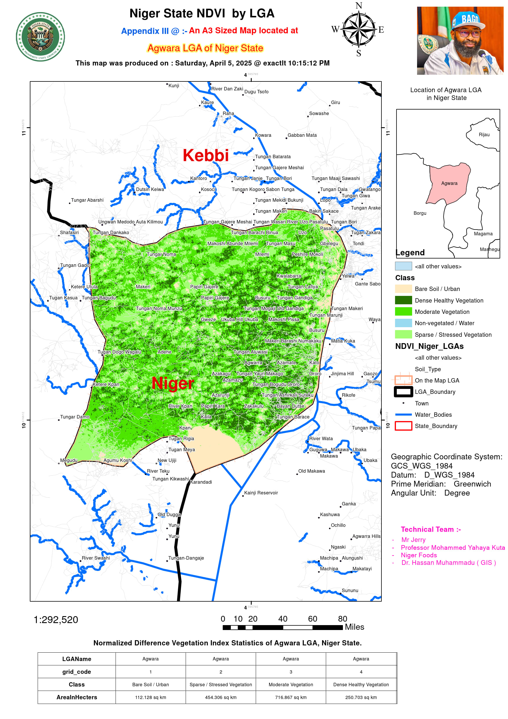
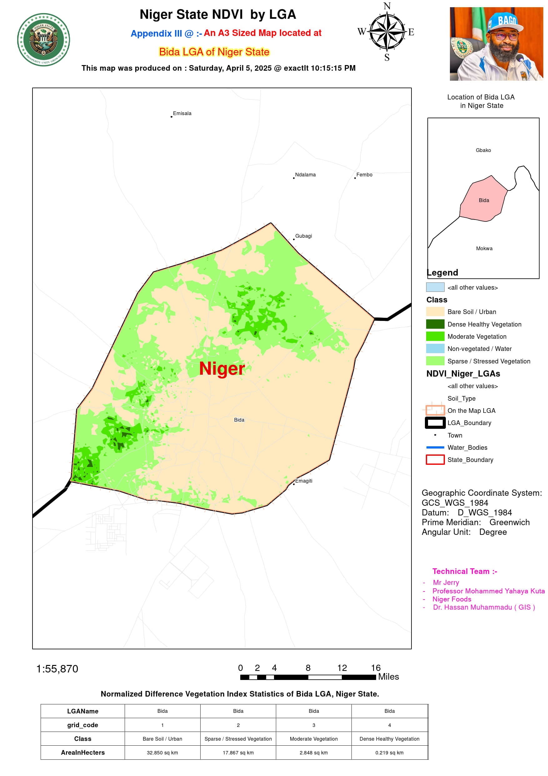
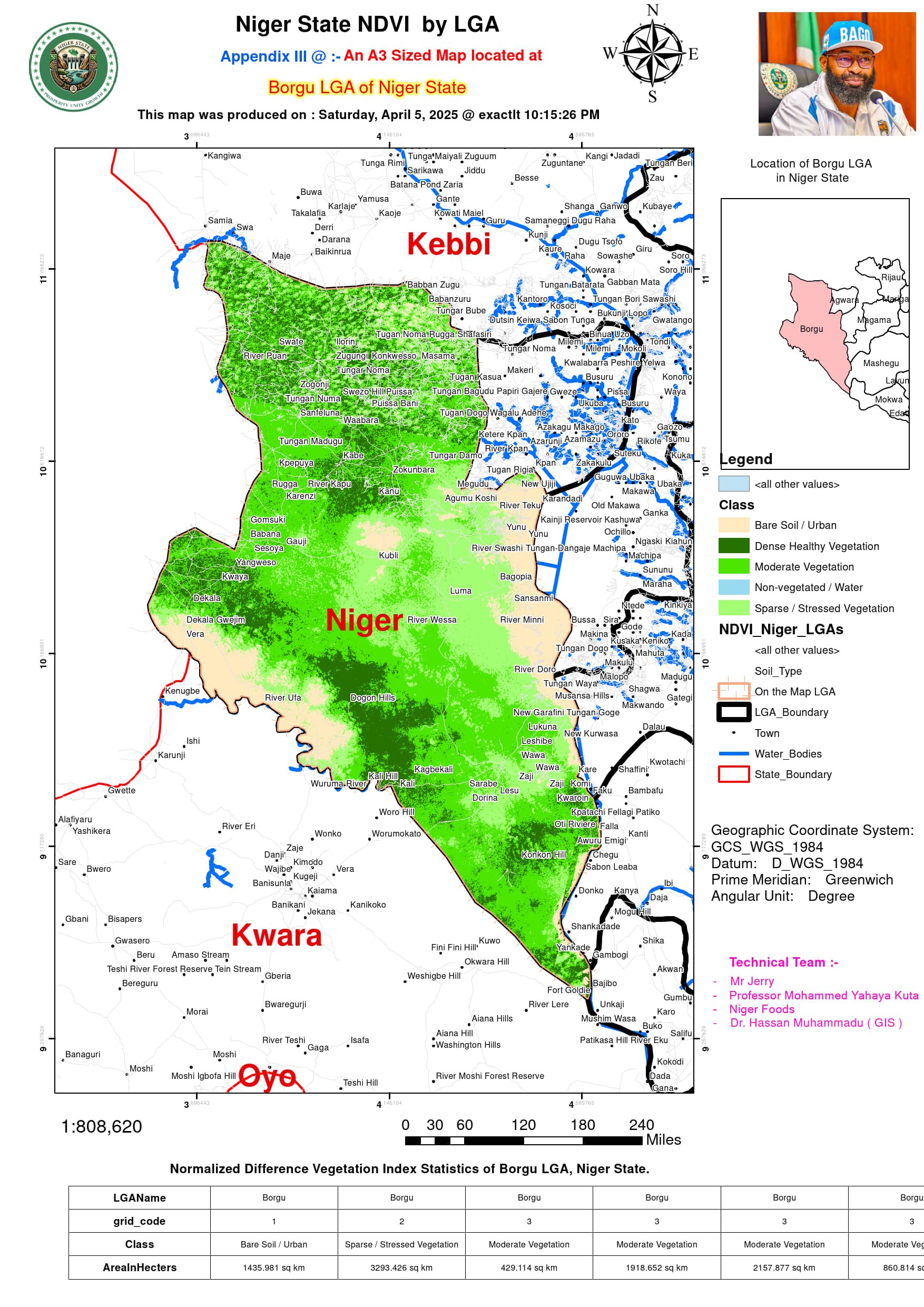
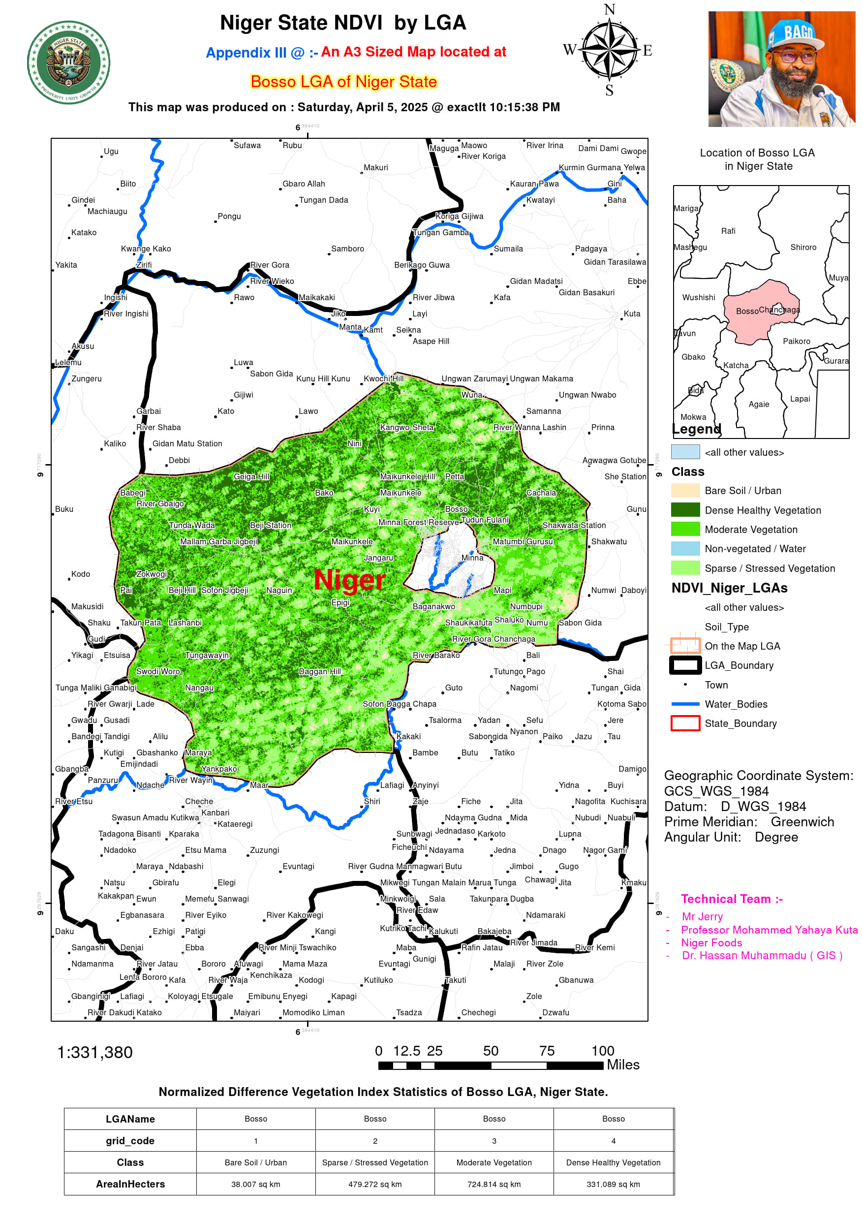
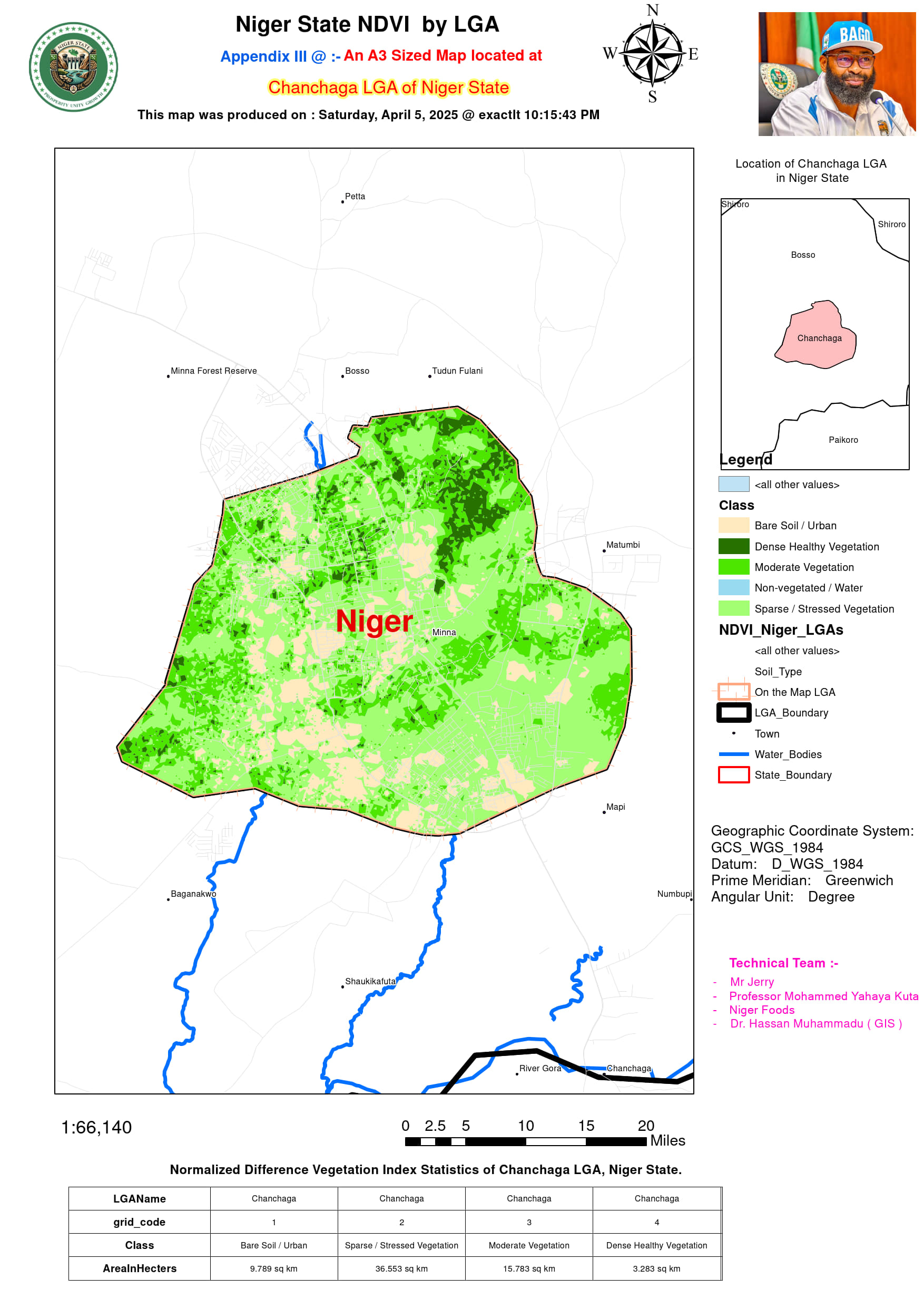
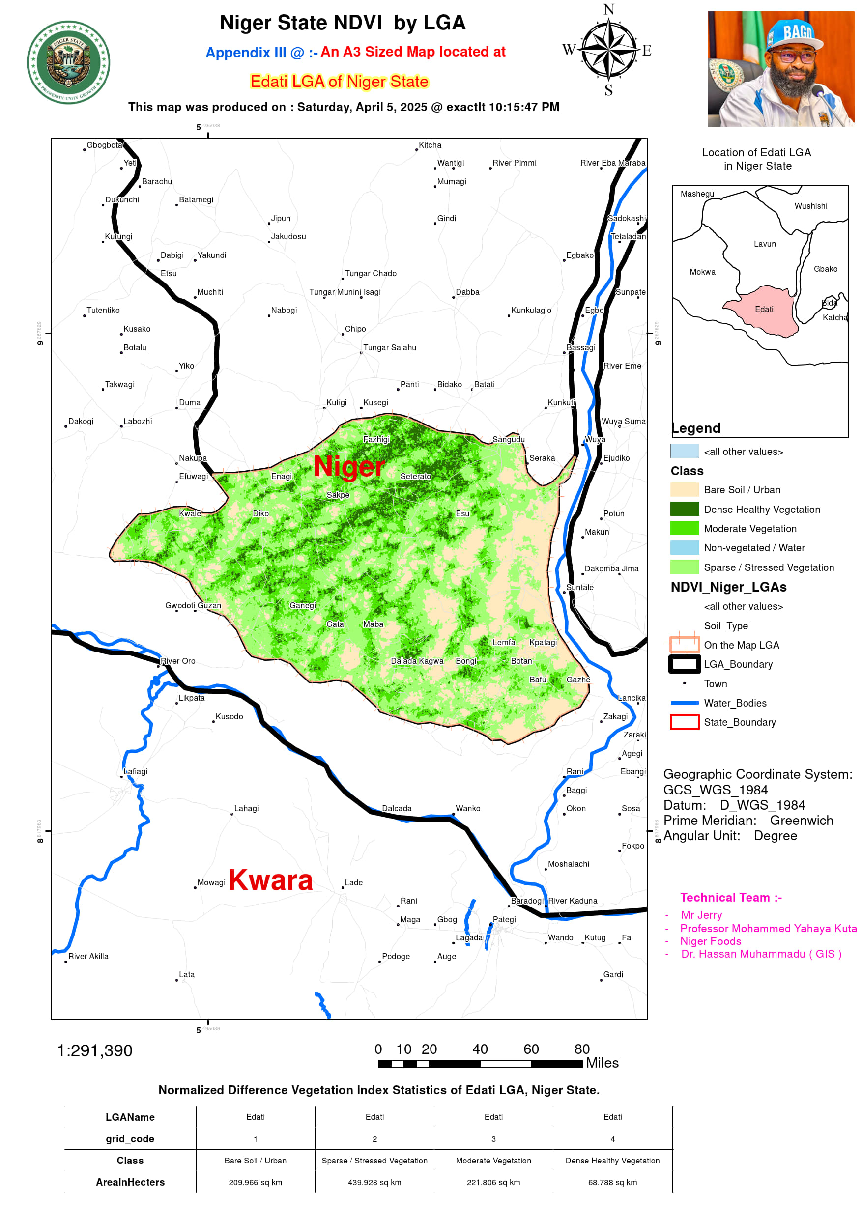
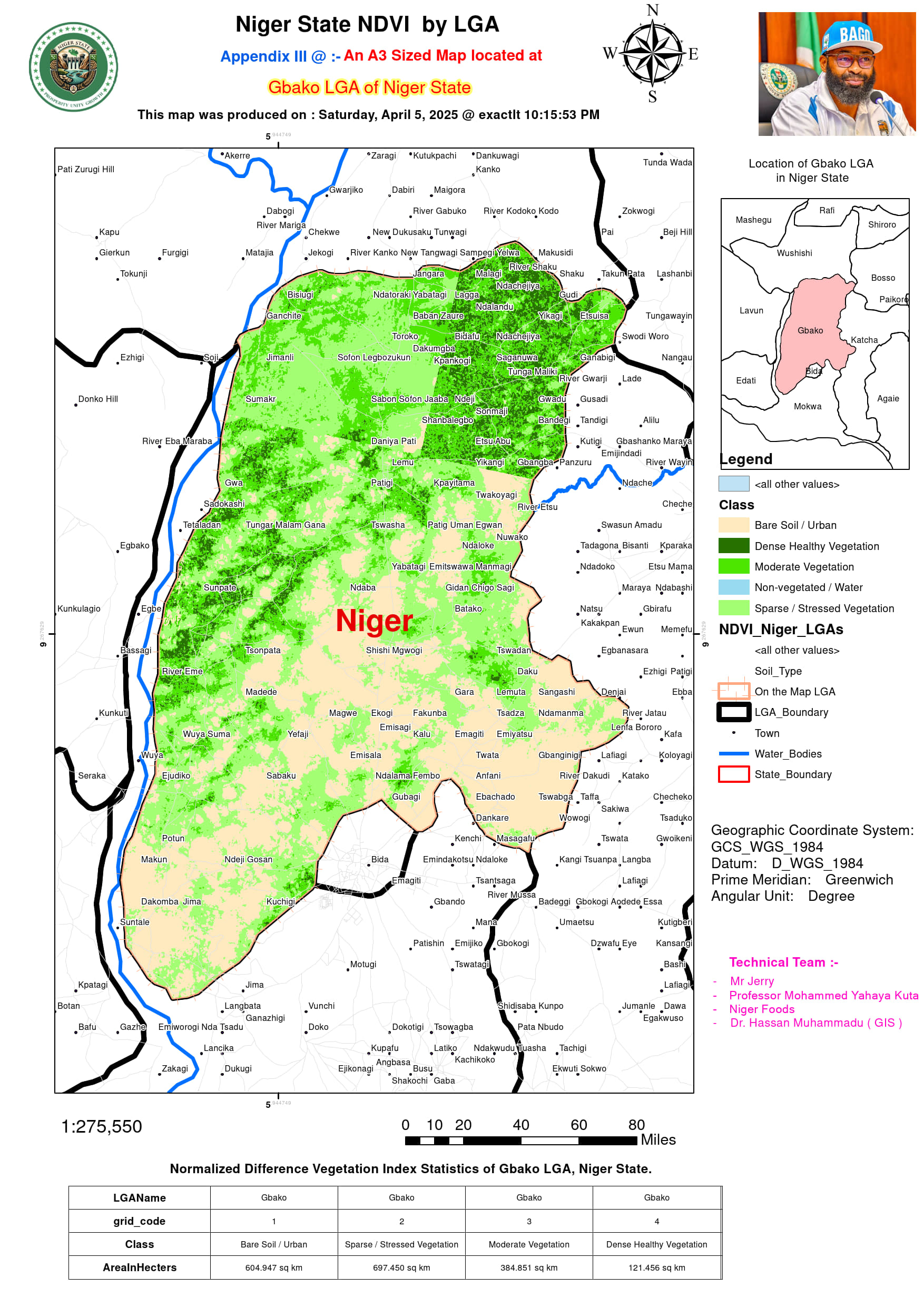
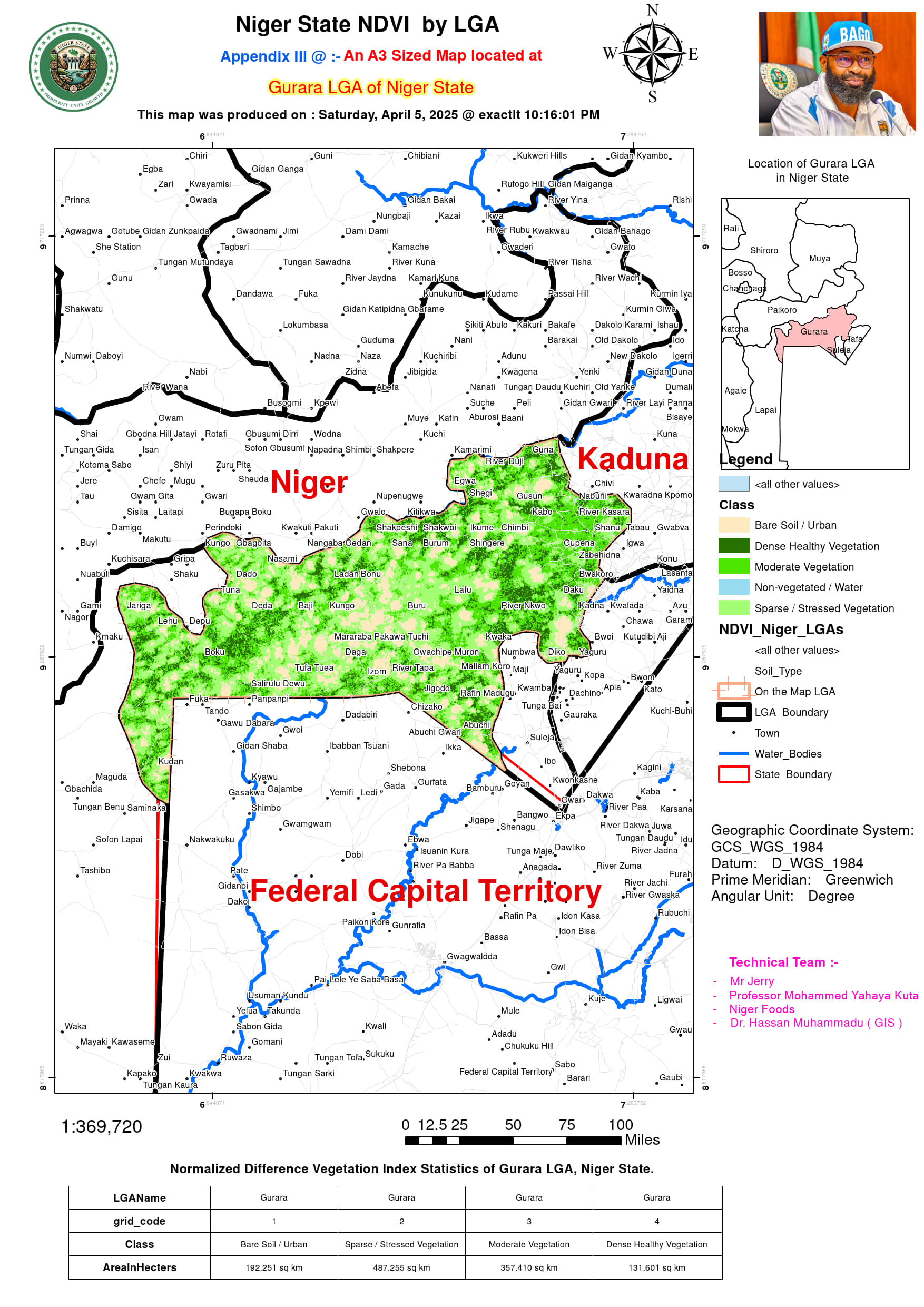
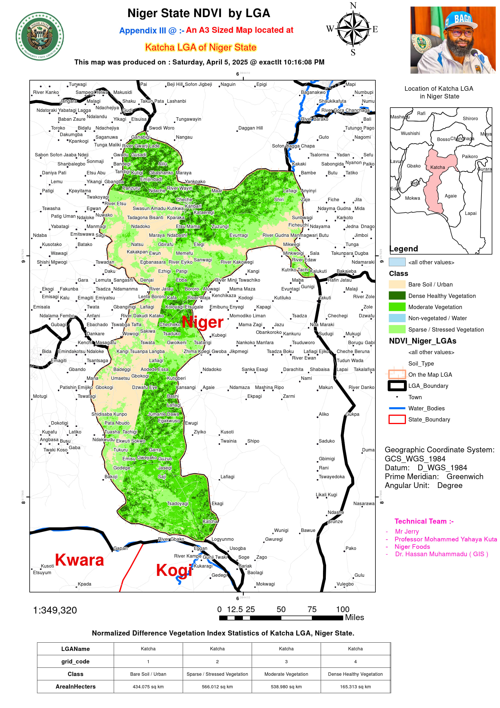
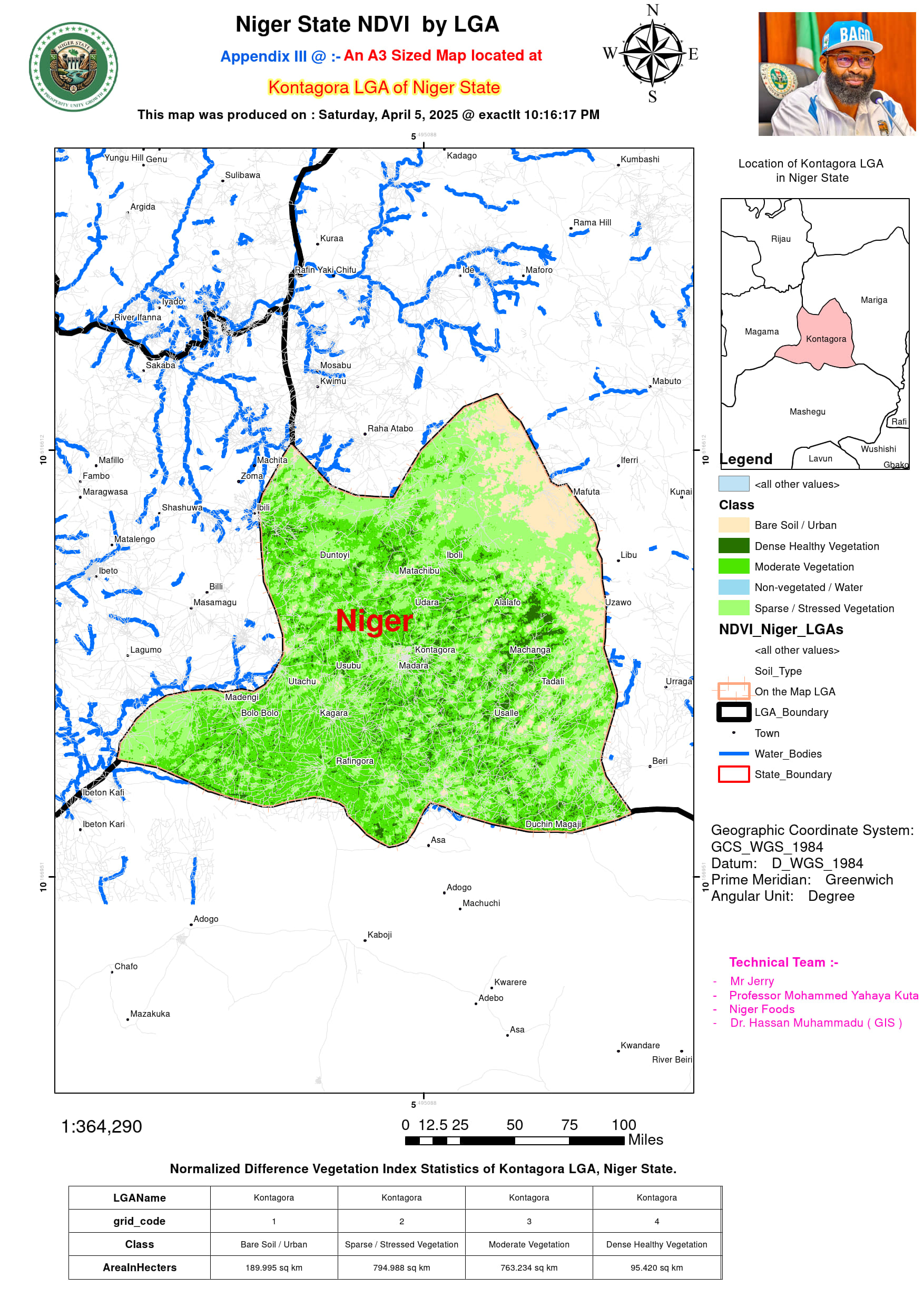
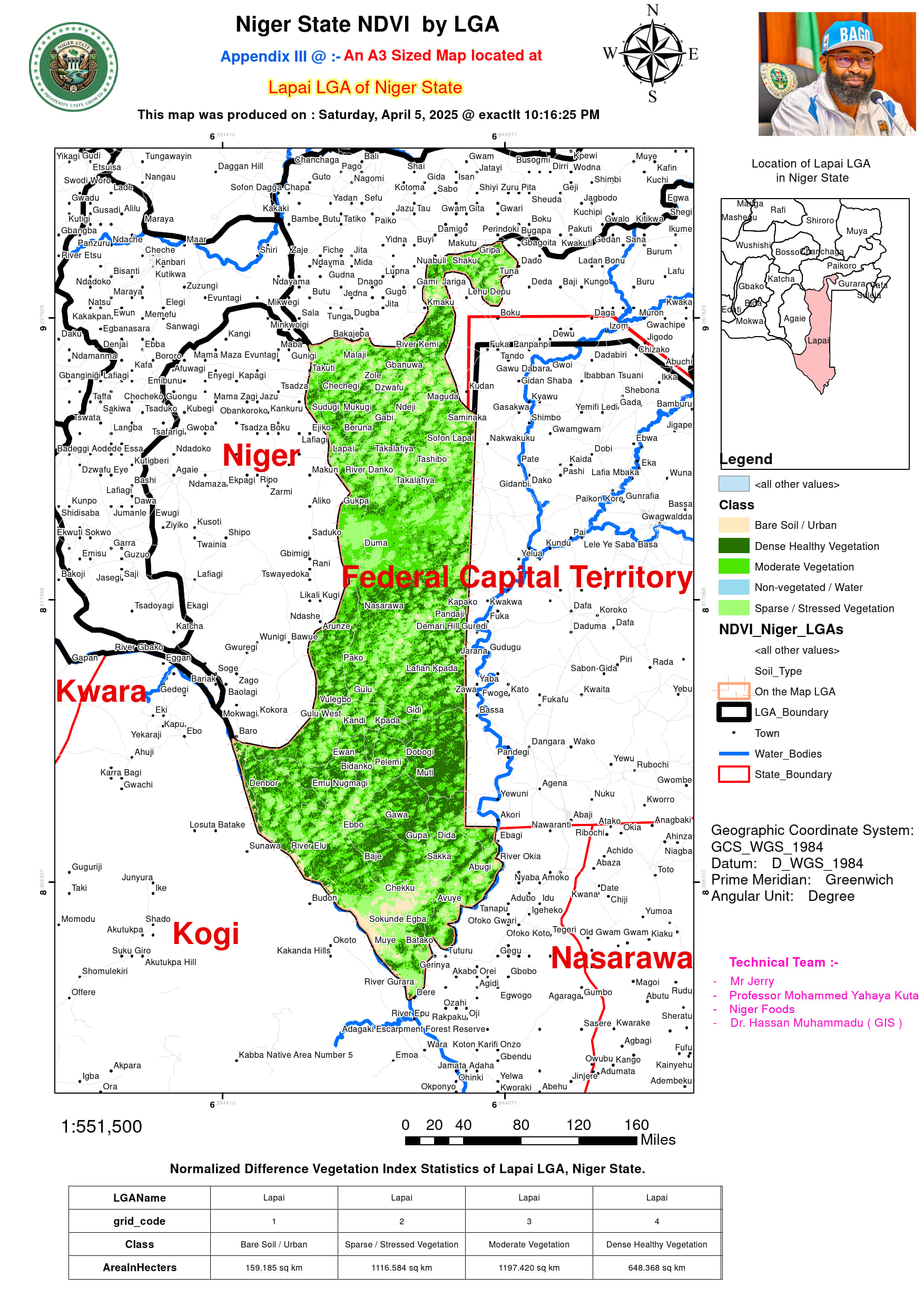
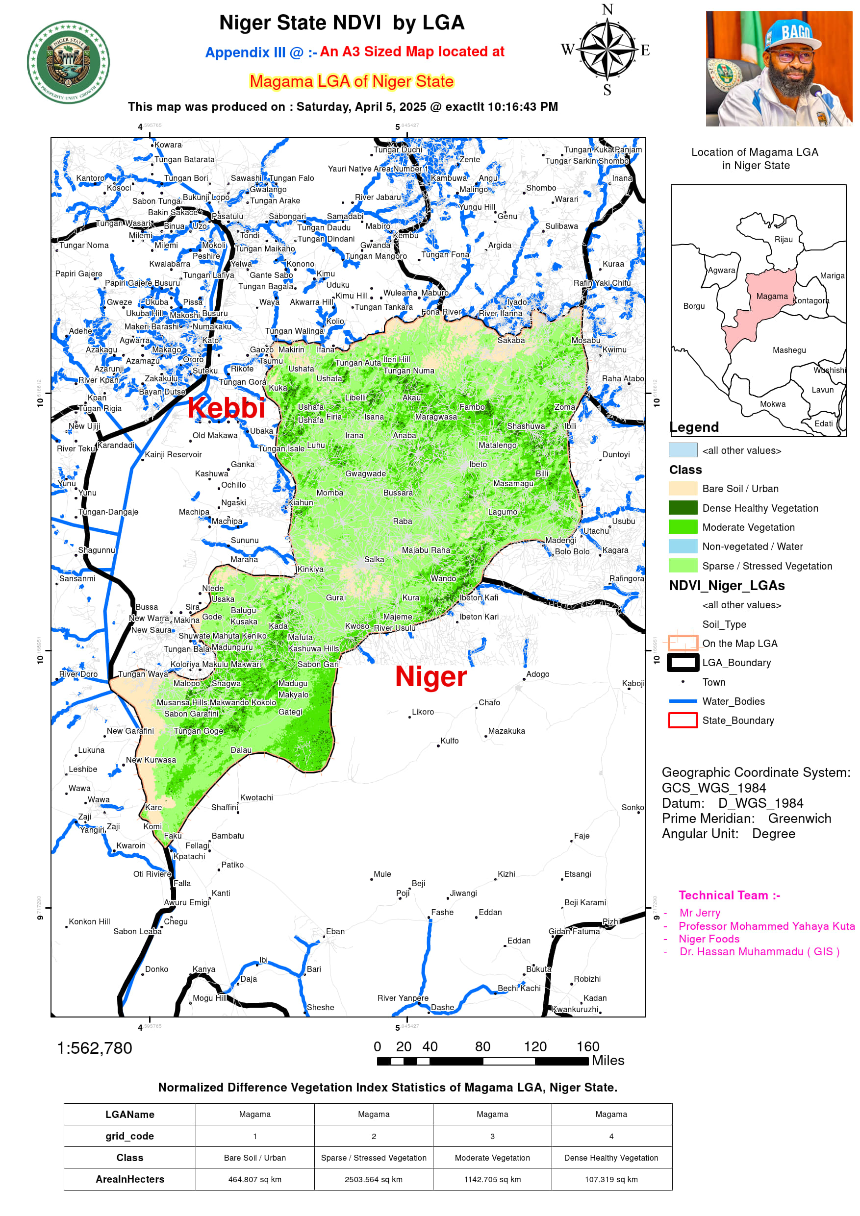
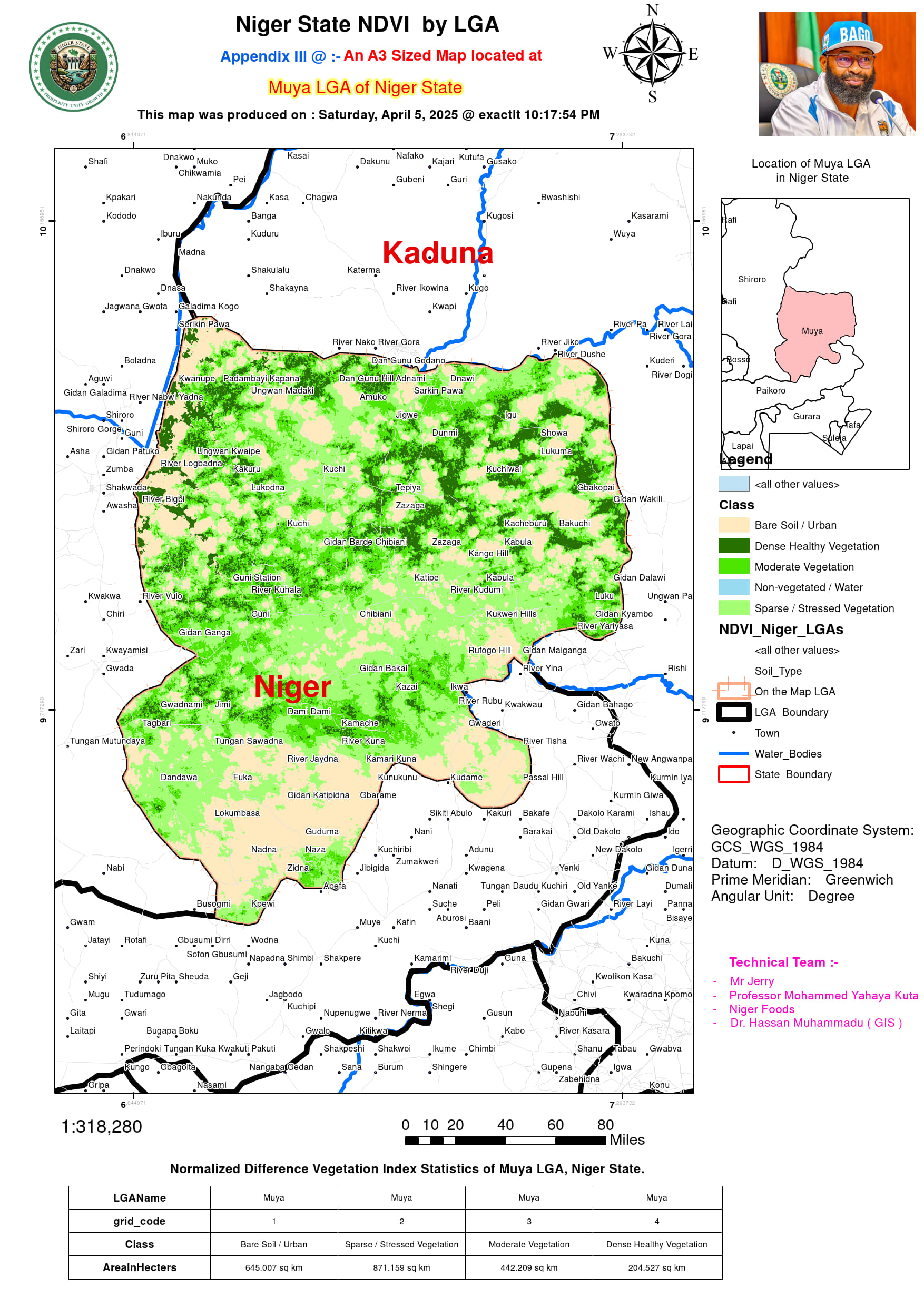
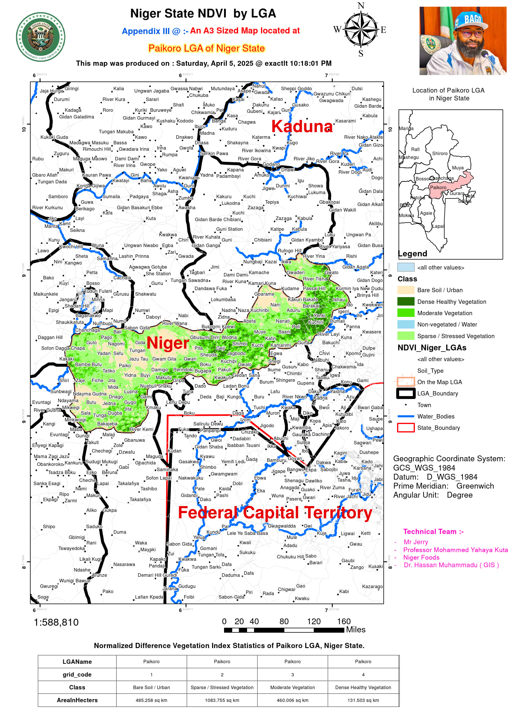
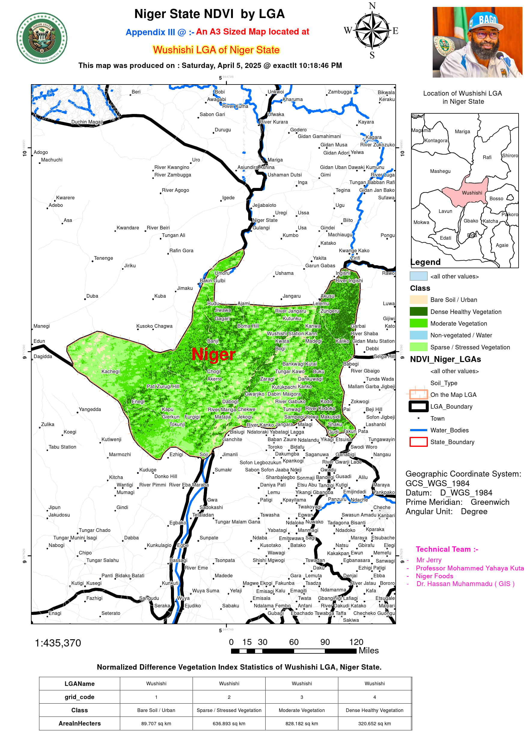
The NDVI classification across Niger State’s Local Government Areas (LGAs) provides crucial insights into land productivity, soil health, and agricultural potential. The land cover types include Bare Soil/Urban areas, which indicate non-vegetated land, urban expansion, or degraded lands; Sparse/Stressed Vegetation, which represents areas with poor vegetation cover due to overgrazing, deforestation, or seasonal drought conditions; Moderate Vegetation, signifying regions with fair vegetative cover, often indicative of farmland or transitional landscapes; and Dense Healthy Vegetation, highlighting areas with lush greenery, ideal for agroforestry, grazing reserves, and high-yield farming. Additionally, some areas contain Non-Vegetated/Water bodies, which are essential for irrigation and livestock watering, supporting sustainable agriculture.
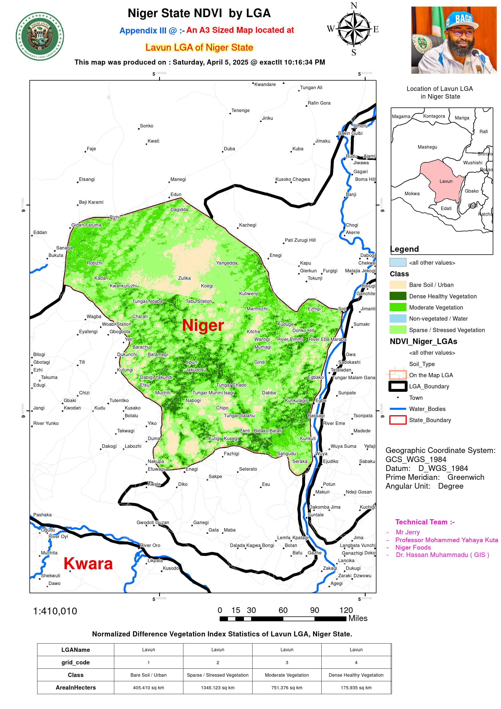
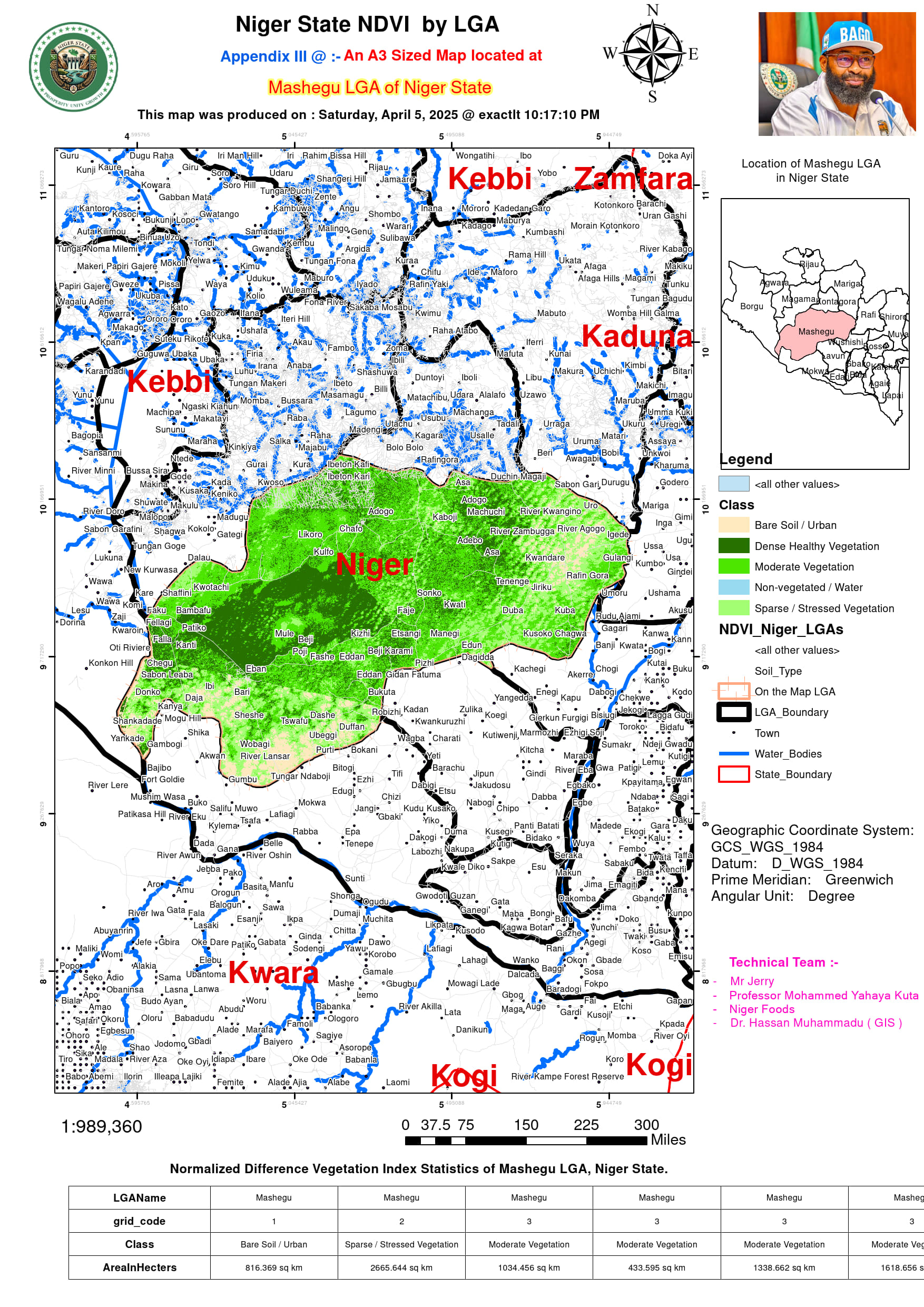
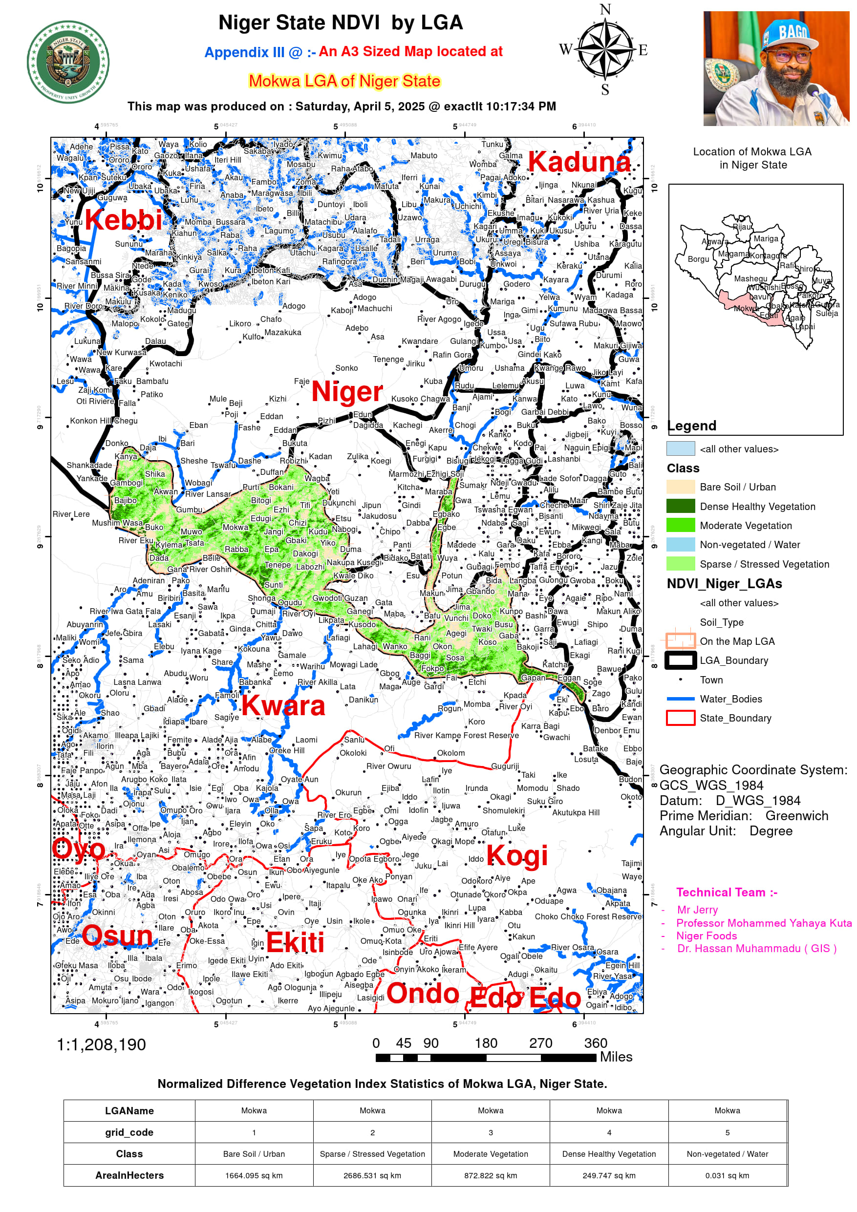
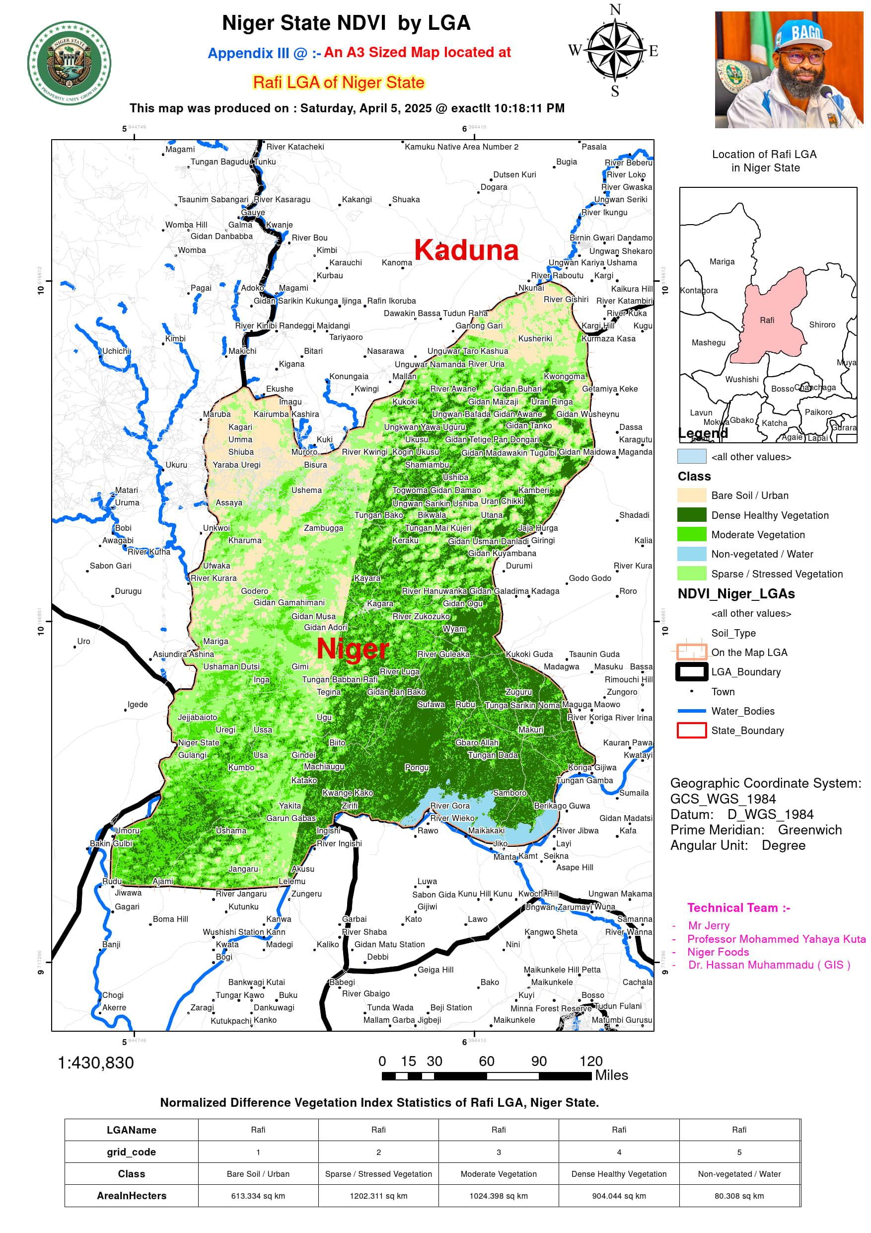
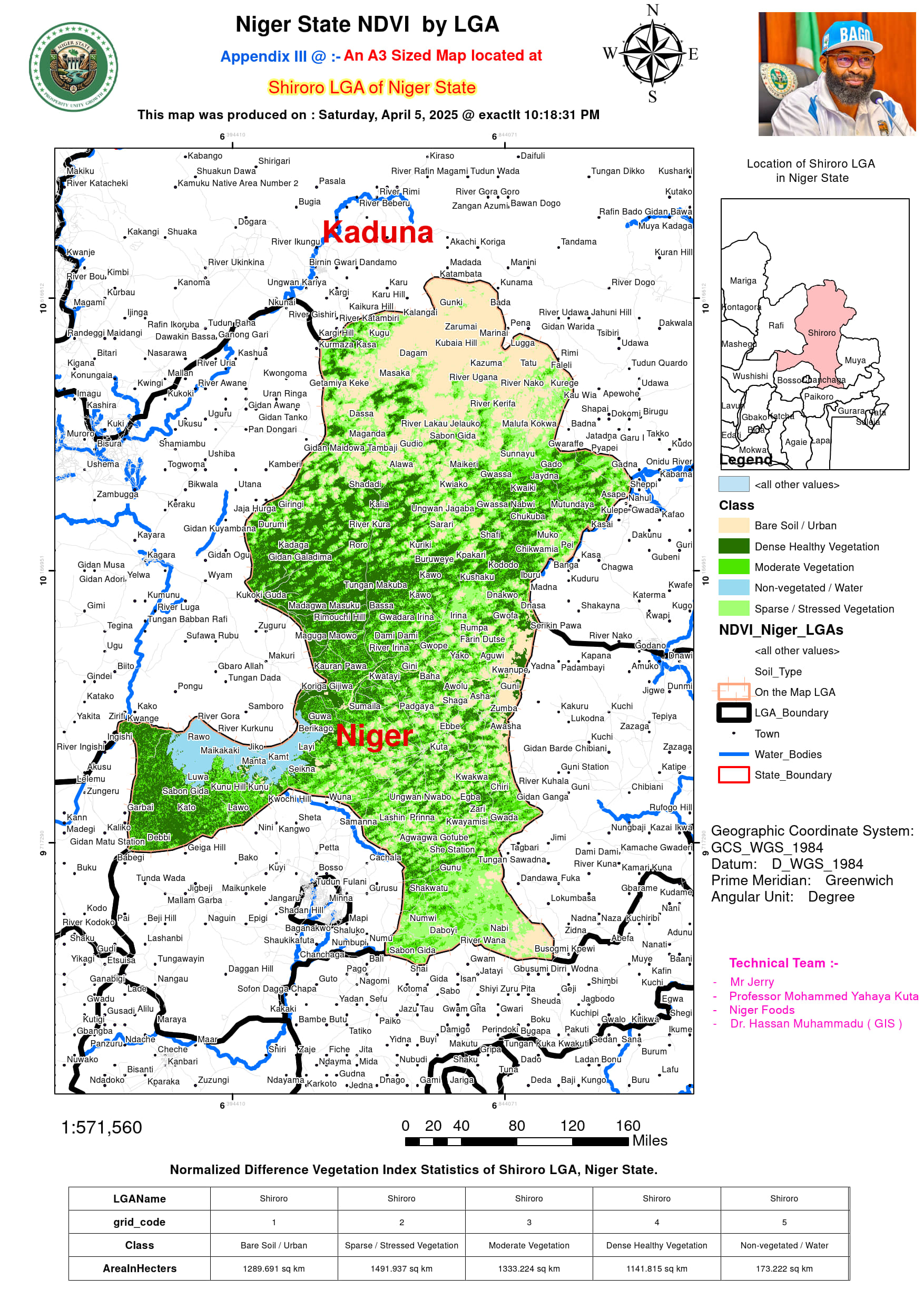
Several LGAs have significant tracts of moderate to dense vegetation, indicating strong potential for agricultural expansion. Mashegu has 1,735.5 sq km of dense healthy vegetation and 3,425.3 sq km of moderate vegetation, making it a prime candidate for integrated crop-livestock farming and agroforestry projects. Rafi, with 904 sq km of dense healthy vegetation, presents an opportunity for large-scale plantation agriculture, including tree crops and sustainable grazing. Lapai and Lavun each have over 1,500 sq km of moderate vegetation, making them suitable for crop diversification, particularly cereals, tubers, and legumes. Shiroro and Mokwa also possess significant areas of dense healthy vegetation, with Shiroro having 1,141 sq km and Mokwa 249 sq km, making them attractive for irrigation-based agriculture given their proximity to water bodies.
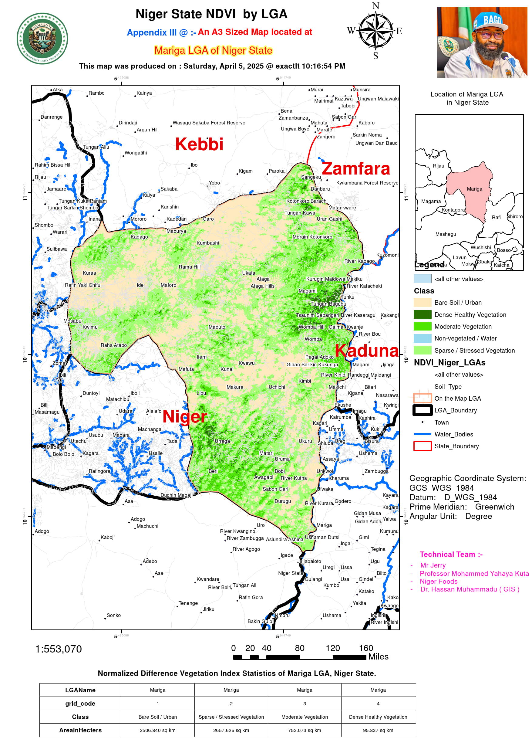
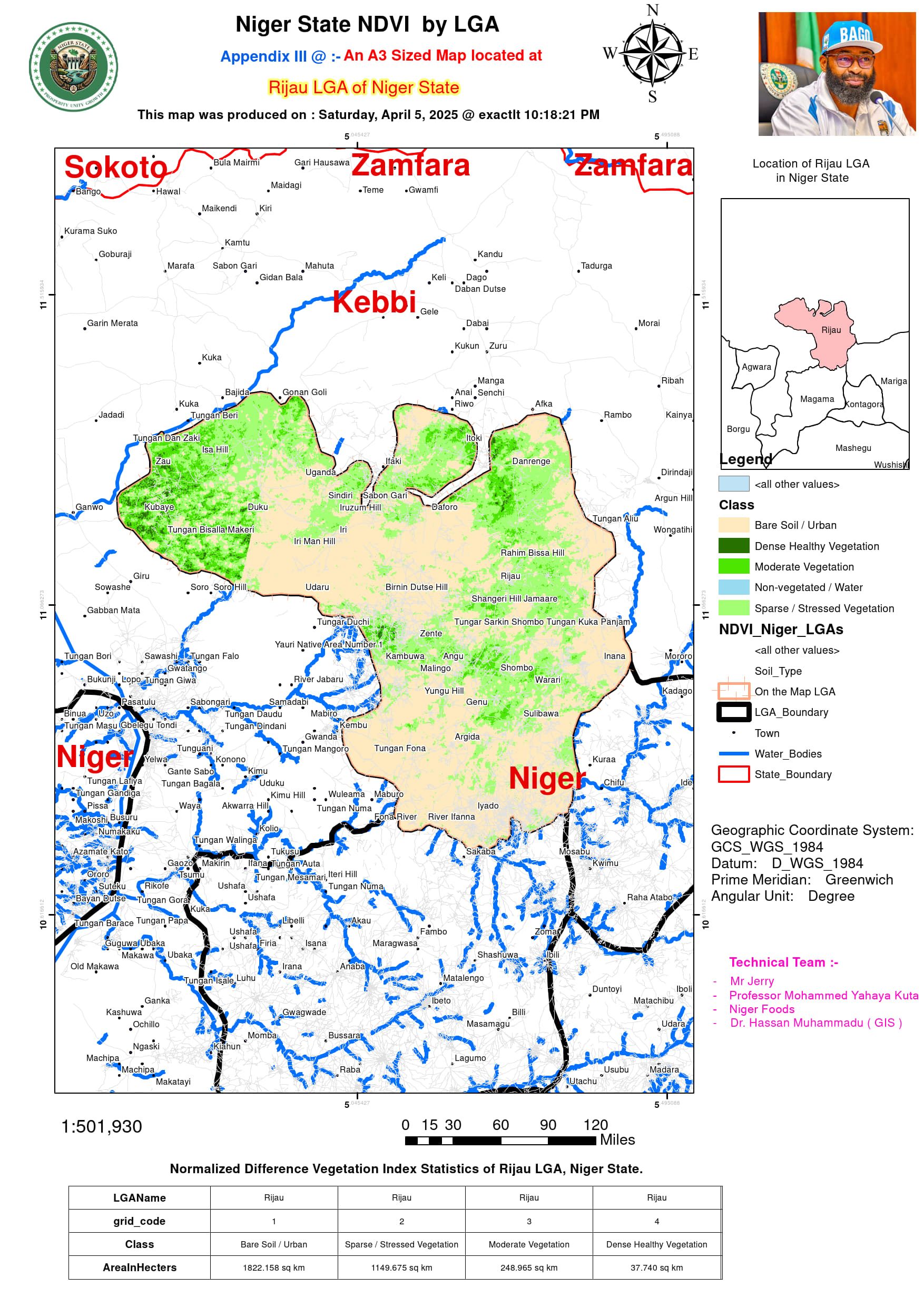
On the other hand, some regions exhibit high concentrations of bare soil and sparse vegetation, signaling challenges such as land degradation, desertification, and urban encroachment. Mariga and Borgu have some of the largest expanses of bare soil, with Mariga recording 2,506 sq km and Borgu 1,435 sq km, suggesting deforestation or poor land management. Reforestation and conservation programs could help restore vegetation cover in these areas. Rijau and Kontagora show a combination of high urbanization and stressed vegetation, highlighting the need for soil conservation measures and afforestation projects. Bida and Chanchaga, predominantly urbanized areas with limited green cover, would benefit from green infrastructure and climate resilience initiatives.
Water bodies play a critical role in agriculture, livestock, and ecosystem health. Shiroro, with 173.2 sq km of water bodies, and Rafi, with 80.3 sq km, possess significant water resources that could support irrigation schemes and hydropower projects. Mokwa, with only 0.03 sq km of mapped water bodies, indicates limited surface water availability, necessitating water conservation efforts such as borehole drilling and dam construction.
To maximize agricultural productivity and environmental sustainability, Niger State should prioritize sustainable land use planning. LGAs with high levels of bare soil and sparse vegetation, such as Mariga, Borgu, and Rijau, should adopt reforestation and agroforestry programs to combat desertification. In regions where sparse and stressed vegetation is dominant, including Kontagora and Edati, controlled grazing and rotational farming will help maintain soil fertility.
Expanding climate-smart agriculture in areas with moderate and dense vegetation, such as Rafi, Lapai, and Mashegu, is essential for ensuring long-term agricultural productivity. Climate-resilient farming techniques, including agroforestry, irrigation-fed crop production, and integrated pest management, should be implemented to enhance food security.
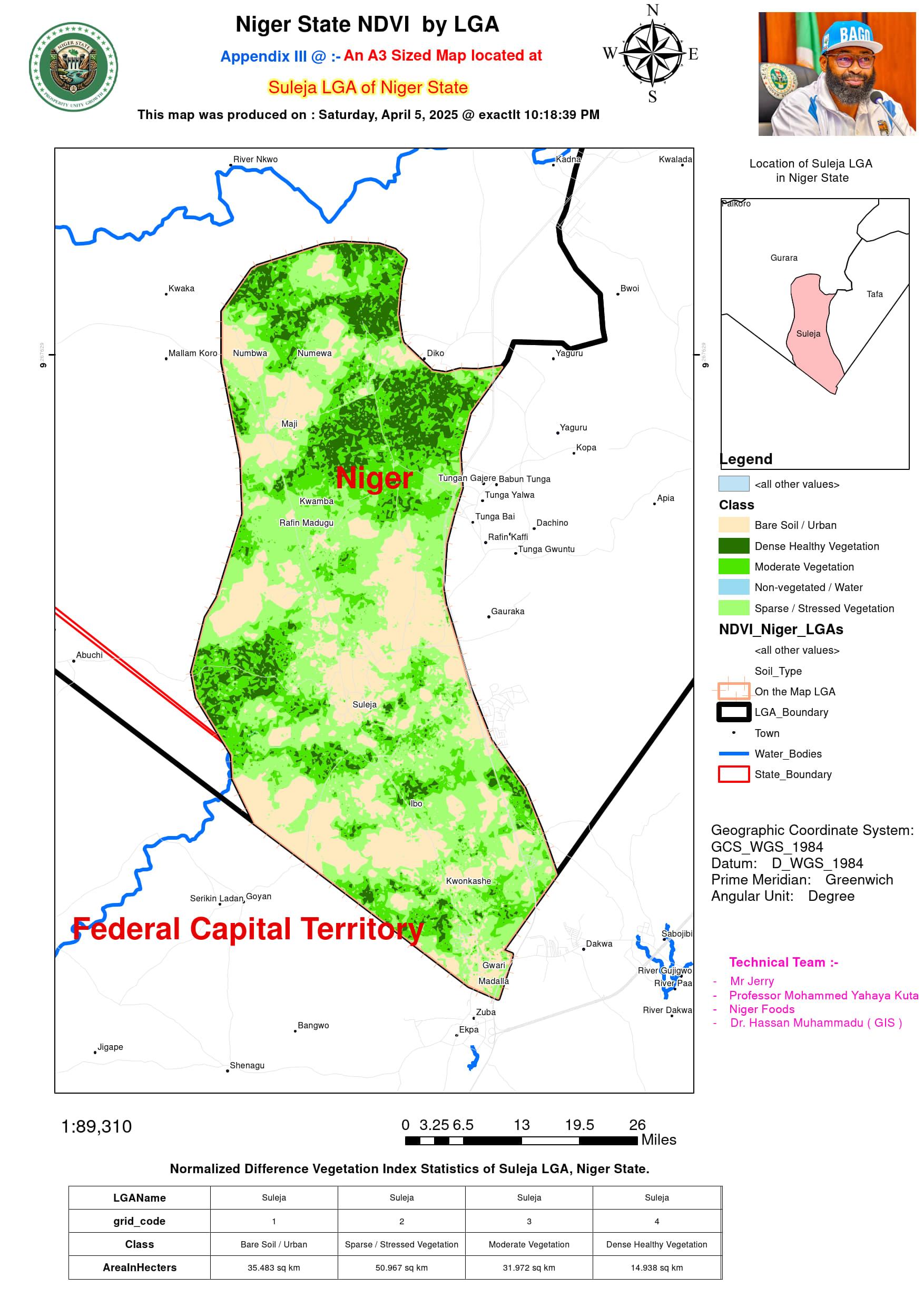
Water resource optimization is crucial for improving agricultural output. LGAs with mapped water bodies, particularly Shiroro, Rafi, Wushishi, and Mokwa, should invest in large-scale irrigation projects to boost dry-season farming and livestock productivity. Additionally, urban-dominated LGAs, such as Bida, Chanchaga, and Suleja, should incorporate green infrastructure projects like afforestation and urban farming to mitigate the effects of urban heat and land degradation.
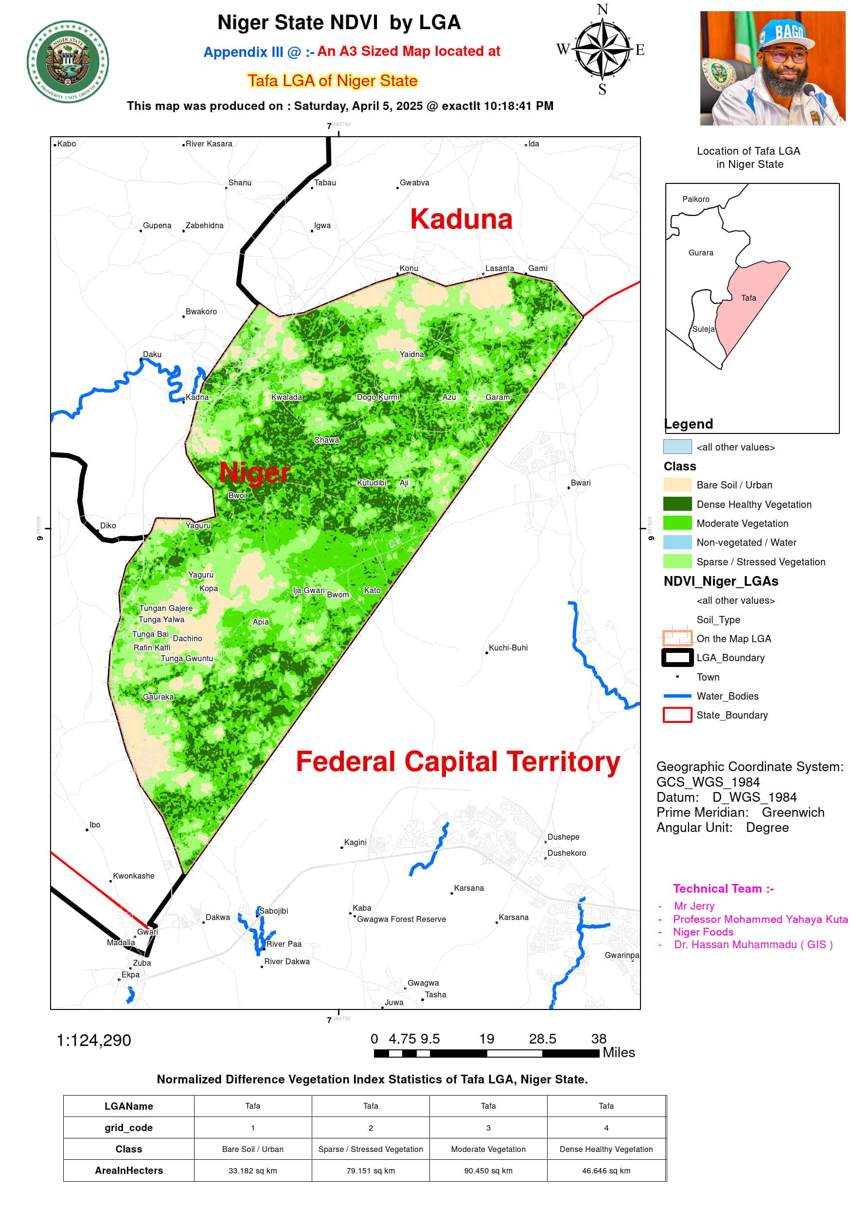
This NDVI analysis serves as a critical tool for agricultural planning, land management, and environmental sustainability in Niger State. By leveraging these data-driven insights, policymakers, farmers, and investors can develop targeted interventions that optimize land use, improve food security, and enhance ecological balance in the state. Find in the slide below the 25 LGAs Maps at NDVI level:-
